Sturgeon River (Prince Edward Island)
For other places with the same name, see Sturgeon River.
| Sturgeon River | |
| Country | Canada |
|---|---|
| Province | Prince Edward Island |
| County | Kings |
| Part of | Atlantic Ocean drainage basin |
| Tributaries | |
| - left | West Branch Sturgeon River |
| - right | South Branch Sturgeon River |
| Source | Field |
| - elevation | 72 m (236 ft) |
| - coordinates | 46°04′21″N 62°39′14″W / 46.07250°N 62.65389°W |
| Mouth | Sturgeon Bay |
| - elevation | 0 m (0 ft) |
| - coordinates | 46°07′00″N 62°32′00″W / 46.11667°N 62.53333°WCoordinates: 46°07′00″N 62°32′00″W / 46.11667°N 62.53333°W |
| Length | 14.8 km (9 mi) |
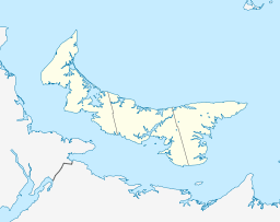 Location of the mouth of the Sturgeon River in Prince Edward Island
| |
The Sturgeon River is a river in the Atlantic Ocean drainage basin in Kings County in eastern Prince Edward Island, Canada.
Course
The Sturgeon River begins in a field about 2.7 kilometres (1.7 mi) southeast of the settlement of Brooklyn. It flows north, then turns east, passes over a dam, and flows past the community of Milltown Cross and Buffaloland Provincial Park. The river takes in the left tributary West Branch Sturgeon River, turns southeast, takes in the right tributary South Branch Sturgeon River, and reaches its mouth at Sturgeon Bay 1.5 kilometres (0.9 mi) northwest of the community of Sturgeon. Sturgeon Bay is part of the larger St. Marys Bay on the Northumberland Strait on the Gulf of Saint Lawrence, which leads to the Atlantic Ocean.
Tributaries
- South Branch Sturgeon River (right)
- West Branch Sturgeon River (left)
References
- "Sturgeon River". Geographical Names Data Base. Natural Resources Canada. Retrieved 2011-03-04.
- "Sturgeon River". Atlas of Canada. Natural Resources Canada. 2010-02-04. Retrieved 2011-03-04.
This article is issued from Wikipedia - version of the 5/20/2016. The text is available under the Creative Commons Attribution/Share Alike but additional terms may apply for the media files.