Sulphur, Louisiana
| Sulphur, Louisiana | |
| City | |
| Official name: City of Sulphur | |
| Motto: Faith - Family - Community | |
| Country | United States |
|---|---|
| State | Louisiana |
| Parish | Calcasieu |
| Elevation | 16 ft (4.9 m) |
| Coordinates | 30°16′49″N 93°21′39″W / 30.28028°N 93.36083°WCoordinates: 30°16′49″N 93°21′39″W / 30.28028°N 93.36083°W |
| Area | 10.0 sq mi (25.9 km2) |
| - land | 10.0 sq mi (25.9 km2) |
| - water | 0.0 sq mi (0 km2), 0% |
| Population | 20,410 (2010) |
| Density | 2,042.9/sq mi (788.8/km2) |
| Mayor | Christopher L. Duncan (R) (first elected 2010) City Council, District 4: Joseph "Randy" Favre, Jr. (R) |
| Timezone | CST (UTC-6) |
| - summer (DST) | CDT (UTC-5) |
| ZIP codes | 70663, 70665 |
| Area code | 337 |
|
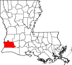
Location of Sulphur in Louisiana | |
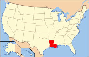
 Location of Louisiana in the United States | |
| Website: www | |
Sulphur (French: Soufre) is a city in Calcasieu Parish, Louisiana, United States. The population was 20,410 at the 2010 census.[1] Sulphur is part of the Lake Charles Metropolitan Statistical Area.
History
Sulphur is named for the sulfur mines that were operated in the area in the 1900s. In 1867, Professor Eugene W. Hilgard, an experienced geologist who was prospecting for oil and other minerals, conducted exploratory borings in Calcasieu Parish, Louisiana and discovered sulfur in the caprock of a salt dome. However, the sulfur was beneath several hundred feet of muck and quicksand containing deadly hydrogen sulfide gas, which made mining extremely hazardous. Repeated unsuccessful attempts to sink conventional mining shafts in the 1870s and 1880s resulted in the loss of many lives.
In 1890, the German immigrant Herman Frasch invented and patented the Frasch Process of mining sulfur, using concentric pipes to pump superheated water into the ground, liquefy the mineral, and force the liquid to the surface with compressed air. The first molten sulfur was brought to the surface on Christmas Eve of 1894. Sulfur soon began to be mined on an industrial scale, with the molten mineral allowed to solidify and dry in enormous vats 100 by 400 feet, then blasted and hauled by rail to the Sabine River for shipment.[2] Frasch's invention greatly facilitated sulfur mining, and the Union Sulphur Company, a joint venture of Dr. Frasch and the American Sulphur Company that owned the land, sparked a period of booming growth in the decades that followed.[3]
The elementary school on South Huntington Street in downtown Sulphur is named after Dr. Frasch.
With the addition of the Cities Service (Citgo) oil refinery in 1943, the areas of Maplewood and Hollywood were developed to house refinery workers. The Sulphur area is still mostly dependent on the oil refineries and petrochemical plants for employment.
Geography
Sulphur is located near the center of Calcasieu Parish at 30°13′49″N 93°21′39″W / 30.23028°N 93.36083°W (30.230355, -93.360837)[4] and has an elevation of 16 feet (4.9 m).[5]
The city lies on Interstate 10 between the towns of Vinton and Westlake, approximately 20 miles (32 km) east of the Texas border. The city of Lake Charles is 9 miles (14 km) to the east. U.S. Route 90 passes through the center of Sulphur as Napoleon Street. Access from I-10 is via exits 20, 21, 23, and 26.
According to the United States Census Bureau, the city has a total area of 10.0 square miles (25.9 km2), all land.[1]
Communities inside Sulphur city limits include, from west to east, old Sulphur, Hollywood, and Maplewood, as well as North Sulphur, also known as Portie Town[6] by natives. Outside of city limits are the communities of Carlyss, Choupique (Shoe-peak), and Moss Lake to the south. The community of Houston River is north of town, and Mossville is east of town. Most new development in the city is taking place south of town in Carlyss or around I-10.
Demographics
| Historical population | |||
|---|---|---|---|
| Census | Pop. | %± | |
| 1920 | 1,714 | — | |
| 1930 | 1,888 | 10.2% | |
| 1940 | 3,504 | 85.6% | |
| 1950 | 5,996 | 71.1% | |
| 1960 | 11,429 | 90.6% | |
| 1970 | 14,959 | 30.9% | |
| 1980 | 19,709 | 31.8% | |
| 1990 | 20,125 | 2.1% | |
| 2000 | 20,512 | 1.9% | |
| 2010 | 20,410 | −0.5% | |
| Est. 2015 | 20,189 | [7] | −1.1% |
As of the census[9] of 2000, there were 22,512 people, 7,901 households, and 5,601 families residing in the city. The population density was 2,043.0 people per square mile (788.8/km²). There were 8,665 housing units at an average density of 863.0 per square mile (333.2/km²).
The racial makeup of the city was 93.43% White, 5.41% African American, 0.33% Native American, 0.37% Asian, 0.04% Pacific Islander, 0.35% from other races, and 1.06% from two or more races. Hispanic or Latino of any race were 1.49% of the population.
There were 7,901 households, out of which 34.6% had children under the age of 18 living with them, 53.2% were married couples living together, 13.8% had a female householder with no husband present, and 29.1% were non-families. 24.9% of all households were made up of individuals and 10.1% had someone living alone who was 65 years of age or older. The average household size was 2.56 and the average family size was 3.06.
In the city the population was spread out with 27.1% under the age of 18, 9.5% from 18 to 24, 28.2% from 25 to 44, 21.7% from 45 to 64, and 13.4% who were 65 years of age or older. The median age was 35 years. For every 100 females there were 92.1 males. For every 100 females age 18 and over, there were 88.9 males.
The median income for a household in the city was $38,247, and the median income for a family was $45,455. Males had a median income of $38,235 versus $22,500 for females. The per capita income for the city was $21,615. About 7.5% of families and 9.3% of the population were below the poverty line, including 10.0% of those under age 18 and 11.5% of those age 65 or over.
Education
Most of Sulphur's schools are under the Calcasieu Parish School Board. One high school, Sulphur High School, serves the city, along with the Sulphur High Ninth Grade Campus that was completed in 2004. Elementary schools include Frasch, E.K. Key, W.T. Henning, R.W. Vincent, Maplewood, and Vincent Settlement (Carlyss). D.S. Perkins Elementary, one of the area's most challenged schools, closed in 2010, and all students and teachers were transferred to Cypress Cove, a completely new facility located in Carlyss. This represented a move from one of the more impoverished areas of old Sulphur (North Sulphur, a.k.a. "Portie Town" [Portie is pronounced pō-chay]) to one of the wealthier, emerging communities south of town. Middle schools include Leblanc Middle School, the W.W. Lewis Middle School, and Maplewood (K-8th grade). There are some private schools in the area as well, including Our Lady's Catholic School on Cypress Street.
Frasch Elementary, W.W. Lewis Middle, and Sulphur High School offer Spanish Immersion classes in which students take Spanish language as well as core classes totally in Spanish from kindergarten all the way to eighth grade, and Spanish language classes up to Spanish V or VI in High School. The program has been praised for giving children a fluency in the Spanish language as well as an understanding of other cultures at an early age. Most of the Immersion teachers come from Hispanic countries or are of Hispanic descent.
Notable people
- Marcus R. Clark, justice of the Louisiana Supreme Court, born in Sulphur in 1956[10]
- Casey Daigle, pitcher in the Houston Astros organization. He graduated from Sulphur High School.[11]
- Mike Danahay, Louisiana state representative for Calcasieu Parish since 2008; sales representative in Lake Charles, reared in Sulphur[12]
- Grady A. Dugas, M.D., native of Sulphur and a 1941 graduate of Sulphur High School, practiced medicine for four decades in Union Parish. He invented an improved wheelchair locks/brake system.[13]
- Michael Durham, born in Sulphur, was an American professional wrestler, better known by his ring name, Johnny Grunge. He has held the ECW and WCW tag titles with his partner, Rocco Rock, who are together known as The Public Enemy.
- Herman Frasch, inventor of the "Frasch Method" of mining sulphur, was head of Union Sulphur Company. Its headquarters were at the Sulphur Mines, a company town just west of present-day Sulphur. Herman Frasch Elementary School is named after him.
- Claude Kirkpatrick, lived in Sulphur in the late 1930s before moving to Jennings, where he served in the Louisiana House of Representatives from 1952-1960.
- Edith Killgore Kirkpatrick, lived in Sulphur in the late 1930s before moving to Jennings. She was a member of Louisiana Board of Regents from 1978-1990.
- Alvan Lafargue, Sulphur physician for fifty years, hospital founder, and mayor from 1926 to 1938[14]
- Janice Lynde, actress, original cast member of the CBS soap opera The Young and the Restless for three years, then went on to ABC's One Life to Live and NBC's Another World
- Dak Prescott, professional football player with the Dallas Cowboys.
- Matt Stevens, football player: Kansas City Chiefs quarterback, UCLA college football radio analyst[15]
- Dennis Stine, former state representative and state commissioner of administration, reared in Sulphur[16]
- Tim Stine, former state representative and city council member, born in Sulphur[17]
References
- 1 2 "Geographic Identifiers: 2010 Demographic Profile Data (G001): Sulphur city, Louisiana". U.S. Census Bureau, American Factfinder. Retrieved August 14, 2014.
- ↑ Cormier, Adley. "A Timeline History of Lake Charles and Southwest Louisiana". Calcasieu Historical Preservation Society. Retrieved 25 May 2015.
- ↑ "History of Sulphur". City of Sulphur. Retrieved 24 May 2015.
- ↑ "US Gazetteer files: 2010, 2000, and 1990". United States Census Bureau. 2011-02-12. Retrieved 2011-04-23.
- ↑ "US Board on Geographic Names". United States Geological Survey. 2007-10-25. Retrieved 2008-01-31.
- ↑ http://www.sulphurdailynews.com/article/20120226/News/302269997
- ↑ "Annual Estimates of the Resident Population for Incorporated Places: April 1, 2010 to July 1, 2015". Retrieved July 2, 2016.
- ↑ "Census of Population and Housing". Census.gov. Retrieved June 4, 2015.
- ↑ "American FactFinder". United States Census Bureau. Retrieved 2008-01-31.
- ↑ "Justice Marcus R. Clark". Louisiana Supreme Court. Retrieved November 26, 2012.
- ↑ "Casey Daigle Stats". Baseball Almanac. Retrieved November 26, 2012.
- ↑ "Mike Danahay". house.louisiana.gov. Retrieved April 20, 2015.
- ↑ "Dr. Grady A. Dugas". The Monroe News-Star. March 26, 2007. Retrieved February 18, 2015.
- ↑ "Lafargue, Alvan Henry". Louisiana Historical Association: A Dictionary of Louisiana Biography. Retrieved February 17, 2011.
- ↑ "Matthew Anthony Stevens". databaseFootball.com. Retrieved November 26, 2012.
- ↑ "Louisiana: Stine, Dennis Neal", Who's Who in American Politics, 2003-2004, 19th ed., Vol. 1 (Alabama-Montana) (Marquis Who's Who: New Providence, New Jersey, 2003), p. 796
- ↑ "Louisiana: Stine, Timothy D.", Who's Who in American Politics, 2003-2004, 19th ed., Vol. 1 (Alabama-Montana) (Marquis Who's Who: New Providence, New Jersey, 2003), p. 796
