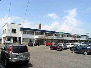
Takikawa Station
Takikawa Station 滝川駅 | |
|---|---|
 Takikawa Station in July 2004 | |
| Location |
Takikawa, Hokkaido Japan |
| Operated by |
|
| Line(s) | |
| Distance | 369.8 km from Hakodate |
| Tracks | 5 |
| Connections | Bus stop |
| Other information | |
| Status | Staffed |
| Station code | A21 |
| Website |
www |
| History | |
| Opened | 16 July 1898 |
| Traffic | |
| Passengers (FY2014) | 1,669 daily |
| Location | |
 Takikawa Station Location within Japan | |
Takikawa Station (滝川駅 Takikawa-eki) is a railway station in Takikawa, Hokkaido, Japan, operated by the Hokkaido Railway Company (JR Hokkaido).
Lines
Takikawa Station is served by the Hakodate Main Line and Nemuro Main Line. The station is numbered "A21".[1]
Station layout

Overview of the station in September 2008
The station consists of three ground level platforms serving five tracks. The station has automated ticket machines, automated turnstiles and a "Midori no Madoguchi" staffed ticket office. The Kitaca farecard cannot be used at this station.[2]
Platforms
| 1 | ■ Nemuro Main Line | for Furano, Shintoku, and Obihiro |
| 4 | ■ Hakodate Main Line | for Iwamizawa and Sapporo (Local services) |
| 5 | ■ Hakodate Main Line | for Iwamizawa and Sapporo (Limited express services) |
| 6 | ■ Hakodate Main Line | for Asahikawa, Abashiri, and Wakkanai (Limited express services) |
| 7 | ■ Hakodate Main Line | for Fukagawa and Asahikawa (Local services) |
Adjacent stations
| « | Service | » | ||
|---|---|---|---|---|
| Hakodate Main Line | ||||
| Sunagawa (A20) | Local | Ebeotsu (A22) | ||
| Nemuro Main Line | ||||
| Terminus | - | Higashi-Takikawa (T22) | ||
History
The station opened on 16 July 1898.[3] With the privatization of Japanese National Railways (JNR) on 1 April 1987, the station came under the control of JR Hokkaido.
Surrounding area
- Takikawa Bus Terminal
- National Route 12
- National Route 38
- National Route 451
- Takikawa City Hall
- Takikawa Police Station
- Takikawa Post Office
- Hokkaido Takikawa Nishi High School
- Hokkaido Takikawa High School
- Hokkaido Takikawa Kogyo High School
- Ishikari River
References
- ↑ "JR Hokkaido Route Map" (PDF). Hokkaido Railway Company. Retrieved 2016-11-19.
- ↑ "Service Range Kitaca". JR Hokkaido. Retrieved 2016-11-19.
- ↑ 滝川駅バリアフリー情報 [Takikawa Station accessibility information] (in Japanese). Japan: Hokkaido Railway Company. Retrieved 9 December 2011.
External links
| Wikimedia Commons has media related to Takikawa Station. |
- JR Hokkaido station information (Japanese)
Coordinates: 43°33′19″N 141°54′05″E / 43.5551614°N 141.9013077°E
This article is issued from Wikipedia - version of the 11/20/2016. The text is available under the Creative Commons Attribution/Share Alike but additional terms may apply for the media files.