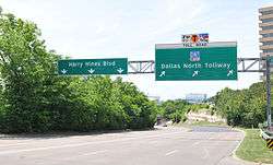
Harry Hines Boulevard
| Length | 10.4 mi[1] (16.7 km) |
|---|---|
| South end | Akard Street in Dallas |
| Major junctions |
|
| North end |
|
Harry Hines Boulevard is a major street in Dallas, Texas, (USA), to the west of Uptown.
It was one of the very first 'highways' in Texas, and is named for Harry Hines in honor of his work helping to get roads paved in this part of the state. Harry Hines served on the Texas Highway Commission from February 15, 1935 to April 11, 1941 and for the first two years as its chair according to the records at the Texas Department of Transportation.[2]
Harry Hines Boulevard forms the main part of the route taken by the Kennedy motorcade to Parkland Memorial Hospital immediately after the assassination shooting in November, 1963. It is home to the University of Texas Southwestern Medical Center at Dallas. Today, the Harry Hines area is home to a wholesale district filled with wholesale warehouses.
Harry Hines Boulevard is also known for being a street populated with prostitution, seedy adult establishments, a street drug culture, and drug motels.
Loop 354
| |
|---|---|
| Location: | Dallas–Farmers Branch |
| Length: | 4.148 mi[3] (6.676 km) |
| Existed: | 1961[3]–present |
The section of Harry Hines Boulevard from Loop 12 (Northwest Highway) to Interstate 35E (Stemmons Freeway) is signed as Loop 354. The Loop 354 used to be much longer, beginning in Downtown Dallas. The highway traversed old sections of U.S. Route 67, U.S. Route 77, and U.S. Route 80.[4][5][6]
Junction list
The entire route is in Dallas County.
| Location | mi[1] | km | Destinations | Notes | |
|---|---|---|---|---|---|
| Dallas | 0.0 | 0.0 | Akard Street | ||
| 0.4 | 0.64 | Interchange; southbound exit and northbound entrance | |||
| 0.8 | 1.3 | Oak Lawn Avenue | Interchange | ||
| 2.6 | 4.2 | Interchange | |||
| 3.3 | 5.3 | Interchange | |||
| 5.7 | 9.2 | I-35E exit 435 | |||
| 6.4 | 10.3 | Interchange; south end of Loop 354 | |||
| 10.0 | 16.1 | I-635 exit 27C | |||
| Farmers Branch | 10.4 | 16.7 | I-35E exit 440C | ||
1.000 mi = 1.609 km; 1.000 km = 0.621 mi
| |||||
References
- 1 2 "Map of Harry Hines Boulevard". Google Maps. Retrieved July 27, 2016.
- ↑ Dallas History Society - Harry Hines
- 1 2 Transportation Planning and Programming Division (n.d.). "State Highway Loop No. 354". Highway Designation Files. Texas Department of Transportation. Retrieved July 27, 2016.
- ↑ Transportation Planning and Programming Division (n.d.). "U.S. Highway No. 67". Highway Designation Files. Texas Department of Transportation. Retrieved July 27, 2016.
- ↑ Transportation Planning and Programming Division (n.d.). "U.S. Highway No. 77". Highway Designation Files. Texas Department of Transportation. Retrieved July 27, 2016.
- ↑ Transportation Planning and Programming Division (n.d.). "U.S. Highway No. 80". Highway Designation Files. Texas Department of Transportation. Retrieved July 27, 2016.