Thurning, Northamptonshire
| Thurning | |
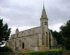
 Church of St James, Thurning |
|
 Thurning |
|
| Population | 93 (2001) |
|---|---|
| OS grid reference | TL0882 |
| District | East Northamptonshire |
| Shire county | Northamptonshire |
| Region | East Midlands |
| Country | England |
| Sovereign state | United Kingdom |
| Post town | Peterborough |
| Postcode district | PE8 |
| Dialling code | 01832 |
| Police | Northamptonshire |
| Fire | Northamptonshire |
| Ambulance | East Midlands |
| EU Parliament | East Midlands |
| UK Parliament | Corby |
|
|
Coordinates: 52°25′47″N 0°24′21″W / 52.4297°N 0.4057°W
Thurning is a village and civil parish in the English county of Northamptonshire. Located in the north-east of the county, about 5.5 miles south-east of Oundle, Thurning forms part of the district of East Northamptonshire and the civil parish of Hemington, Luddington and Thurning. Until 1888 the ecclesiastical parish of Thurning was partly in Northamptonshire and partly in Huntingdonshire, its parish church being in the latter county. At the time of the 2001 census, the population of Thurning Civil Parish was 93 people.[1] At the time of the 2011 Census the population of the village remained less than 100 and is included in the civil parish of Hemington.
References
- ↑ Office for National Statistics: Thurning CP: Parish headcounts. Retrieved 25 November 2009
External links
| Wikimedia Commons has media related to Thurning, Northamptonshire. |
- GENUKI page
- Some details of the parish church on CRSBI
- Map sources for Thurning, Northamptonshire
This article is issued from Wikipedia - version of the 7/11/2016. The text is available under the Creative Commons Attribution/Share Alike but additional terms may apply for the media files.