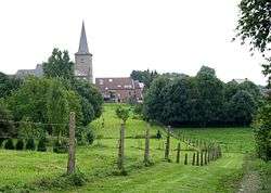
Tongrinne
| Tongrinne Tongrene | |
|---|---|
| Village | |
 | |
 Tongrinne | |
| Coordinates: 50°30′56.68″N 4°37′26.18″E / 50.5157444°N 4.6239389°ECoordinates: 50°30′56.68″N 4°37′26.18″E / 50.5157444°N 4.6239389°E | |
| Country |
|
| Province | Namur |
| Municipality | Sombreffe |
| Area[1] | |
| • Total | 5.89 km2 (2.27 sq mi) |
| Time zone | CET (UTC+1) |
Tongrinne (Walloon: Tongrene) is a village in the municipality of Sombreffe (in the province of Namur), Wallonia Region, Belgium.
Tongrinne was its own municipality until the fusion of the Belgian municipalities in 1977 when it merged with Sombreffe. Tongrinne is on the banks of the river Ligny.
History
The village and the heights of Tongrene were the location for the left wing of the Prussian army Prussian during the Battle of Ligny on 16 June 1815. Despite attempts by the French the Prussians were still in possession of Tongrene at the end of the battle but were forced to give it up during the night of the 16/17 June after the defeat of their central position around Ligny.[2]
Notes
- ↑ "Sombreffe (Municipality, Province of Namur, Belgium)". crwflags.com. 2015. Retrieved 31 March 2016.
- ↑ Siborne 1848, pp. 200–201, 217, 233–234, 252.
References
- Siborne, William (1848), The Waterloo Campaign, 1815 (4th ed.), Westminster: A. Constable
This article is issued from Wikipedia - version of the 10/24/2016. The text is available under the Creative Commons Attribution/Share Alike but additional terms may apply for the media files.