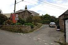
Trenale
Coordinates: 50°39′33″N 4°43′57″W / 50.6593°N 4.7326°W

Trenale
Trenale is a hamlet in north Cornwall, England, United Kingdom. It is located within the civil parish of Tintagel, to the south-east of Tintagel village.[1]
Near Trenale was the Iron Age fort of Trenale Bury which was ploughed up during the Second World War.[2][3] The first Methodist meeting house in the parish of Tintagel was established at Trenale in 1807.[4]
References
- ↑ Ordnance Survey One-inch Map of Great Britain; Bodmin and Launceston, sheet 186. 1961
- ↑ Dyer, Peter (2005) Tintagel: a portrait of a parish. Cambridge: Cambridge Books. ISBN 0-9550097-0-7; pp. 15-20
- ↑ Canner, A. C. (1982) The Parish of Tintagel. Camelford: A. C. Canner; p. 4
- ↑ Canner, A. C. (1982) The Parish of Tintagel. Camelford: A. C. Canner; p. 72
This article is issued from Wikipedia - version of the 1/23/2016. The text is available under the Creative Commons Attribution/Share Alike but additional terms may apply for the media files.