Udo (island)
| Native name: <span class="nickname" ">우도/牛島 | |
|---|---|
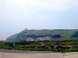
 The Udobong of the Udo | |
| Geography | |
| Location | Udo-myeon, Jeju-si, Jeju-do, South Korea |
| Archipelago | Jeju |
| Area | 5.9 km2 (2.3 sq mi) |
| Administration | |
| Demographics | |
| Population | 1,752 |
| Ethnic groups | Korean |
Udo, (also called U-island, since do means island) is located on the northeast of Seongsan-ri, 3.5 kilometres (2.2 miles) off the coast of Jeju, South Korea. This is the largest of the islands included in Jeju-si.[1] Udo, literally "Cow Island" in Chinese, has this name because it looks like a cow lying down. The whole of Udo is a lava plateau and a fertile flatland where major agricultural products such as sweet potatoes, garlic, and peanuts are produced. There is a parasitic cone, called shoi meori oreum,in the southeast.
Tourism
Udo is one of the most visited spots in Jeju-do. About a million people visit Udo every year. Thanks to the beautiful scenery, it became the location for a few Korean films. Especially, Seobinbaeksa located on the west-coast of Udo Island was created by Rhodolith, which is the only beach created by this in Korea.[2]
Main sights
The eight kinds of scenery of Udo

The eight kinds of scenery of Udo, called Udopalkyeong (우도팔경/牛島八景),refer to the following: 'day and night', 'sky and ground','front and back', and 'east and west', which are the typical kinds of scenery found on Udo.[3]
- Juganmyeongwol (주간명월/晝間明月)
- Yahangabyum (야항어범/夜航漁帆)
- Chunjinguansan (천진관산/天津觀山)
- Jiduchungsa (지두청사/地頭靑莎)
- Jeonphomangdo (전포망도/前浦望島)
- Huhaesukbyeok (후해석벽/後海石壁)
- Dongankyeonggul (동안경굴/東岸鯨窟)
- Seobinbaeksa (서빈백사/西濱白沙)
Tourist Attractions
- Hongjodangoe (Coralsand beach) (홍조단괴해변/紅潮團塊海邊)
- Hagosudong beach (하고수동해수욕장/河高水洞海水浴場)
- Dongangyoeng cave (동안경굴/東岸鯨窟)
- Udo museum
Notes and references
- ↑ http://www.lonelyplanet.com/south-korea/jejudo/udo-island
- ↑ 우경식·김진경·강순석, 「읍지제주도 우도의 홍조단괴 해빈 퇴적물의 특징」(『제1회 학술심포지엄자료집』, 제주화산연구소, 2003)
- ↑ http://www.jejusi.go.kr/contents/index.php?mid=610601
Coordinates: 34°43′14″N 127°18′39″E / 34.72056°N 127.31083°E