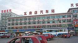
Wafangdian
| Wafangdian 瓦房店市 | ||||||||||||||||||||||||||||||||||
|---|---|---|---|---|---|---|---|---|---|---|---|---|---|---|---|---|---|---|---|---|---|---|---|---|---|---|---|---|---|---|---|---|---|---|
| County-level city | ||||||||||||||||||||||||||||||||||
|
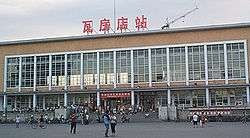
Wafangdian Railway Station | ||||||||||||||||||||||||||||||||||
 Wafangdian Location in Liaoning | ||||||||||||||||||||||||||||||||||
| Coordinates: 39°37′52″N 121°58′26″E / 39.631°N 121.974°ECoordinates: 39°37′52″N 121°58′26″E / 39.631°N 121.974°E[1] | ||||||||||||||||||||||||||||||||||
| Country |
| |||||||||||||||||||||||||||||||||
| Province | Liaoning | |||||||||||||||||||||||||||||||||
| Sub-provincial city | Dalian | |||||||||||||||||||||||||||||||||
| Divisions |
11 subdistricts 13 towns 6 townships 2 ethnic townships | |||||||||||||||||||||||||||||||||
| Seat | Xinhua Subdistrict (新华街道) | |||||||||||||||||||||||||||||||||
| Area[2] | ||||||||||||||||||||||||||||||||||
| • Total | 3,576.40 km2 (1,380.86 sq mi) | |||||||||||||||||||||||||||||||||
| Elevation | 121 m (397 ft) | |||||||||||||||||||||||||||||||||
| Population (2010)[3] | ||||||||||||||||||||||||||||||||||
| • Total | 942,197 | |||||||||||||||||||||||||||||||||
| • Density | 260/km2 (680/sq mi) | |||||||||||||||||||||||||||||||||
| Time zone | China Standard (UTC+8) | |||||||||||||||||||||||||||||||||
| Postal code | 1163XX | |||||||||||||||||||||||||||||||||
| Dalian district map |
| |||||||||||||||||||||||||||||||||
| GDP | 51.1 billion RMB (7.87 billion USD)[4][5] | |||||||||||||||||||||||||||||||||
| GDP per capita | 48874 RMB (7526 USD)[4][5] | |||||||||||||||||||||||||||||||||
| GDP annual growth rate | 22.6% | |||||||||||||||||||||||||||||||||
| Website |
dlwfd | |||||||||||||||||||||||||||||||||
Wafangdian (Chinese: 瓦房店; pinyin: Wǎfángdiàn), formerly Fuxian or Fu County (Chinese: 复县), is one of the two "northern county-level cities", the other being Zhuanghe, under the administration of Dalian, located in the south of Liaoning province, China. The city is famous for its ball bearing industry. Wafangdian Bearing Factory is the largest bearing manufacturer in Asia and was initially built by the Japanese during World War II. Its area is 3,576.40 square kilometres (1,380.86 sq mi) and its permanent population as of 2010 is 942,197, compared to 1,024,876 registered with hukou permits.[2][3] The city borders the prefecture-level city of Yingkou to the northeast.
Overview
Wafangdian City is located in the southwest of the Liaodong Peninsula, with a total area of 3,793 square kilometres (1,464 sq mi) and a population of around 1.02 million. There are rich mines here. Wafangdian is a newly developed city of diamond in the East and its deposits of diamond account for 54% of the national proven diamond deposits. The deposits of the limestone reach over 400,000,000 cubic metres. Wafangdian is famous for bearings and apples in China. Wafangdian has solid industry base, fast—developing agriculture, convenient transportation and telecommunications.
Climate
Wafangdian has a four-season, monsoon-influenced, humid continental climate (Köppen Dwa), with long, cold, windy but dry winters, and humid and very warm summers. The area experiences a seasonal delay due to the influence of the nearby ocean, which also helps temper the summers. In winter, as the Liaodong Bay is typically frozen north of the urban area of Dalian, the moderating effects of that body of water are minimised, as the Siberian high often causes winds to blow from the northwest: the monthly daily average temperature in January is −7.1 °C (19.2 °F), as compared to −3.9 °C (25.0 °F) in downtown Dalian.[6] For Wafangdian, the same figure in July is 23.8 °C (74.8 °F). The annual mean temperature is 9.59 °C (49.3 °F). Close to half of the annual precipitation falls in July and August alone. The frost-free period is 165−185 days per annum.
| Climate data for Wafangdian (1971−2000) | |||||||||||||
|---|---|---|---|---|---|---|---|---|---|---|---|---|---|
| Month | Jan | Feb | Mar | Apr | May | Jun | Jul | Aug | Sep | Oct | Nov | Dec | Year |
| Record high °C (°F) | 9.5 (49.1) |
13.2 (55.8) |
19.9 (67.8) |
27.8 (82) |
33.4 (92.1) |
36.0 (96.8) |
35.8 (96.4) |
35.0 (95) |
32.6 (90.7) |
28.0 (82.4) |
22.0 (71.6) |
14.2 (57.6) |
36 (96.8) |
| Average high °C (°F) | −2 (28) |
0.7 (33.3) |
7.2 (45) |
15.8 (60.4) |
22.0 (71.6) |
25.9 (78.6) |
27.8 (82) |
28.1 (82.6) |
24.3 (75.7) |
17.3 (63.1) |
8.4 (47.1) |
1.3 (34.3) |
14.7 (58.5) |
| Daily mean °C (°F) | −7.1 (19.2) |
−4.4 (24.1) |
2.0 (35.6) |
10.1 (50.2) |
16.3 (61.3) |
20.9 (69.6) |
23.8 (74.8) |
23.7 (74.7) |
18.8 (65.8) |
11.6 (52.9) |
3.2 (37.8) |
−3.8 (25.2) |
9.6 (49.3) |
| Average low °C (°F) | −11.5 (11.3) |
−8.6 (16.5) |
−2.7 (27.1) |
4.9 (40.8) |
11.2 (52.2) |
16.4 (61.5) |
20.4 (68.7) |
20.0 (68) |
13.9 (57) |
6.7 (44.1) |
−1.1 (30) |
−8 (18) |
5.1 (41.2) |
| Record low °C (°F) | −23 (−9) |
−22.1 (−7.8) |
−19 (−2) |
−5.5 (22.1) |
3.5 (38.3) |
9.7 (49.5) |
11.7 (53.1) |
10.0 (50) |
3.1 (37.6) |
−7.1 (19.2) |
−13.3 (8.1) |
−19.4 (−2.9) |
−23 (−9) |
| Average precipitation mm (inches) | 5.1 (0.201) |
4.4 (0.173) |
10.4 (0.409) |
27.4 (1.079) |
46.4 (1.827) |
86.5 (3.406) |
156.4 (6.157) |
150.7 (5.933) |
65.4 (2.575) |
34.7 (1.366) |
17.6 (0.693) |
7.5 (0.295) |
612.5 (24.114) |
| Average precipitation days (≥ 0.1 mm) | 2.9 | 2.6 | 3.7 | 5.6 | 7.1 | 9.2 | 11.6 | 9.9 | 7.1 | 6.2 | 4.9 | 2.7 | 73.5 |
| Source: Weather China | |||||||||||||
Administrative divisions
There are 11 subdistricts, 13 towns, 6 township, and 2 ethnic townships under the city's administration:[7]
Subdistricts (街道)
|
|
Towns (镇)
|
|
Townships (乡)
- Zhaotun Township (赵屯乡)
- Tucheng Township, Liaoning (土城乡)
- Yandian Township (阎店乡)
- Xiyang Township (西杨乡)
- Tuoshan Township (驼山乡)
- Santai Manchu Ethnic Township (三台满族乡)
- Paoya Township (泡崖乡)
- Yangjia Manchu Township (杨家满族乡)
Economy

Wafangdian's basic industry is industry, agriculture, fishing and mining. Bearing industry is the main income for the citizen. Nearly 50% population engage in the bearing business. It is called the "bearing capital" of China, more than 400 bearing factories in this city, including the Chinese No. 1 brand "ZWZ". Wafangdian also produces apple and other fruits. Its fishing industry prospers in the Bohai Sea. It is also noted for producing diamonds.
Wafangdian is also quickly industrialized. China's largest bearing company(ZWZ), established in 1938, is also located here. Wafangdian is also noted for the Changxing Island Seaport Industrial Area and Hongyanhe Nuclear Power Station.
For its sightseeing locations, there is Laomao Mountain, located in the eastern part, on the border with Pulandian City.
Coastal Area
Wafangdian has 461 kilometres of coast line and the annual aquatic output is over 250,000 tons including sea cucumber, prawn, clam, crab, mullet, Spanish macherel, jellyfish, scallop, aballone and mantis-shrimp etc. The following thirteen towns and communes belong to this area: Changxingdao, Jiaoliudao, Donggang, Fuzhouwan, Paotai, Xianyuwan, Yongning, Xiyang, Tuoshan and Santai etc.
Investment Area for the Agriculture and Native Products Process
Wafangdian has rich agriculture and native products. The total export value exceeds RMB 1 billion yuan in 1999. The main products include meat-chick, bee-honey, peanut, dried-gourd, burdock, horgeradish, red-bean and other products. The products are mainly produced and processed in the followings 14 towns: Fuzhoucheng Town, Laohutun Town, Paotai Town, Yong-ning Town, etc..
Subarea for Industry Production
Wafangdian has a solid industry base with complete product kinds. There are many industries such as bearings, parts for auto and the agriculture machiney, castings, machinexy process, foodstuff, textile and garment, etc.. The following towns and communes include this subarea: Yongning, Laohutun, Yandian, and the Subdistricts of Zhuhua, etc..
Investment Area for Fruit Process
Wafangdian has rich resources in fruit. The total output reached over 300,000 tons in 1999, The main fruits are as following: apple, pear, plum, peach, strawchew, apricot and grape, etc.. Thirteen towns and communes belong to this subarea: wanjialing, Songshu Tucheng, and Gangdian Subdistrict, etc..
Investment Subarea for Tourism and Service in Wafangdian
Wafangdian has beautiful beach, sand, scenic spots and natural warm spring. All this consists good conditions for tour here. The following places are satisfied for tourism service, they are Changxingdiao Town, Liguan Town, Xutun Town, Xianyuwan Town and Tuoshan Commune, etc.
Economic Development Zone
Wafangdian Economic Development Subarea is located in the south-west of Wafangdian. It's two kilometres from the centre of the city. The planned area of the Economic Development Zone is 2.9 km2 (1.1 sq mi) including the Hi-tech Garden, Industry Process Area, Storage and Transportation Area, Living Area and the Service Area and also there is the green area. The roads have been built now and the "five-through and one flat" engineering will be finished soon.
See also
References
- ↑ Google (2014-07-02). "Wafangdian" (Map). Google Maps. Google. Retrieved 2014-07-02.
- 1 2 Dalian Statistical Yearbook 2012 (《大连统计年鉴2012》). Accessed 8 July 2014.
- 1 2 2010 Census county-by-county statistics (《中国2010年人口普查分县资料》). Accessed 8 July 2014.
- 1 2 综合经济 (in Chinese). Wafangdian People's Government. Retrieved 2011-05-28.
- 1 2 Calculated from the exchange rate as of 28 May 2011.
- ↑ 中国地面国际交换站气候标准值月值数据集(1971-2000年) (in Chinese). China Meteorological Administration. Retrieved 2011-05-28.
- ↑ 2011年统计用区划代码和城乡划分代码:瓦房店市 (in Chinese). National Bureau of Statistics of the People's Republic of China. Retrieved 2013-01-09.
External links
- Wafangdian City home page (in Chinese)


