Waggaman, Louisiana
| Waggaman | |
| Census-designated place | |
| Country | United States |
|---|---|
| State | Louisiana |
| Parish | Jefferson |
| Coordinates | 29°55′47″N 90°13′48″W / 29.92972°N 90.23000°WCoordinates: 29°55′47″N 90°13′48″W / 29.92972°N 90.23000°W |
| Area | 6.6 sq mi (17.1 km2) |
| - land | 5.6 sq mi (15 km2) |
| - water | 1.0 sq mi (3 km2), 15.15% |
| Population | 10,304 (2010) |
| Density | 1,827/sq mi (705/km2) |
| Timezone | CST (UTC-6) |
| - summer (DST) | CDT (UTC-5) |
| Area code | 504 |
|
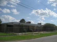
Location of Waggaman in Louisiana | |
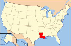
 Location of Louisiana in the United States | |
Waggaman is a census-designated place and unincorporated community in Jefferson Parish, Louisiana, United States. Waggaman is on the West Bank of the Mississippi River, within the New Orleans–Metairie–Kenner Metropolitan Statistical Area. The population was 10,304 at the 2010 census. The area was named for U.S. Senator George Augustus Waggaman (1782–1843).
History
George Augustus Waggaman settled in the area with his wife, Camille Arnoult, who inherited a large tract of land there. The two built a considerable plantation which they named Avondale, which later succumbed to the Mississippi River in 1892. Today the Avondale area, also an unincorporated community and which abuts Waggaman, is home to Avondale Shipyards, one of the largest employers in Jefferson Parish.
Geography
Waggaman is located at 29°55′47″N 90°13′48″W / 29.92972°N 90.23000°W (29.929856, -90.230053).[1]
According to the United States Census Bureau, the CDP has a total area of 6.6 square miles (17 km2), of which, 5.6 square miles (15 km2) of it is land and 1.0 square mile (2.6 km2) of it (14.94%) is water.
Demographics
As of the census[2] of 2010, there were 10,304 people and 3,351 households in the CPD The population density was 1,827 people per square mile. The racial makeup of the CDP was 36.22% White,59.33% African American, 0.45% Native American, 0.82% Asian, and 3.18% from other races. Hispanic or Latino of any race were 5.69% of the population.
There were 3,351 households out of which 39.2% had children under the age of 18 living with them, 54.7% were married couples living together, 21.9% had a female householder with no husband present, and 17.2% were non-families. 14.5% of all households were made up of individuals and 4.0% had someone living alone who was 65 years of age or older. The average household size was 3.14 and the average family size was 3.45.
In the CDP the population was spread out with 30.3% under the age of 18, 9.6% from 18 to 24, 29.4% from 25 to 44, 23.2% from 45 to 64, and 7.4% who were 65 years of age or older. The median age was 33 years. For every 100 females there were 93.4 males. For every 100 females age 18 and over, there were 89.1 males.
The median income for a household in the CDP was $33,084, and the median income for a family was $34,639. Males had a median income of $30,957 versus $19,477 for females. The per capita income for the CDP was $12,078. About 15.1% of families and 18.0% of the population were below the poverty line, including 23.5% of those under age 18 and 21.5% of those age 65 or over.
Education

Jefferson Parish Public School System serves Waggaman.[3]
Two elementary schools in Waggaman, Lucille Cherbonnier/Norbert Rillieux Elementary School and Live Oak Manor Elementary School, serve the city.[4] Previously the Cherbonnier/Rillieux school was two separate campuses: Norbert Rillieux Elementary School and Cherbonnier Elementary School.[5] In 2012 the superintendent recommended that the schools be consolidated with the Cherbonnier campus being used.[6] All residents are zoned to Henry Ford Middle School in Avondale and L.W. Higgins High School in Marrero.[7][8] In regards to advanced studies academies, residents are zoned to the Marrero Academy.[9]
Jefferson Parish Library operates the Live Oak Library in Waggaman.[3][10] The library, located adjacent to Thomas Jefferson Park, opened in 1989. It is designed to appear similar to an Acadian style cottage.[10]
References
- ↑ "US Gazetteer files: 2010, 2000, and 1990". United States Census Bureau. 2011-02-12. Retrieved 2011-04-23.
- ↑ "American FactFinder". United States Census Bureau. Retrieved 2008-01-31.
- 1 2 "2010 CENSUS - CENSUS BLOCK MAP: Waggaman CDP, LA" (Archive). U.S. Census Bureau. Retrieved on May 19, 2014.
- ↑ "Elementary School Districts 2012-2013 West Bank of Jefferson Parish Louisiana" (Archive). Jefferson Parish Public Schools. Retrieved on May 18, 2014.
- ↑ "Elementary School Districts 2009-2010 West Bank of Jefferson Parish Louisiana" (Archive). Jefferson Parish Public Schools. Retrieved on May 18, 2014.
- ↑ "SR-3 School Closure,Consolidation,and Boundary Changes for the 2012/2013 School Year." (Archive) Jefferson Parish Public School System. Retrieved on April 1, 2013.
- ↑ "Middle School Districts 2012-2013 West Bank of Jefferson Parish Louisiana" (Archive). Jefferson Parish Public Schools. Retrieved on May 18, 2014.
- ↑ "High School Districts 2012-2013 West Bank of Jefferson Parish Louisiana" (Archive). Jefferson Parish Public Schools. Retrieved on May 18, 2014.
- ↑ "Westbank Advanced Studies Academies Attendance Zones" (Archive). Jefferson Parish Public Schools. Retrieved on May 18, 2014.
- 1 2 "Live Oak Library." Jefferson Parish Library. Retrieved on September 28, 2010.
| Wikimedia Commons has media related to Waggaman, Louisiana. |
