Woodmansey
| Woodmansey | |
 St Peter's Church, Woodmansey |
|
 Woodmansey |
|
| Population | 7,109 (2011 census)[1] |
|---|---|
| OS grid reference | TA055379 |
| Civil parish | Woodmansey |
| Unitary authority | East Riding of Yorkshire |
| Ceremonial county | East Riding of Yorkshire |
| Region | Yorkshire and the Humber |
| Country | England |
| Sovereign state | United Kingdom |
| Post town | BEVERLEY |
| Postcode district | HU17 |
| Dialling code | 01482 |
| Police | Humberside |
| Fire | Humberside |
| Ambulance | Yorkshire |
| EU Parliament | Yorkshire and the Humber |
| UK Parliament | Haltemprice and Howden[2] |
Coordinates: 53°49′36″N 0°23′54″W / 53.826710°N 0.398419°W
Woodmansey is a village and civil parish in the East Riding of Yorkshire, England. It is situated approximately 1.5 miles (2.4 km) south-east of Beverley on the A1174 road from Hull to Beverley.
The civil parish of Woodmansey consists of the villages of Woodmansey and Dunswell and the hamlet of Thearne. According to the 2011 UK census, Woodmansey parish had a population of 7,109,[1] an increase on the 2001 UK census figure of 6,497.[3]
The village has a small primary school, Woodmansey Church of England Voluntary Controlled Primary School, which was opened in 1856 and celebrated its 150th anniversary in 2006.[4][5]
Opposite the school is the village church of St Peter's which was built to a design by Alfred Beaumont and opened in 1898.[6]
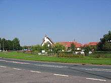
The Warton Arms (pictured) with its thatched roof, is the only pub in the village.[7]
Governance
The civil parish was in the Beverley and Holderness parliamentary constituency until the 2010 general election when it was transferred to the constituency of Haltemprice and Howden.[2]
References
- 1 2 "Key Figures for 2011 Census: Key Statistics: Area: Woodmansey CP (Parish)". Neighbourhood Statistics. Office for National Statistics. Retrieved 7 February 2013.
- 1 2 "Are you ready to vote in the next election?". East Riding News. East Riding of Yorkshire Council: p. 3. April 2010.
- ↑ "2001 Census: Key Statistics: Parish Headcounts: Area: Woodmansey CP (Parish)". Neighbourhood Statistics. Office for National Statistics. Retrieved 12 March 2008.
- ↑ "Woodmansey Church of England Voluntary Controlled Primary School". Departmant for Education. Retrieved 1 November 2016.
- ↑ Baggs, A. P.; Brown, L. M.; Forster, G. C. F.; Hall, I.; Horrox, R. E.; Kent, G. H. R.; Neave, D. (1989). "'Outlying townships: Thearne and Woodmansey'". In Allison, K. J. A History of the County of York East Riding: Volume 6, the Borough and Liberties of Beverley. British History Online. London: Victoria County History. pp. 295–301. Retrieved 31 October 2016.
- ↑ "St Peter's Woodmansey". Beverley Minster. Retrieved 27 January 2012.
- ↑ "Warton Arms". CAMRA Hull & East Yorkshire Branch. Retrieved 31 October 2016.
- Gazetteer — A–Z of Towns Villages and Hamlets. East Riding of Yorkshire Council. 2006. p. 12.
| Wikimedia Commons has media related to Woodmansey. |