Wykebeck
Coordinates: 53°48′07″N 1°29′06″W / 53.802°N 1.485°W

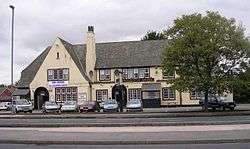
Wykebeck Arms
Wykebeck is an area of Leeds, West Yorkshire, England named after the Wyke Beck. The area is situated in between Gipton and Seacroft along Wykebeck Road. The area falls within the Gipton and Harehills ward of the Leeds Metropolitan Council. The area is seldom referred to, instead people usually perceive Gipton to be West of the beck and Seacroft to be East of it. The area consists of several blocks of highrise council flats to the south.
Schools
Wykebeck Primary School is on Brander Street.[1]
References
External links
- Leodis website containing archive photographs of Wykebeck (type Wykebeck into search box).
| Wikimedia Commons has media related to Wykebeck, Leeds. |
This article is issued from Wikipedia - version of the 7/22/2016. The text is available under the Creative Commons Attribution/Share Alike but additional terms may apply for the media files.