Zeila & Lughaya State
Zeila & Lughaya State of Somalia
| |
|---|---|
|
Flag | |
|
Anthem: Qolobaa Calankeed | |
 | |
| Capital and largest city |
Zeila 10°48′N 43°10′E / 10.800°N 43.167°E |
| Official languages | |
| Government | |
• President | Mahad Abib Maxamuud |
| Establishment | |
• Declared | 2011 |
| Area | |
• Total | 18,566 km2 (7,168 sq mi) |
| Population | |
• 2015 estimate | 270,858 |
| Time zone | EAT (UTC+3) |
| Calling code | +252 (Somalia) |
Zeila & Lughaya State, or Saylac & Lughaya State, officially the Zeila & Lughaya State of Somalia, (Somali: Maamul Goboleedka Saylac & Lughaya ee Soomaaliya), is a region in northwestern Somalia. Saylac and Lughaya State was formed in 2011 and on 07 February 2012 ofitialy go out of Somaliland, claiming to be a federal state of Somalia. Zeila State is proclaimed first. It later it united with Lugayhe to form the state of Sayla and Lugayhe. Each individual state and the combined state has its own flag. Unlike the secessionist Somaliland region in northern Somalia, Zelia & Lughaya State is not trying to obtain international recognition as a separate nation. However, the government of Somaliland soon regained some kind of control of the territory. The territory has a total area of 18,566 km. Its main city is Zeila, which is situated on the coast. Lughaya, Asha Addo, Harirad, Jidhi and Lawyacado are the other principal cities in the region.
Overview


Local control of the regions has been disputed between the autonomous Awdalland region in northern Somalia. Somaliland, a self-declared republic that is internationally recognized onley as an autonomous region of Somalia and local unionist authorities
History
Land of Punt

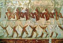
Together with northern Somalia, Eritrea and the Red Sea coast of Sudan, Djibouti is considered the most likely location of the land known to the ancient Egyptians as Punt (or "Ta Netjeru", meaning "God's Land"), whose first mention dates to the 25th century BC.[1] The Puntites were a nation of people that had close relations with Ancient Egypt during the times of Pharaoh Sahure and Queen Hatshepsut. They "traded not only in their own produce of incense, ebony and short-horned cattle, but also in goods from other neighbouring regions, including gold, ivory and animal skins."[2] According to the temple reliefs at Deir el-Bahari, the Land of Punt was ruled at that time by King Parahu and Queen Ati.[3]
Ifat Sultanate
The Ifat Sultanate was a medieval kingdom in the Horn of Africa. Founded in 1285 by the Walashma dynasty, it was centered in Zeila.[4][5] Ifat established bases in northern Somalia, and from there expanded southward to the Ahmar Mountains. Its Sultan Umar Walashma (or his son Ali, according to another source) is recorded as having conquered the Sultanate of Shewa in 1285. Taddesse Tamrat explains Sultan Umar's military expedition as an effort to consolidate the Muslim territories in the Horn, in much the same way as Emperor Yekuno Amlak was attempting to unite the Christian territories in the highlands during the same period. These two states inevitably came into conflict over Shewa and territories further south. A lengthy war ensued, but the Muslim sultanates of the time were not strongly unified. Ifat was finally defeated by Emperor Amda Seyon I of Ethiopia in 1332, and withdrew from Shewa.
Adal Sultanate
Islam was introduced to the area early on from the Arabian peninsula, shortly after the hijra. In the late 800s, Al-Yaqubi wrote that Muslims were living along the northern Horn seaboard.[6] He also mentioned that the Adal kingdom had its capital in Zeila, a port city in the northwestern Awdal region abutting Djibouti.[6][7] This suggests that the Adal Sultanate with Zeila as its headquarters dates back to at least the 9th or 10th centuries. According to I.M. Lewis, the polity was governed by local dynasties consisting of Somalized Arabs or Arabized Somalis, who also ruled over the similarly established Sultanate of Mogadishu in the Benadir region to the south. Adal's history from this founding period forth would be characterized by a succession of battles with neighbouring Abyssinia.[7] At its height, the Adal kingdom controlled large parts of modern-day Djibouti, Somalia, Eritrea and Ethiopia.
British Somaliland
In 1888, after signing successive treaties with the then ruling Somali Sultans such as Mohamoud Ali Shire of the Warsangali Sultanate, the British established a protectorate in the region referred to as British Somaliland.[7] The British garrisoned the protectorate from Aden and administered it from their British India colony until 1898. British Somaliland was then administered by the Foreign Office until 1905 and afterwards by the Colonial Office.
Somali Civil War
By the late 1980s, the moral authority of Barre's government had collapsed. Many Somalis had become disillusioned with life under military dictatorship. The government became increasingly totalitarian, and resistance movements, encouraged by Ethiopia, sprang up across the country, eventually leading to the Somali Civil War and Barre's ouster.
Demographics
Most residents of the region belong to the Somali ethnic group, with the Issa especially well-represented.
Towns
| Town names | Population |
|---|---|
| Zeila district | 105,000 |
| Lawyacado area | 3,600 |
| Lughaya district | 75,000 |
| Ceel Gaal area | 1,645 |
| Abdol Ghadar area | 2,780 |
| Xariirad district | 57,000 |
| Asha Addo area | 1,874 |
| Jidhi area | 785 |
References
- ↑ Simson Najovits, Egypt, trunk of the tree, Volume 2, (Algora Publishing: 2004), p.258.
- ↑ Tyldesley, Hatchepsut, p.147
- ↑ Breasted 1906-07, pp. 246–295, vol. 1.
- ↑ J. Gordon Melton and Martin Baumann, Religions of the World, Second Edition: A Comprehensive Encyclopedia of Beliefs and Practices, page 2663
- ↑ Asafa Jalata, State Crises, Globalisation, And National Movements In North-east Africa page 3-4
- 1 2 Encyclopedia Americana, Volume 25. Americana Corporation. 1965. p. 255.
- 1 2 Lewis, I.M. (1955). Peoples of the Horn of Africa: Somali, Afar and Saho. International African Institute. p. 140.

