Chae Hom District
| Chae Hom แจ้ห่ม | |
|---|---|
| Amphoe | |
 Amphoe location in Lampang Province | |
| Coordinates: 18°42′46″N 99°33′27″E / 18.71278°N 99.55750°ECoordinates: 18°42′46″N 99°33′27″E / 18.71278°N 99.55750°E | |
| Country |
|
| Province | Lampang |
| Seat | Wichet Nakhon |
| Area | |
| • Total | 1,349.121 km2 (520.899 sq mi) |
| Population (2005) | |
| • Total | 42,457 |
| • Density | 31.2/km2 (81/sq mi) |
| Time zone | THA (UTC+7) |
| Postal code | 52120 |
| Geocode | 5206 |
Chae Hom (Thai: แจ้ห่ม; IPA: [tɕɛ̂ː hòm]) is a district (amphoe) of Lampang Province, northern Thailand.
Geography
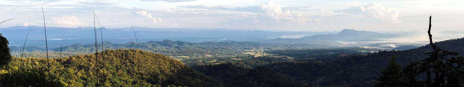
Panoramic view of the Wang River valley in Chae Hom district, with the mountains of the Phi Pan Nam Range in the distance, as seen from road 1252 in the mountains of the Khun Tan Range
Neighboring districts are (from the north clockwise): Wang Nuea, Ngao, Mae Mo, Mueang Lampang and Mueang Pan of Lampang Province.
Administration
The district is subdivided into 7 subdistricts (tambon), which are further subdivided into 58 villages (muban). Chae Hom is a township (thesaban tambon) which covers parts of tambon Chae Hom. There are further 7 Tambon administrative organizations (TAO).
| No. | Name | Thai name | Villages | Inh. | |
|---|---|---|---|---|---|
| 1. | Chae Hom | แจ้ห่ม | 10 | 8,903 | |
| 2. | Ban Sa | บ้านสา | 7 | 5,299 | |
| 3. | Pong Don | ปงดอน | 8 | 5,188 | |
| 4. | Mae Suk | แม่สุก | 11 | 7,400 | |
| 5. | Mueang Mai | เมืองมาย | 5 | 3,332 | |
| 6. | Thung Phueng | ทุ่งผึ้ง | 6 | 4,121 | |
| 7. | Wichet Nakhon | วิเชตนคร | 11 | 8,214 |
External links
- amphoe.com (Thai)
This article is issued from Wikipedia - version of the 6/14/2014. The text is available under the Creative Commons Attribution/Share Alike but additional terms may apply for the media files.