Beatrice, Alabama
| Beatrice, Alabama | |
|---|---|
| Town | |
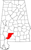
 Location in Monroe County and the state of Alabama | |
| Coordinates: 31°43′59″N 87°12′24″W / 31.73306°N 87.20667°W | |
| Country | United States |
| State | Alabama |
| County | Monroe |
| Area | |
| • Total | 1.4 sq mi (3.5 km2) |
| • Land | 1.4 sq mi (3.5 km2) |
| • Water | 0 sq mi (0 km2) |
| Elevation | 269 ft (82 m) |
| Population (2010) | |
| • Total | 301 |
| Time zone | Central (CST) (UTC-6) |
| • Summer (DST) | CDT (UTC-5) |
| ZIP code | 36425 |
| Area code(s) | 251 |
| FIPS code | 01-04900 |
| GNIS feature ID | 0113705 |
| Website |
www |
Beatrice /biːˈætrᵻs/ is a town in Monroe County, Alabama, United States. It incorporated in 1901.[1] At the 2010 census the population was 301, down from 412 in 2000.[2]
Geography
Beatrice is located at 31°43′59″N 87°12′24″W / 31.73306°N 87.20667°W (31.733178, -87.206773).[3]
According to the U.S. Census Bureau, the town has a total area of 1.4 square miles (3.6 km2), all land.
Demographics
| Historical population | |||
|---|---|---|---|
| Census | Pop. | %± | |
| 1910 | 345 | — | |
| 1920 | 293 | −15.1% | |
| 1930 | 342 | 16.7% | |
| 1940 | 410 | 19.9% | |
| 1950 | 375 | −8.5% | |
| 1960 | 506 | 34.9% | |
| 1970 | 455 | −10.1% | |
| 1980 | 558 | 22.6% | |
| 1990 | 454 | −18.6% | |
| 2000 | 412 | −9.3% | |
| 2010 | 301 | −26.9% | |
| Est. 2015 | 285 | [4] | −5.3% |
| U.S. Decennial Census[5] 2013 Estimate[6] | |||
As of the census[7] of 2000, there were 412 people, 158 households, and 106 families residing in the town. The population density was 304.8 people per square mile (117.8/km2). There were 203 housing units at an average density of 150.2 per square mile (58.1/km2). The racial makeup of the town was 26.94% White, 72.57% Black or African American, 0.24% Native American and 0.24% Pacific Islander. 0.49% of the population were Hispanic or Latino of any race.
There were 158 households out of which 32.9% had children under the age of 18 living with them, 36.1% were married couples living together, 25.3% had a female householder with no husband present, and 32.3% were non-families. 29.7% of all households were made up of individuals and 18.4% had someone living alone who was 65 years of age or older. The average household size was 2.61 and the average family size was 3.17.
In the town the population was spread out with 28.9% under the age of 18, 9.7% from 18 to 24, 20.6% from 25 to 44, 21.4% from 45 to 64, and 19.4% who were 65 years of age or older. The median age was 38 years. For every 100 females there were 89.0 males. For every 100 females age 18 and over, there were 84.3 males.
The median income for a household in the town was $15,833, and the median income for a family was $15,625. Males had a median income of $30,417 versus $15,469 for females. The per capita income for the town was $8,661. About 39.6% of families and 44.4% of the population were below the poverty line, including 54.5% of those under age 18 and 29.2% of those age 65 or over.
Local industry
Beatrice is home to Monroe Sausage, a locally owned smoked pork sausage product. The town holds an annual sausage festival to celebrate the industry. It also has a thriving timber industry and rejuvenated downtown area that includes several antique and gift shops, a cafe, and a bed and breakfast. Country music songwriter Derek Johnson has a residence in Beatrice. He is a former President of A&R Country Division in iMG Records/Universal/EMI and also has two songs by Shenandoah and Dave Gibson of the Gibson/Miller Band and one song unreleased by Lady Antebellum.
Notable person
- Butch Avinger, former NFL player
References
- ↑ http://www.encyclopediaofalabama.org/article/h-3588
- ↑
- ↑ "US Gazetteer files: 2010, 2000, and 1990". United States Census Bureau. 2011-02-12. Retrieved 2011-04-23.
- ↑ "Annual Estimates of the Resident Population for Incorporated Places: April 1, 2010 to July 1, 2015". Retrieved July 2, 2016.
- ↑ "U.S. Decennial Census". Census.gov. Archived from the original on May 11, 2015. Retrieved June 6, 2013.
- ↑ "Annual Estimates of the Resident Population: April 1, 2010 to July 1, 2013". Retrieved June 3, 2014.
- ↑ "American FactFinder". United States Census Bureau. Archived from the original on 2013-09-11. Retrieved 2008-01-31.
External links
Coordinates: 31°43′59″N 87°12′24″W / 31.733178°N 87.206773°W
