D5 road (Croatia)
| |
|---|---|
| Route information | |
|
Part of | |
| Length: | 123.1 km (76.5 mi) |
| Major junctions | |
| From: |
|
|
| |
| To: |
|
| Location | |
| Counties: | Virovitica-Podravina, Bjelovar-Bilogora, Požega-Slavonia, Brod-Posavina |
| Major cities: | Virovitica, Daruvar, Pakrac, Lipik |
| Highway system | |
| State roads in Croatia | |

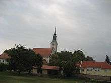
Virovitica, on the D5 route
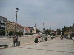
Daruvar, on the D5 route
D5 is a state road in the eastern Croatia the A3 motorway Okučani interchange to a number of cities in the western Slavonia region, including Pakrac and Daruvar, as well as to Drava River valley city of Virovitica. The road also links international border crossings Terezino Polje and Stara Gradiška providing access to Barcs, Hungary and Bosanska Gradiška, Bosnia and Herzegovina respectively.[maps 1][1] The road is 123.1 km (76.5 mi) long.[2]
The road, as well as all other state roads in Croatia, is managed and maintained by Hrvatske ceste, a state-owned company.[3]
Traffic volume
Traffic is regularly counted and reported by Hrvatske ceste, operator of the road.[4]
| D5 traffic volume | ||||
| Road | Counting site | AADT | ASDT | Notes |
| |
2202 Terezino Polje | 760 | 1,071 | Adjacent to the Ž4004 junction. |
| |
2214 Virovitica bypass north | 780 | 974 | Between the D2 and the Ž4249 junctions. |
| |
2215 Virovitica bypass south | 1,296 | 1,580 | Between the D2 and the Ž4251 junctions. |
| |
2205 Grubišno Polje | 2,917 | 3,011 | Between the Ž3094 and the Ž3139 junctions. |
| |
2206 Končanica west | 2,484 | 2,580 | Adjacent to the Ž3138 junction. |
| |
2210 Kip | 1,853 | 2,167 | Adjacent to the Ž3171 junction. |
| |
2213 Badljevina | 2,178 | 2,278 | Adjacent to the Ž3272 junction. |
| |
3411 Lipik | 4,722 | 5,018 | Adjacent to the D47 junction. |
| |
3406 Cage | 1,451 | 1,497 | Adjacent to the Ž3252 junction. |
| |
3412 Okučani | 3,592 | 3,918 | Between the Ž3241 and the Ž4158 junctions. |
| |
3410 Stara Gradiška | 3,470 | 4,140 | Between the Ž4226 and the Ž4227 junctions.The AADT figure estimated by Hrvatske ceste. |
Road junctions and populated areas
| D5 junctions/populated areas | |
| Type | Slip roads/Notes |
| |
Terezino Polje border crossing to Hungary The northern terminus of the road. |
| |
Terezino Polje |
| |
Gornje Bazje Ž4004 to Veliko Polje. |
| |
Kapela Dvor Ž4009 to Turanovac. |
| |
Lukač Ž4007 to Rogovac (D2) and Gradina. |
| |
Virovitica |
| |
Lončarica |
| |
Velika Dapčevica |
| |
Grubišno Polje Ž3094 to Veliki Grđevac (D28) and Ivanovo Selo. |
| |
Orlovac Zdenački Ž3139 to Grbavac |
| |
Mali Zdenci |
| |
Veliki Zdenci |
| |
Končanica Ž3138 to D26 state road. |
| |
Donji Daruvar Ž3301 to Đulovac Suhopolje (D2). |
| |
Daruvar Ž3170 to Vrbovac and Markovac. Ž3287 within Daruvar itself. |
| |
Ž3172 to Doljani and Sirač. |
| |
Ž3171 to Šibovac. |
| |
Kip |
| |
Badljevina Ž3169 to Trojeglava. Ž3272 to Sirač. |
| |
Ž3291 to Dereza, Sirač and Pakrani. |
| |
Ž4097 to Gornja Obrijež and Donja Obrijež. |
| |
Pakrac Ž4098 to Prekopakra. Ž4099 to Šeovica. |
| |
Lipik |
| |
Donji Čaglić |
| |
Bjelanovac |
| |
Bijela Stijena |
| |
Benkovac |
| |
Cage |
| |
Okučani Ž3252 to Novska (D312). Ž4153 to Vrbovljani. Ž4158 to Nova Gradiška, Staro Petrovo Selo and Batrina (D49). Ž4241 to Okučani railway station (M105 railway). |
| |
Dubovac |
| |
|
| |
Novi Varoš |
| |
Ž4226 to Stara Gradiška and Gornji Varoš. |
| |
Ž4227 to Donji Varoš. |
| |
Stara Gradiška border crossing to Bosnia and Herzegovina The southern terminus of the road. |
Maps
- ↑ Overview map of the D5 (Map). OpenStreetMap. Retrieved February 4, 2014.
Sources
- ↑ "Regulation on motorway markings, chainage, interchange/exit/rest area numbers and names". Narodne novine (in Croatian). May 6, 2003.
- ↑ Ministry of Sea, Transport and Infrastructure (Croatia) (June 4, 2013). "Decision on categorization of public roads" (in Croatian). Narodne novine. Retrieved July 25, 2014.
- ↑ "Public Roads Act". Narodne novine (in Croatian). December 14, 2004.
- ↑ "Traffic counting on the roadways of Croatia in 2013 - digest" (PDF). Hrvatske ceste. May 2014. Retrieved 2014-07-20.
This article is issued from Wikipedia - version of the 9/7/2014. The text is available under the Creative Commons Attribution/Share Alike but additional terms may apply for the media files.