Durant, Mississippi
| Durant, Mississippi | |
|---|---|
| City | |
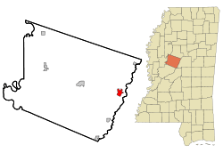
 Location of Durant, Mississippi | |
 Durant, Mississippi Location in the United States | |
| Coordinates: 33°4′35″N 89°51′23″W / 33.07639°N 89.85639°WCoordinates: 33°4′35″N 89°51′23″W / 33.07639°N 89.85639°W | |
| Country | United States |
| State | Mississippi |
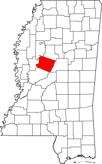
| County | Holmes |
| Government | |
| • Mayor | Tasha Boyette-Davis |
| Area | |
| • Total | 2.3 sq mi (5.8 km2) |
| • Land | 2.2 sq mi (5.8 km2) |
| • Water | 0.0 sq mi (0.1 km2) |
| Elevation | 259 ft (79 m) |
| Population (2010) | |
| • Total | 2,673 |
| • Density | 1,162.1/sq mi (508.3/km2) |
| Time zone | Central (CST) (UTC-6) |
| • Summer (DST) | CDT (UTC-5) |
| ZIP code | 39063 |
| Area code(s) | 662 |
| FIPS code | 28-20500 |
| GNIS feature ID | 0669521 |
Durant is a city in Holmes County, Mississippi. It was founded in 1858 as a station on the Mississippi Central Railroad, later part of the Illinois Central. Durant was named for Louis Durant, a Choctaw chief who had lived on a bluff just across the nearby Big Black River before Indian Removal.
Before the Civil War, this was known as the "dark corner of the county."[1] It was an area of cotton plantations and numerous enslaved African-American workers. The area is largely rural and agricultural. The population of the city was 2,932 at the 2000 census.
Murders of two nuns
Sister Paula Merrill, a nurse practitioner with the Sisters of Charity of Nazareth in Kentucky, and Sister Margaret Held, a nurse practitioner with the School Sisters of St. Francis in Milwaukee, both aged 68, were found dead Thursday, August 25, 2016, in their home on Castalian Springs Road in Durant; the two women had been stabbed to death. A felon, Rodney Earl Sanders (aged 46), from nearby Kosciusko, was charged with the murders.[2]
Geography
Durant is located at 33°4′35″N 89°51′23″W / 33.07639°N 89.85639°W (33.076313, -89.856405).[3]
According to the United States Census Bureau, the city has a total area of 2.2 square miles (5.7 km2), of which 2.2 square miles (5.7 km2) is land and 0.04 square miles (0.10 km2) (0.89%) is water.
Demographics
| Historical population | |||
|---|---|---|---|
| Census | Pop. | %± | |
| 1870 | 375 | — | |
| 1880 | 724 | 93.1% | |
| 1890 | 1,259 | 73.9% | |
| 1900 | 1,766 | 40.3% | |
| 1910 | 1,881 | 6.5% | |
| 1920 | 1,870 | −0.6% | |
| 1930 | 2,480 | 32.6% | |
| 1940 | 2,510 | 1.2% | |
| 1950 | 2,311 | −7.9% | |
| 1960 | 2,617 | 13.2% | |
| 1970 | 2,752 | 5.2% | |
| 1980 | 2,889 | 5.0% | |
| 1990 | 2,838 | −1.8% | |
| 2000 | 2,932 | 3.3% | |
| 2010 | 2,673 | −8.8% | |
| Est. 2015 | 2,486 | [4] | −7.0% |
As of the census[6] of 2010, there were 2,673 people, 1,171 households, and 978 families residing in the city. The population density was 1,316.4 people per square mile (507.6/km²). There were 1,209 housing units at an average density of 542.8 per square mile (209.3/km²). The racial makeup of the city was 13.80% White, 85.29% African American, 0.22% Native American, 0% Asian, 0.29% from other races, and 0.33% from two or more races. Hispanic or Latino of any race were 0.26% of the population.
There were 1,171 households out of which 33.9% had children under the age of 18 living with them, 35.9% were married couples living together, 30.1% had a female householder with no husband present, and 30.7% were non-families. 28.7% of all households were made up of individuals and 14.3% had someone living alone who was 65 years of age or older. The average household size was 2.68 and the average family size was 3.32.
In the city the population was spread out with 31.6% under the age of 18, 6.2% from 20 to 24, 30.1% from 25 to 49, 15.7% from 50 to 64, and 13.2% who were 65 years of age or older. The median age was 32 years. There were 1,230 males and 1,443 females.
The median income for a household in the city was $19,659, and the median income for a family was $25,065. Males had a median income of $26,500 versus $20,200 for females. The per capita income for the city was $12,210. About 27.9% of families and 35.1% of the population were below the poverty line, including 44.1% of those under age 18 and 26.7% of those age 65 or over.
Education
The city of Durant is served by two school districts - Durant and Holmes County. Their schools are William Sullivan Elementary, Jr. High, and High Schools and Durant Elementary, Jr. High, and High Schools.
Notable people
- Absolom M. West - planter, politician, Civil War general, labor organizer and Vice Presidential candidate; he owned a plantation near Durant prior to the American Civil War.
- Minerva Hamilton Hoyt - born on a nearby plantation; an early activist in California to preserve its deserts
- Tommy McClennan - American Delta blues singer and guitarist.
- Jimmy W. Jamison - American recording artist and lead singer in the musical group 'Survivor'
- John Howell - son of Durant Mayor William Edgar Howell, became a civil rights activist in Atlanta.[7]
References
- ↑ Dr. Pamela A. Smoot, PhD "Alexander Lane; From Slavery to Freedom: The Life of Alexander Lane, Educator, Physician and Illinois State Legislator, 1860-1911, The Simon Review, Paper #29, February 2012
- ↑ "Man charged in slaying of 2 nuns". Clarionledger.com. 2016-08-27. Retrieved 2016-11-13.
- ↑ "US Gazetteer files: 2010, 2000, and 1990". United States Census Bureau. 2011-02-12. Retrieved 2011-04-23.
- ↑ "Annual Estimates of the Resident Population for Incorporated Places: April 1, 2010 to July 1, 2015". Retrieved July 2, 2016.
- ↑ "Census of Population and Housing". Census.gov. Retrieved June 4, 2015.
- ↑ "American FactFinder". United States Census Bureau. Retrieved 2008-01-31.
- ↑ "Former Durant mayor dies; rites Wednesday", Holmes County Herald, August 29, 1968, page 1]
