Err, Pyrénées-Orientales
| Err Er | |
|---|---|
|
The church of Saint-Génis and the chapel of the Virgin, in Err | |
 Err | |
|
Location within Occitanie region 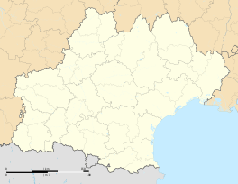 Err | |
| Coordinates: 42°26′28″N 2°02′03″E / 42.4411°N 2.0342°ECoordinates: 42°26′28″N 2°02′03″E / 42.4411°N 2.0342°E | |
| Country | France |
| Region | Occitanie |
| Department | Pyrénées-Orientales |
| Arrondissement | Prades |
| Canton | Saillagouse |
| Intercommunality | Pyrénées Cerdagne |
| Government | |
| • Mayor (2008–2014) | Raymond Pouget |
| Area1 | 25.92 km2 (10.01 sq mi) |
| Population (1999)2 | 638 |
| • Density | 25/km2 (64/sq mi) |
| Time zone | CET (UTC+1) |
| • Summer (DST) | CEST (UTC+2) |
| INSEE/Postal code | 66067 / 66800 |
| Elevation |
1,309–2,911 m (4,295–9,551 ft) (avg. 1,335 m or 4,380 ft) |
|
1 French Land Register data, which excludes lakes, ponds, glaciers > 1 km² (0.386 sq mi or 247 acres) and river estuaries. 2 Population without double counting: residents of multiple communes (e.g., students and military personnel) only counted once. | |
.JPG)
Err (Catalan: Er) is a commune in the Pyrénées-Orientales department in southern France.
Geography
Err is located in the canton of Saillagouse and in the arrondissement of Prades.
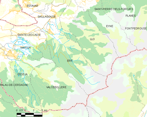
Map of Err and its surrounding communes
Population
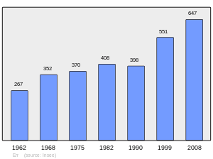
Population 1962-2008
See also
References
| Wikimedia Commons has media related to Err. |
This article is issued from Wikipedia - version of the 11/3/2015. The text is available under the Creative Commons Attribution/Share Alike but additional terms may apply for the media files.