Georgia State Route 59
| ||||
|---|---|---|---|---|
 | ||||
| Route information | ||||
| Maintained by GDOT | ||||
| Length: | 32.3 mi[1] (52.0 km) | |||
| Major junctions | ||||
| Southwest end: |
| |||
| Northeast end: | Lake Hartwell | |||
| Location | ||||
| Counties: | Jackson, Banks, Franklin, Hart | |||
| Highway system | ||||
| ||||

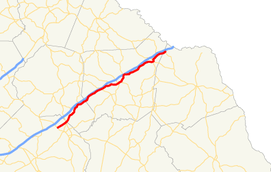
State Route 59 (SR 59) is a 32.3-mile-long (52.0 km) state highway that runs southwest-to-northeast through portions of Jackson, Banks, Franklin, and Hart counties in the northeastern part of the U.S. state of Georgia. The route connects Commerce with the northwestern shore of Lake Hartwell, via Carnesville and Lavonia. The highway closely parallels Interstate 85 (I-85).
Route description
SR 59 begins at an intersection with US 441/SR 15 (Homer Road) in the northeastern part of Commerce within Jackson County. This intersection also marks the northern terminus of US 441 Business/SR 15 Alternate, which take the Homer Road designation. South of here, US 441/SR 15 are known as Veterans Memorial Parkway. Almost immediately, SR 59 crosses into Banks County. The only major intersections in the county are with the eastern terminus of SR 164 and the southern terminus of SR 63. In Franklin County, it intersects SR 51 before meeting the eastern terminus of SR 198. Less than 1 mile (1.6 km) later, the highway intersects SR 106, which travels concurrent with it into Carnesville. In town, SR 145 joins the concurrency for just over 1 mile (1.6 km). At the end of the concurrency, SR 59 splits off to continue its northeast routing. In Lavonia, SR 59 intersects SR 17, before meeting the northern terminus of SR 77 Connector. About 2 miles (3.2 km) later, the road crosses into Hart County. It intersects SR 77. It continues to the northeast and curves to the east to meet its northern terminus, along the northwestern shore of Lake Hartwell.[1]
History
Before the construction of Lake Hartwell, SR 59 continued into South Carolina as South Carolina Highway 59. With the I-85 bridge less than 1 mile (1.6 km) away from the old crossing, the states had no need to directly reconnect the roads. SR 59 is not concurrent with I-85 on either side of the lake and the two highways do not officially connect.
Major intersections
| County | Location | mi[1] | km | Destinations | Notes |
|---|---|---|---|---|---|
| Jackson | Commerce | 0.0 | 0.0 | Southern terminus | |
| Banks | | 3.9 | 6.3 | Southern terminus of SR 164 | |
| Hudson River | 4.9 | 7.9 | Unnamed bridge | Crossing over the Hudson River | |
| | 5.1 | 8.2 | Southern terminus of SR 63 | ||
| Franklin | | 11.7 | 18.8 | ||
| | 14.2 | 22.9 | Eastern terminus of SR 198 | ||
| Middle Fork Broad River | 15.0 | 24.1 | Unnamed bridge | Crossing over the Middle Fork Broad River | |
| | 16.0 | 25.7 | Southern terminus of SR 320 | ||
| Carnesville | 16.4 | 26.4 | Southern end of SR 106 concurrency | ||
| 16.8 | 27.0 | Southern end of SR 145 concurrency | |||
| 18.2 | 29.3 | Northern end of SR 106 & SR 145 concurrencies | |||
| North Fork Broad River | 20.9 | 33.6 | Unnamed bridge | Crossing over the North Fork Broad River | |
| Lavonia | 26.3 | 42.3 | |||
| 26.5 | 42.6 | Northern terminus of SR 77 Connector | |||
| 27.5 | 44.3 | Southern terminus of SR 328 | |||
| Hart | | 30.3 | 48.8 | ||
| Lake Hartwell | 32.3 | 52.0 | Northern terminus | ||
1.000 mi = 1.609 km; 1.000 km = 0.621 mi
| |||||
See also
-
.svg.png) Georgia (U.S. state) portal
Georgia (U.S. state) portal -
 U.S. Roads portal
References
- 1 2 3 Google (August 3, 2013). "Route of SR 59" (Map). Google Maps. Google. Retrieved August 3, 2013.