Gheorgheni, Cluj-Napoca
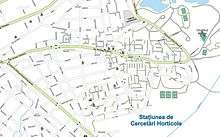
Map of the district
Gheorgheni is a district located in the east of Cluj-Napoca in Romania, built in the 1960s during the Ceausescu Regime with many green areas.
Coordinates: 46°45′53″N 23°37′13″E / 46.76472°N 23.62028°E
This article is issued from Wikipedia - version of the 2/22/2015. The text is available under the Creative Commons Attribution/Share Alike but additional terms may apply for the media files.