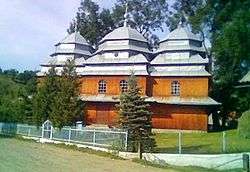
Kamianka, Skole Raion
| Kamianka Ка́м'янка | |
|---|---|
| village | |
 | |
 Kamianka | |
| Coordinates: UA 49°00′48″N 23°34′41″E / 49.01333°N 23.57806°ECoordinates: UA 49°00′48″N 23°34′41″E / 49.01333°N 23.57806°E | |
| Country |
|
| Province |
|
| District | Skole Raion |
| Established | 1774 |
| Area | |
| • Total | 0,650 km2 (250 sq mi) |
| Elevation/(average value of) | 601 m (1,972 ft) |
| Population | |
| • Total | 447 |
| • Density | .690/km2 (1.79/sq mi) |
| Time zone | EET (UTC+2) |
| • Summer (DST) | EEST (UTC+3) |
| Postal code | 82600 |
| Area code | +380 3251 |
| Website | село Кам'янка (Ukrainian) |
Kamianka (Ukrainian: Ка́м'янка; until 1952 Ukrainian: Ри́сяча я́ма, Rysya Yama, lit. Lynx Pit; Polish: Kamionka) is a village (selo) in Skole Raion, Lviv Oblast, of Western Ukraine. Local government is administered by Kamiantska village council.[1]
The village is located in southern part in Lviv Oblast in the Ukrainian Carpathians within the limits the Eastern Beskids (Skole Beskids).
The village is located at a distance 112 kilometres (70 mi) from the regional center of Lviv, 26 kilometres (16 mi) from the district center Skole, and 170 kilometres (110 mi) from Uzhhorod.
Downstream river Kamianka located Kamyanetskiy Falls, hydrological natural monument of Ukraine.[2]
The first mention of Kamianka dates from the year 1774.[3]
Notes
- ↑ Кам’янська сільська рада (Ukrainian)
- ↑ Водоспад Кам’янка, Кам’янка (Ukrainian)
- ↑ (Ukrainian)
External links
This article is issued from Wikipedia - version of the 8/30/2016. The text is available under the Creative Commons Attribution/Share Alike but additional terms may apply for the media files.