Kenton, Ohio
| Kenton, Ohio | |
|---|---|
| City | |
|
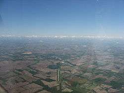
Aerial view of Kenton from the southwest | |
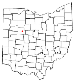
 Location of Kenton, Ohio | |
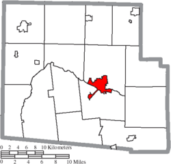
 Location of Kenton in Hardin County | |
| Coordinates: 40°38′48″N 83°36′31″W / 40.64667°N 83.60861°WCoordinates: 40°38′48″N 83°36′31″W / 40.64667°N 83.60861°W | |
| Country | United States |
| State | Ohio |
| County | Hardin |
| Government | |
| • Mayor | Randy Manns |
| Area[1] | |
| • Total | 5.13 sq mi (13.29 km2) |
| • Land | 5.04 sq mi (13.05 km2) |
| • Water | 0.09 sq mi (0.23 km2) |
| Elevation[2] | 991 ft (302 m) |
| Population (2010)[3] | |
| • Total | 8,262 |
| • Estimate (2012[4]) | 8,195 |
| • Density | 1,639.3/sq mi (632.9/km2) |
| Time zone | Eastern (EST) (UTC-5) |
| • Summer (DST) | EDT (UTC-4) |
| ZIP code | 43326 |
| Area code(s) | 419 567 |
| FIPS code | 39-39886[5] |
| GNIS feature ID | 1064929[2] |
| Website | http://www.kentoncity.com/ |
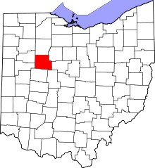
Kenton is a city in and the county seat of Hardin County, Ohio, United States,[6] located in the west central part of Ohio. The population was 8,262 at the 2010 census. The city was named for frontiersman Simon Kenton of Kentucky and Ohio.
Geography
Kenton is located at 40°38′48″N 83°36′31″W / 40.64667°N 83.60861°W (40.646555, -83.608706).[7]
According to the United States Census Bureau, the city has a total area of 5.13 square miles (13.29 km2), of which, 5.04 square miles (13.05 km2) is land and 0.09 square miles (0.23 km2) is water.[1]
History
In 1845, Kenton was incorporated as a village; it became a city in 1886. The city was named after frontiersman Simon Kenton.[8]
The city began as a center for agriculture trade, then in the late nineteenth century developed industry common to America of the time.[9] From 1890 to 1952, Kenton was home to the Kenton Hardware Company, manufacturers of locks, cast-iron toys, and the very popular Gene Autry toy cap guns.[10]
Demographics
| Historical population | |||
|---|---|---|---|
| Census | Pop. | %± | |
| 1840 | 299 | — | |
| 1850 | 1,065 | 256.2% | |
| 1860 | 1,612 | 51.4% | |
| 1870 | 2,610 | 61.9% | |
| 1880 | 3,940 | 51.0% | |
| 1890 | 5,557 | 41.0% | |
| 1900 | 6,852 | 23.3% | |
| 1910 | 7,185 | 4.9% | |
| 1920 | 7,690 | 7.0% | |
| 1930 | 7,069 | −8.1% | |
| 1940 | 7,593 | 7.4% | |
| 1950 | 8,475 | 11.6% | |
| 1960 | 8,747 | 3.2% | |
| 1970 | 8,315 | −4.9% | |
| 1980 | 8,605 | 3.5% | |
| 1990 | 8,356 | −2.9% | |
| 2000 | 8,336 | −0.2% | |
| 2010 | 8,262 | −0.9% | |
| Est. 2015 | 8,211 | [11] | −0.6% |
| Sources:[12][13][14][15][16][17][5][18] | |||
2010 census
As of the census[19] of 2010, there were 8,262 people, 3,351 households, and 2,092 families residing in the city. The population density was 1,836 persons per square mile (712.2/km²). There were 3,773 housing units at an average density of 838.4 per square mile (325.3/km²). The racial makeup of the city was 96.2% White, 0.9% African American, 0.2% Native American, 0.3% Asian, 0.9% from other races, and 1.4% from two or more races. Hispanic or Latino of any race were 0.90% of the population.
There were 3,351 households out of which 29.2% had children under the age of 18 living with them, 40.1% were married couples living together, 6.6% had a male householder with no wife present, 15.8% had a female householder with no husband present, and 37.6% were non-families. 31.9% of all households were made up of individuals and 14.3% had someone living alone who was 65 years of age or older. The average household size was 2.4 and the average family size was 2.97.
In the city the population was spread out with 28.1% under the age of 20, 6.5% from 20 to 24, 25.1% from 25 to 44, 24.8% from 45 to 64, and 15.5% who were 65 years of age or older. The median age was 37.2 years. For every 100 females there were 88.8 males.
2000 census
As of the census[5] of 2000, there were 8,336 people, 3,495 households, and 2,149 families residing in the city. The population density was 1,860.6 people per square mile (718.4/km²). There were 3,795 housing units at an average density of 847.0/sq mi (327.1/km²). The racial makeup of the city was 97.11% White, 0.91% African American, 0.28% Native American, 0.37% Asian, 0.32% from other races, and 1.01% from two or more races. Hispanic or Latino of any race were 0.90% of the population.
There were 3,495 households out of which 29.9% had children under the age of 18 living with them, 44.0% were married couples living together, 12.9% had a female householder with no husband present, and 38.5% were non-families. 33.4% of all households were made up of individuals and 15.3% had someone living alone who was 65 years of age or older. The average household size was 2.34 and the average family size was 2.95.
In the city the population was spread out with 25.5% under the age of 18, 9.0% from 18 to 24, 28.3% from 25 to 44, 21.3% from 45 to 64, and 15.9% who were 65 years of age or older. The median age was 36 years. For every 100 females there were 87.7 males. For every 100 females age 18 and over, there were 83.8 males.
The median income for a household in the city was $29,065, and the median income for a family was $37,170. Males had a median income of $31,225 versus $19,413 for females. The per capita income for the city was $16,324. About 11.6% of families and 16.2% of the population were below the poverty line, including 19.0% of those under age 18 and 17.2% of those age 65 or over.
Education
Kenton is home to the Kenton City School district, which includes a new elementary school, Kenton Middle School, Kenton High School. Kenton Elementary School is a new facility opened in 2014 which replaces the three previous elementary and one kindergarten buildings. Simon Kenton, a special education school, is run by a different Board of Education and is associated with the Harco Workshop for Developmental Disabilities.
Sports and recreation
The local high school is Kenton High School, with the nickname the "Wildcats". The Wildcat football team won consecutive state championships in 2001 and 2002 in division IV, runner-up in 2012 in division IV, and runner-up in 2003 in division III.[20][21]
The city offers camping and fishing at Salsbury Park located west of Kenton on Ohio State Route 67. This city park and reservoir was named in honor of former Mayor Helen Salsbury.
Media
Two media outlets currently operate in Kenton: WKTN, a radio station, and The Kenton Times, a daily newspaper.
Attractions
Kenton has a variety of attractions and activities. The Hardin County Courthouse is a historical site in the center of the public square. Kenton has one public library, the Mary Lou Johnson Hardin County District Library,[22] which was formerly located in a 1905 Carnegie library. The city also possesses a museum, the Hardin County Historical Museum, located in a near north side historic district.
The city also has the Kenton Theater and the Hi-Road Drive-in. The local YMCA offers basketball, lift, and swimming. Restaurants include En Lai, a Chinese restaurant; Salsa's Mexican Restaurant; Michael Angelo's Pizza; and Jolene's Cozy Cafe.
Kenton's large Amish population sells produce, baked goods, and furniture. The Hardin County Fair is held during the week of Labor Day.
CSX 8888 incident
The "Crazy Eights" unmanned train incident in 2001, ended in Kenton. The train, led by CSX Transportation engine SD40-2 #8888, left the rail yard in Walbridge, Ohio, and rumbled on a 66-mile journey through northwestern Ohio with no one at the controls, due to the throttle being applied on full instead of a brake. Two of the train's tank cars contained thousands of gallons of molten phenol, a toxic ingredient of paints and dyes harmful when it is inhaled, ingested, or comes into contact with the skin. For two hours, the train traveled along at speeds of up to 47 miles per hour until the crew of a second train coupled onto the runaway and slowly applied its brakes. Once #8888 was slowed to a speed of 11 miles an hour, a CSX employee, trainmaster Jon Hosfeld, ran alongside the train and climbed aboard, shutting down the locomotive. The train was stopped just southeast of Kenton. The incident later inspired the 2010 motion picture Unstoppable.
Notable people
- John R. Goodin, Democratic congressman from Kansas
- William Lawrence, Republican congressman involved with the attempt to impeach Andrew Johnson
- Ben Mauk, football player
- Maty Mauk, football player
- Jacob Parrott, first recipient of the Medal of Honor
- Paul Robinson, creator of the long-running Etta Kett comic strip for King Features Syndicate
- Luther M. Strong, US representative from Ohio
References
- 1 2 "US Gazetteer files 2010". United States Census Bureau. Retrieved 2013-01-06.
- 1 2 "US Board on Geographic Names". United States Geological Survey. 2007-10-25. Retrieved 2008-01-31.
- ↑ "American FactFinder". United States Census Bureau. Retrieved 2013-01-06.
- ↑ "Population Estimates". United States Census Bureau. Retrieved 2013-06-17.
- 1 2 3 "American FactFinder". United States Census Bureau. Retrieved 2008-01-31.
- ↑ "Find a County". National Association of Counties. Retrieved 2011-06-07.
- ↑ "US Gazetteer files: 2010, 2000, and 1990". United States Census Bureau. 2011-02-12. Retrieved 2011-04-23.
- ↑ Overman, William Daniel (1958). Ohio Town Names. Akron, OH: Atlantic Press. p. 69.
- ↑ Kenton. "City of Kenton Web site". Retrieved 2011-10-14.
- ↑ Gene Autry cap guns. "Gene Autry cap guns". Retrieved 2011-10-14.
- ↑ "Annual Estimates of the Resident Population for Incorporated Places: April 1, 2010 to July 1, 2015". Retrieved July 2, 2016.
- ↑ "Population of Civil Divisions Less than Counties" (PDF). Statistics of the Population of the United States at the Tenth Census. U.S. Census Bureau. Retrieved 28 November 2013.
- ↑ "Population of Civil Divisions Less than Counties" (PDF). Statistics of the Population of the United States at the Tenth Census. U.S. Census Bureau. Retrieved 28 November 2013.
- ↑ "Population: Ohio" (PDF). 1910 U.S. Census. U.S. Census Bureau. Retrieved 28 November 2013.
- ↑ "Population: Ohio" (PDF). 1930 US Census. U.S. Census Bureau. Retrieved 28 November 2013.
- ↑ "Number of Inhabitants: Ohio" (PDF). 18th Census of the United States. U.S. Census Bureau. Retrieved 22 November 2013.
- ↑ "Ohio: Population and Housing Unit Counts" (PDF). U.S. Census Bureau. Retrieved 22 November 2013.
- ↑ "Incorporated Places and Minor Civil Divisions Datasets: Subcounty Population Estimates: April 1, 2010 to July 1, 2012". U.S. Census Bureau. Retrieved 25 November 2013.
- ↑ 2010 Census. "2010 Census". Retrieved 2011-10-17.
- ↑ OHSAA. "Ohio High School Athletic Association Web site". Retrieved 2006-12-31.
- ↑ Yappi. "Yappi Sports Football". Retrieved 2007-02-12.
- ↑ Mary Lou Johnson Hardin County District Library
External links
| Wikisource has the text of the 1911 Encyclopædia Britannica article Kenton. |
- City website
- WKTN 95.3
- Kenton Times
- KentonOhio.com - basic Kenton information
- Kenton City Schools
- Mary Lou Johnson-Hardin County District Library paranormal investigation

