Khirbat Al-Lawz
| Khirbat Al-Lawz | |
|---|---|
|
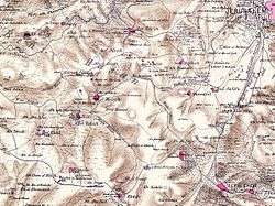
Map of Khirbat Al-Lawz-area, 1870's | |
| Subdistrict | Jerusalem |
| Palestine grid | 160/130 |
| Population | 450 (1945) |
| Area | 4,502 dunams |
| Date of depopulation | July 13, 1948 |
Khirbat Al-Lawz was a Palestinian Arab village in the Jerusalem Subdistrict. According to a census conducted in 1931 by the British Mandate authorities, Khirbat Al-Lawzz had a population of 315 inhabitants, in 67 houses.[1] It was depopulated during the 1948 Arab-Israeli War on July 13, 1948 by the Har'el Brigade of Operation Dani. It was located 11 km west of Jerusalem, situated north of Wadi al-Sarar.
In 1945, the village had a population of 450. Khirbat al-Lawz had a shrine dedicated to a local sage known as al-Shaykh Salama.
References
- Barron, J.B., ed. (1923). Palestine: Report and General Abstracts of the Census of 1922. Government of Palestine.
- Conder, Claude Reignier; Kitchener, H. H. (1883). The Survey of Western Palestine: Memoirs of the Topography, Orography, Hydrography, and Archaeology. 3. London: Committee of the Palestine Exploration Fund. (p. 21)
- Finkelstein, Israel; Lederman, Zvi, eds. (1997). Highlands of many cultures. Tel Aviv: Institute of Archaeology of Tel Aviv University Publications Section. ISBN 965-440-007-3. (p. 152)
- Guérin, Victor (1869). Description Géographique Historique et Archéologique de la Palestine (in French). 1: Judee, pt. 2. Paris: L'Imprimerie Nationale. (pp. 4-5)
- Hadawi, Sami (1970). Village Statistics of 1945: A Classification of Land and Area ownership in Palestine. Palestine Liberation Organization Research Center.
- Khalidi, Walid (1992). All That Remains: The Palestinian Villages Occupied and Depopulated by Israel in 1948. Washington D.C.: Institute for Palestine Studies. ISBN 0-88728-224-5. (pp. 299–300)
- Mills, E., ed. (1932). Census of Palestine 1931. Population of Villages, Towns and Administrative Areas. Jerusalem: Government of Palestine.
- Morris, Benny (2004). The Birth of the Palestinian Refugee Problem Revisited. Cambridge University Press. ISBN 978-0-521-00967-6.
- Palmer, E. H. (1881). The Survey of Western Palestine: Arabic and English Name Lists Collected During the Survey by Lieutenants Conder and Kitchener, R. E. Transliterated and Explained by E.H. Palmer. Committee of the Palestine Exploration Fund.
- Ze'evi, Dror (1996). An Ottoman century: the district of Jerusalem in the 1600s. SUNY Press. ISBN 0-7914-2915-6. (p. 90)
External links
- Welcome To Khirbat al-Lawz
- Survey of Western Palestine, Map 17: IAA, Wikimedia commons
- Al-Lawz, Khirbat, from the Khalil Sakakini Cultural Center
- A Tour to Khirbet Alaluz By Umar Agbariya, 7.6.2008, Zochrot
Coordinates: 31°46′04″N 35°06′41″E / 31.76778°N 35.11139°E
This article is issued from Wikipedia - version of the 11/29/2016. The text is available under the Creative Commons Attribution/Share Alike but additional terms may apply for the media files.
