List of highways in Pecos County, Texas
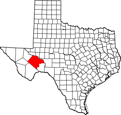
Location of Pecos County
The following is a list of all state highways in Pecos County, Texas maintained by the Texas Department of Transportation. All state highways in Texas are paved.
Interstates
| Route Name | Direction | Termini | Junctions | Length[1] | Remarks |
|---|---|---|---|---|---|
| W/E | Reeves County to Crockett County | 100.5 miles (161.7 km)[1] | Bypasses Fort Stockton, Bakersfield |
Interstate business routes
| Route Name | Direction | Termini | Junctions | Length | Remarks |
|---|---|---|---|---|---|
| W/E | 1.4 miles (2.3 km)[3] | Fort Stockton business loop |
U.S. highways
State highways
| Route Name | Direction | Termini | Junctions | Length | Remarks |
|---|---|---|---|---|---|
| S/N | 28.7 miles (46.2 km)[15] | Ends at Fort Stockton | |||
| W/E | 8.7 miles (14.0 km)[17] | Passes through Sheffield | |||
| S/N | Terrell County to Crockett County | 31.8 miles (51.2 km)[19] | Passes through Sheffield, Iraan |
State highway loops and spurs
| Route Name | Direction | Termini | Junctions | Length | Remarks |
|---|---|---|---|---|---|
| S/N | Old Alpine Road to |
1.4 miles (2.3 km)[20] | |||
| S/N | I-10 frontage road to I-10 frontage road | 3.2 miles (5.1 km)[21] | Passes through Bakersfield |
Farm and ranch to market roads
Historic Roads
| Route Name | Direction | Termini | Remarks |
|---|---|---|---|
| W/E | Reeves County to Crockett County | Replaced by I-10, Bus. I-10-G, and SH 290 in 1992 | |
| W/E | Brewster County to Terrell County | Replaced by US 90 in 1939 | |
| W/E | Reeves County to Crockett County | Replaced by US 290 in 1939 | |
| SH 51[44] | W/E | Brewster County to Crockett County | Replaced by SH 349 in 1957Redesignation replaced by US 385 in 1959 |
| SH 82[45] | S/N | Terrell County to Ward County | Replaced by US 285 south of Fort Stockton in 1939Replaced by TX 18 north of Fort Stockton in 1958 |
| SH 99[46] | S/N | Brewster County to Crockett County | Replaced by US 67 in 1939 |
| SH 192[47] | S/N | Replaced by US 285 in 1939 | |
| S/N | Replaced by FM 11 in 1951 | ||
| S/N | Brewster County to |
Replaced by SH 51 in 1956 | |
| S/N | Terrell County to |
Replaced by SH 349 in 1990 |
Adjacent counties
- Ward County (north)
- Crane County (northeast)
- Crockett County (east)
- Terrell County (southeast)
- Brewster County (southwest)
- Jeff Davis County (west)
- Reeves County (northwest)
References
- 1 2 Texas Department of Transportation, Statewide Planning Map using map's measurement utility.
- ↑ Transportation Planning and Programming Division (n.d.). "Interstate Highway No. 10". Highway Designation Files. Texas Department of Transportation. Retrieved 2009-09-27.
- 1 2 Texas Department of Transportation, "Highway Designation File - Business Interstate Highway No. 10-G". Retrieved 2009-09-27.
- ↑ Transportation Planning and Programming Division (n.d.). "U.S. Highway No. 67". Highway Designation Files. Texas Department of Transportation. Retrieved 2009-09-27.
- ↑ Route of US 67 through Pecos County (Map). Google Maps. Retrieved 2009-09-30. External link in
|publisher=(help) - ↑ Transportation Planning and Programming Division (n.d.). "U.S. Highway No. 90". Highway Designation Files. Texas Department of Transportation. Retrieved 2009-09-27.
- ↑ Route of US 67 through Pecos County (Map). Google Maps. Retrieved 2009-09-30. External link in
|publisher=(help) - ↑ Transportation Planning and Programming Division (n.d.). "U.S. Highway No. 190". Highway Designation Files. Texas Department of Transportation. Retrieved 2009-09-27.
- ↑ Route of US 190 through Pecos County (Map). Google Maps. Retrieved 2009-09-30. External link in
|publisher=(help) - ↑ Transportation Planning and Programming Division (n.d.). "U.S. Highway No. 285". Highway Designation Files. Texas Department of Transportation. Retrieved 2009-09-27.
- ↑ Route of US 285 through Pecos County (Map). Google Maps. Retrieved 2009-09-30. External link in
|publisher=(help) - ↑ Transportation Planning and Programming Division (n.d.). "U.S. Highway No. 385". Highway Designation Files. Texas Department of Transportation. Retrieved 2009-09-27.
- ↑ Route of US 385 through Pecos County (Map). Google Maps. Retrieved 2009-09-30. External link in
|publisher=(help) - ↑ Transportation Planning and Programming Division (n.d.). "State Highway No. 18". Highway Designation Files. Texas Department of Transportation. Retrieved 2009-09-27.
- ↑ Route of US 385 through Pecos County (Map). Google Maps. Retrieved 2009-10-01. External link in
|publisher=(help) - ↑ Transportation Planning and Programming Division (n.d.). "State Highway No. 290". Highway Designation Files. Texas Department of Transportation. Retrieved 2009-09-27.
- ↑ Route of US 385 through Pecos County (Map). Google Maps. Retrieved 2009-10-01. External link in
|publisher=(help) - ↑ Transportation Planning and Programming Division (n.d.). "State Highway No. 349". Highway Designation Files. Texas Department of Transportation. Retrieved 2009-09-27.
- ↑ Route of US 385 through Pecos County (Map). Google Maps. Retrieved 2009-10-01. External link in
|publisher=(help) - 1 2 Transportation Planning and Programming Division (n.d.). "State Highway Spur No. 194". Highway Designation Files. Texas Department of Transportation. Retrieved 2009-09-27.
- 1 2 Transportation Planning and Programming Division (n.d.). "State Highway Loop No. 293". Highway Designation Files. Texas Department of Transportation. Retrieved 2009-09-27.
- ↑ Transportation Planning and Programming Division (n.d.). "Farm to Market Road No. 11". Highway Designation Files. Texas Department of Transportation. Retrieved 2009-09-27.
- ↑ Route of US 385 through Pecos County (Map). Google Maps. Retrieved 2009-10-01. External link in
|publisher=(help) - ↑ Transportation Planning and Programming Division (n.d.). "Farm to Market Road No. 305". Highway Designation Files. Texas Department of Transportation. Retrieved 2009-09-27.
- ↑ Route of US 385 through Pecos County (Map). Google Maps. Retrieved 2009-10-01. External link in
|publisher=(help) - ↑ Transportation Planning and Programming Division (n.d.). "Farm to Market Road No. 1053". Highway Designation Files. Texas Department of Transportation. Retrieved 2009-09-27.
- ↑ Route of US 385 through Pecos County (Map). Google Maps. Retrieved 2009-10-01. External link in
|publisher=(help) - ↑ Transportation Planning and Programming Division (n.d.). "Farm to Market Road No. 1450". Highway Designation Files. Texas Department of Transportation. Retrieved 2009-09-27.
- ↑ Route of US 385 through Pecos County (Map). Google Maps. Retrieved 2009-10-01. External link in
|publisher=(help) - ↑ Transportation Planning and Programming Division (n.d.). "Farm to Market Road No. 1776". Highway Designation Files. Texas Department of Transportation. Retrieved 2009-09-27.
- ↑ Route of US 385 through Pecos County (Map). Google Maps. Retrieved 2009-10-01. External link in
|publisher=(help) - ↑ Transportation Planning and Programming Division (n.d.). "Farm to Market Road No. 1901". Highway Designation Files. Texas Department of Transportation. Retrieved 2009-09-27.
- ↑ Route of US 385 through Pecos County (Map). Google Maps. Retrieved 2009-10-01. External link in
|publisher=(help) - 1 2 Transportation Planning and Programming Division (n.d.). "Ranch to Market Road No. 2023". Highway Designation Files. Texas Department of Transportation. Retrieved 2009-09-27.
- 1 2 Transportation Planning and Programming Division (n.d.). "Farm to Market Road No. 2037". Highway Designation Files. Texas Department of Transportation. Retrieved 2009-09-27.
- ↑ Transportation Planning and Programming Division (n.d.). "Ranch to Market Road No. 2400". Highway Designation Files. Texas Department of Transportation. Retrieved 2009-09-27.
- ↑ Route of US 385 through Pecos County (Map). Google Maps. Retrieved 2009-10-01. External link in
|publisher=(help) - 1 2 Transportation Planning and Programming Division (n.d.). "Ranch to Market Road No. 2593". Highway Designation Files. Texas Department of Transportation. Retrieved 2009-09-27.
- ↑ Transportation Planning and Programming Division (n.d.). "Ranch to Market Road No. 2886". Highway Designation Files. Texas Department of Transportation. Retrieved 2009-09-27.
- ↑ Route of US 385 through Pecos County (Map). Google Maps. Retrieved 2009-10-01. External link in
|publisher=(help) - ↑ Transportation Planning and Programming Division (n.d.). "U.S. Highway No. 290". Highway Designation Files. Texas Department of Transportation. Retrieved 2009-10-01.
- ↑ Transportation Planning and Programming Division (n.d.). "State Highway No. 3". Highway Designation Files. Texas Department of Transportation. Retrieved 2009-10-01.
- ↑ Transportation Planning and Programming Division (n.d.). "State Highway No. 27". Highway Designation Files. Texas Department of Transportation. Retrieved 2009-10-01.
- ↑ Transportation Planning and Programming Division (n.d.). "State Highway No. 62". Highway Designation Files. Texas Department of Transportation. Retrieved 2009-10-01.
- ↑ Transportation Planning and Programming Division (n.d.). "State Highway No. 82". Highway Designation Files. Texas Department of Transportation. Retrieved 2009-10-01.
- ↑ Transportation Planning and Programming Division (n.d.). "State Highway No. 99". Highway Designation Files. Texas Department of Transportation. Retrieved 2009-10-01.
- ↑ Transportation Planning and Programming Division (n.d.). "State Highway No. 192". Highway Designation Files. Texas Department of Transportation. Retrieved 2009-10-01.
- ↑ Transportation Planning and Programming Division (n.d.). "Farm to Market Road No. 847". Highway Designation Files. Texas Department of Transportation.
- ↑ Transportation Planning and Programming Division (n.d.). "Farm to Market Road No. 1214". Highway Designation Files. Texas Department of Transportation.
- ↑ Transportation Planning and Programming Division (n.d.). "Farm to Market Road No. 1217". Highway Designation Files. Texas Department of Transportation.
This article is issued from Wikipedia - version of the 11/9/2016. The text is available under the Creative Commons Attribution/Share Alike but additional terms may apply for the media files.