| Name | Location | Coordinates | Image | Focal
Height | Built[note 1] | Automated | Deactivated | Status |
|---|
| Algoma Pierhead Light | Algoma | 44°36′25″N 87°25′45″W / 44.6070°N 87.4293°W / 44.6070; -87.4293 (Algoma Pierhead Light) |  | 048 48 ft (15 m) | 1915 | 1973 | | Active |
| Ashland Harbor Breakwater Light | Ashland | 46°37′42″N 90°52′14″W / 46.6282°N 90.8706°W / 46.6282; -90.8706 (Ashland Harbor Breakwater Light) | 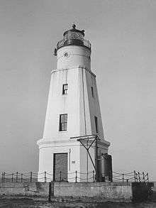 | 060 60 ft (18 m) | 1893/1932 | 1980[note 2] | | Active |
| Baileys Harbor Light | Baileys Harbor | 45°03′21″N 87°05′49″W / 45.0559°N 87.0970°W / 45.0559; -87.0970 (Baileys Harbor Light)[3] |  | 054 54 ft (16 m)[4] | 1853 | | 1870 | Inactive |
| Baileys Harbor Range Front Light | Baileys Harbor | 45°04′13″N 87°07′11″W / 45.0704°N 87.1198°W / 45.0704; -87.1198 (Baileys Harbor Range Front Light)[5] | 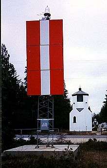 | 021 21 ft (6.4 m)[4] | 1870 | 1930 | 1969 | Inactive;
replaced with directional light |
| Baileys Harbor Range Rear Light | Baileys Harbor | 45°04′22″N 87°07′16″W / 45.0729°N 87.121°W / 45.0729; -87.121 (Baileys Harbor Range Rear Light)[6] | 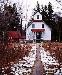 | 036 36 ft (11 m)[4] | 1870 | 1930 | 1969 | Inactive;
replaced with directional light |
| Cana Island Light | near Baileys Harbor | 45°05′17″N 87°02′51″W / 45.0881°N 87.0476°W / 45.0881; -87.0476 (Cana Island Light) | 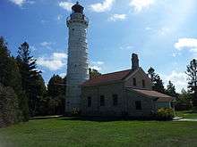 | 083 83 ft (25 m) | 1869 | 1945 | | Active |
| Chambers Island Light | Chambers Island | 45°12′08″N 87°21′53″W / 45.2022°N 87.3648°W / 45.2022; -87.3648 (Chambers Island Light)[7] |  | 068 68 ft (21 m)[7] | 1868 | | 1961 | Inactive;
replaced with skeleton tower |
| Chequamegon Point Light | Long Island | 46°43′43″N 90°48′33″W / 46.7285°N 90.8093°W / 46.7285; -90.8093 (Chambers Island Light)[note 3] |  | 042 42 ft (13 m)[8] | 1896[8] | 1964 | 1986 | Inactive;
replaced with cylindrical tower |
| Devils Island Light | Devils Island | 47°04′46″N 90°43′41″W / 47.0795°N 90.7281°W / 47.0795; -90.7281 (Devils Island Light) |  | 100 100 ft (30 m) | 1891/1901 | 1978 | | Active |
| Eagle Bluff Light | Ephraim | 45°10′07″N 87°14′12″W / 45.1687°N 87.2367°W / 45.1687; -87.2367 (Eagle Bluff Light) |  | 075 75 ft (23 m) | 1868 | 1926 | | Active |
| Grassy Island Range Lights | Grassy Island north of Green Bay, Wisconsin | 44°33′36″N 87°59′35″W / 44.560°N 87.993°W / 44.560; -87.993 (Grassy Island Range Lights (original))[9] (original)
44°32′10″N 88°00′19″W / 44.5362°N 88.0052°W / 44.5362; -88.0052 (Grassy Island Range Lights (current)) (current)[10] | 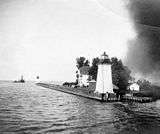 | 035 35 ft (11 m) (upper light);
27 ft (8.2 m) (lower light)[4] | 1872 | 1934 | 1966 | relocated to Green Bay Yacht Club |
| Green Bay Harbor Entrance Light | approaches to Green Bay, Wisconsin harbor | 44°39′11″N 87°54′05″W / 44.6531°N 87.9013°W / 44.6531; -87.9013 (Green Bay Harbor Entrance Light) | 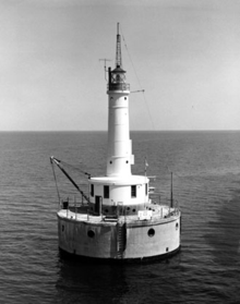 | 072 72 ft (22 m) | 1935 | 1979 | | Active |
| Green Island Light | Green Island | 45°03′23″N 87°29′34″W / 45.0564°N 87.4929°W / 45.0564; -87.4929 (Green Island Light)[11] | 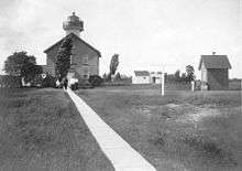 | 055 55 ft (17 m)[11] | 1863 | 1933 | 1956 | Ruins;
replaced with skeleton tower |
| Gull Island Light | Gull Island | 46°54′24″N 90°26′36″W / 46.9067°N 90.4433°W / 46.9067; -90.4433 (Gull Island Light) | | 056 56 ft (17 m) | 1929 | 1929[note 4] | | Active |
| Kenosha Light[note 5] | Kenosha | 42°35′22″N 87°48′57″W / 42.5894°N 87.8157°W / 42.5894; -87.8157 (Kenosha Light)[12] | 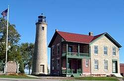 | 050 50 ft (15 m)[4] | 1848/1866 | | 1906 | Inactive;
museum |
| Kenosha North Pier Light[note 5] | Kenosha | 42°35′20″N 87°48′31″W / 42.5888°N 87.8086°W / 42.5888; -87.8086 (Kenosha North Pier Light) |  | 050 50 ft (15 m) | 1867/1906[13] | unknown | | Active |
| Kevich Light | east of Grafton | 43°19′24″N 87°53′19″W / 43.3233°N 87.8885°W / 43.3233; -87.8885 (Kevich Light) | 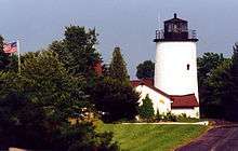 | 163 163 ft (50 m) | 1990[14] | 1990[14] | | Active; private aid |
| Kewaunee Pierhead Light | Kewaunee | 44°27′27″N 87°29′34″W / 44.4574°N 87.4929°W / 44.4574; -87.4929 (Kewaunee Pierhead Light) |  | 045 45 ft (14 m) | 1889/1931 | unknown | | Active |
| La Pointe Light | Apostle Islands | 46°43′43″N 90°47′06″W / 46.7287°N 90.7849°W / 46.7287; -90.7849 (La Pointe Light) | 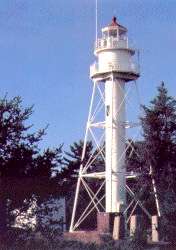 | 070 70 ft (21 m) | 1858/1896 | 1964 | | Active |
| Long Tail Point Light | Green Bay | 44°35′45″N 87°59′01″W / 44.5959°N 87.9835°W / 44.5959; -87.9835 (Long Tail Point Light)[15][note 6] | 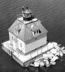 | | 1872/1899 | 1936 | 1973 | first tower abandoned; second tower destroyed during move; third tower destroyed by storm and replaced by steel pylon[15] |
| Manitowoc Breakwater Light | Manitowoc | 44°05′34″N 87°38′37″W / 44.0928°N 87.6436°W / 44.0928; -87.6436 (Manitowoc Breakwater Light) | 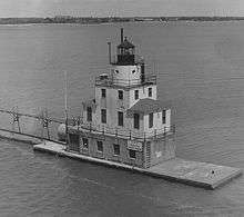 | 052 52 ft (16 m) | | | | Active |
| Michigan Island Light | Apostle Islands | 46°52′17″N 90°29′50″W / 46.8714°N 90.4971°W / 46.8714; -90.4971 (Michigan Island Light)[note 7] | 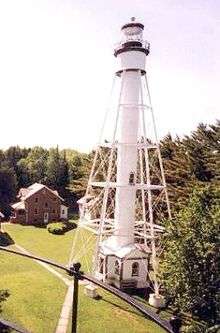 | 170 170 ft (52 m)[note 7] | 1869/1880 | 1943 | | Active |
| Milwaukee Pierhead Light | Milwaukee, Wisconsin | 43°01′33″N 87°53′43″W / 43.0259°N 87.8953°W / 43.0259; -87.8953 (Milwaukee Pierhead Light) | 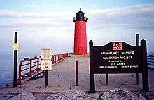 | 045 45 ft (14 m) | 1926 | unknown | | Active |
| Milwaukee Breakwater Light | Milwaukee, Wisconsin | 43°01′37″N 87°52′55″W / 43.0269°N 87.8819°W / 43.0269; -87.8819 (Milwaukee Breakwater Light) | 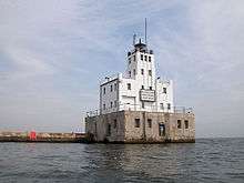 | 061 61 ft (19 m) | 1872/1906 | 1966 | | Active |
| North Point Light | Milwaukee | 43°03′56″N 87°52′17″W / 43.0656°N 87.8714°W / 43.0656; -87.8714 (North Point Light)[16] | 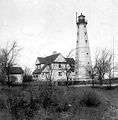 | 154 154 ft (47 m)[16] | 1855/1888 | 1943 | 1994 | Inactive |
| Outer Island Light | Apostle Islands | 47°04′35″N 90°25′00″W / 47.0765°N 90.4167°W / 47.0765; -90.4167 (Outer Island Light) | 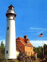 | 130 130 ft (40 m) | 1874 | 1961 | | Active |
| Peshtigo Reef Light | Green Bay east of Peshtigo Point | 44°57′24″N 87°34′45″W / 44.9566°N 87.5791°W / 44.9566; -87.5791 (Peshtigo Reef Light) | | 072 72 ft (22 m) | 1936 | 1936 | | Active |
| Pilot Island Light | near Gills Rock | 45°17′03″N 86°55′11″W / 45.2842°N 86.9197°W / 45.2842; -86.9197 (Pilot Island Light) | 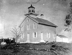 | 048 48 ft (15 m) | 1858/1873 | 1962 | | Active |
| Plum Island Range Front Light | Plum Island | 45°18′14″N 86°57′18″W / 45.3038°N 86.9550°W / 45.3038; -86.9550 (Plum Island Range Front Light)[note 8] | 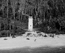 | 032 32 ft (9.8 m)[4] | 1897 | | 1964 | Demolished;
replaced with skeleton light |
| Plum Island Range Rear Light | Plum Island | 45°18′27″N 86°57′30″W / 45.3076°N 86.9582°W / 45.3076; -86.9582 (Plum Island Range Rear Light) | 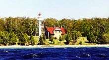 | 084 84 ft (26 m) | 1897 | 1969 | | Active |
| Port Washington Light | Port Washington | 43°23′28″N 87°52′04″W / 43.391°N 87.8677°W / 43.391; -87.8677 (Port Washington Light)[17] | 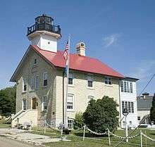 | 113 133 ft (41 m)[18] | 1848/1860 | | 1903 | Inactive;
museum |
| Pottawatomie Light | Rock Island State Park | 45°25′39″N 86°49′44″W / 45.4276°N 86.8288°W / 45.4276; -86.8288 (Pottawatomie Light) |  | 159 159 ft (48 m) | 1837/1858 | 1966 | | Active |
| Racine Harbor Light | Racine | 42°44′03″N 87°46′42″W / 42.7341°N 87.7783°W / 42.7341; -87.7783 (Racine Harbor Light)[19] | | | 1866 | | 1903 | Inactive |
| Racine North Breakwater Light | Racine | 42°44′05″N 87°46′19″W / 42.7346°N 87.7720°W / 42.7346; -87.7720 (Racine North Breakwater Light)[20] | | 053 53 ft (16 m)[21] | 1872/1902 | | 1987[20] | Inactive[20] |
| Racine Reef Light | Lake Michigan off Racine | 42°43′39″N 87°44′10″W / 42.7276°N 87.7361°W / 42.7276; -87.7361 (Racine Reef Light) | 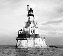 | 072 72 ft (22 m)[4] | 1906 | 1954 | 1961 | replace with skeleton light |
| Raspberry Island Light | Apostle Islands | 46°58′14″N 90°48′18″W / 46.9706°N 90.8050°W / 46.9706; -90.8050 (Raspberry Island Light)[22] | 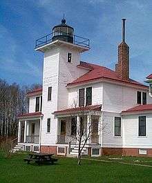 | 077 77 ft (23 m)[23] | 1863 | 1947 | 1957 | Inactive;
museum |
| Rawley Point Light | Near Two Rivers | 44°12′39″N 87°30′32″W / 44.2108°N 87.5088°W / 44.2108; -87.5088 (Rawley Point Light) | .jpg) | 113 113 ft (34 m) | 1874/1894 | 1979 | | Active |
| Sand Island Light | Apostle Islands | 47°00′12″N 90°56′15″W / 47.0033°N 90.9374°W / 47.0033; -90.9374 (Sand Island Light) |  | 060 60 ft (18 m) | 1881 | 1921 | 1933–1980 | Active |
| Sheboygan Breakwater Light | Sheboygan | 43°44′58″N 87°41′34″W / 43.7495°N 87.6927°W / 43.7495; -87.6927 (Sheboygan Breakwater Light) |  | 055 55 ft (17 m) | 1915 | unknown | | Active |
| Sherwood Point Light | near Sturgeon Bay | 44°53′34″N 87°26′00″W / 44.8928°N 87.4334°W / 44.8928; -87.4334 (Sherwood Point Light) | 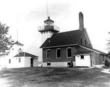 | 061 61 ft (19 m) | 1883 | 1983 | | Active |
| Sturgeon Bay Canal Light | Sturgeon Bay | 44°47′42″N 87°18′48″W / 44.7950°N 87.3133°W / 44.7950; -87.3133 (Sturgeon Bay Canal Light) | 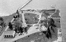 | 107 107 ft (33 m) | 1903 | 1972 | | Active |
| Sturgeon Bay Canal North Pierhead Light | Sturgeon Bay | 44°47′31″N 87°18′34″W / 44.7920°N 87.3095°W / 44.7920; -87.3095 (Sturgeon Bay Canal North Pierhead Light) |  | 040 40 ft (12 m) | 1882/1903 | 1972 | | Active |
| Two Rivers Light | Two Rivers | 44°08′34″N 87°33′38″W / 44.1428°N 87.5605°W / 44.1428; -87.5605 (Two Rivers Light (original)) (original);
44°09′12″N 87°33′45″W / 44.1532°N 87.5624°W / 44.1532; -87.5624 (Two Rivers Light (current)) (current)[24] | 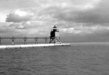 | 035 35 ft (11 m)[25] | 1886 | unknown | 1969 | Moved to museum;
replaced with modern tower |
| Wind Point Light | Racine | 42°46′52″N 87°45′30″W / 42.7811°N 87.7583°W / 42.7811; -87.7583 (Wind Point Light) |  | 111 111 ft (34 m) | 1880 | 1964 | | Active |
| Wisconsin Point Light | Superior | 46°42′37″N 92°00′22″W / 46.7102°N 92.0062°W / 46.7102; -92.0062 (Wisconsin Point Light) | 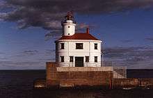 | 070 70 ft (21 m) | 1913 | 1970 | | Active |


.jpg)


