Listed buildings in Västerbotten County
There are 75 listed buildings (Swedish: byggnadsminne) in Västerbotten County.
Lycksele Municipality
| Image | Name | Premises | Number of buildings |
Year built | Architect | Coordinates | ID |
|---|---|---|---|---|---|---|---|
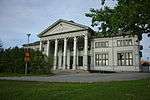 |
Gamla folkskolan i Lycksele | Magistern 1 | 1 | 1891–93 | Carl Fridolf Engelbert Sandgren | 64°35′41″N 18°40′28″E / 64.59461°N 18.67435°E | 21300000012564 |
Nordmaling Municipality
| Image | Name | Premises | Number of buildings |
Year built | Architect | Coordinates | ID |
|---|---|---|---|---|---|---|---|
| Levar Hotell | Levar 4:19 | 2 | 1827 | 63°34′15″N 19°31′30″E / 63.57072°N 19.52499°E | 21300000012568 | ||
_1919.jpg) |
Tallbergsbron | Tallberg 3:32 | 1 | 1916–1919 | 63°47′38″N 19°20′54″E / 63.79396°N 19.34829°E | 21300000019504 |
Norsjö Municipality
| Image | Name | Premises | Number of buildings |
Year built | Architect | Coordinates | ID |
|---|---|---|---|---|---|---|---|
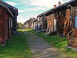
| Dahlbergsgården | Bastutjärn 1:27-28 | 7 | 1826 | 64°56′51″N 19°36′05″E / 64.94753°N 19.60128°E | 21300000012573 | ||
| Rundloge i Kvammarnäs | Kvammarnäs 1:9 | 1 | 1853 | 64°57′09″N 19°16′01″E / 64.95244°N 19.26701°E | 21300000012571 |
Robertsfors Municipality
| Image | Name | Premises | Number of buildings |
Year built | Architect | Coordinates | ID |
|---|---|---|---|---|---|---|---|
 |
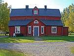
Dalkarlså herrgård | Dalkarlså 10:2 | 3 | 1817 | Johan Anders Linder | 64°02′41″N 20°51′24″E / 64.04479°N 20.85673°E | 21300000012528 |
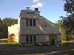
| Mareografen i Ratan | Ratahamn 1:3 | 1 | 1891 | 63°59′29″N 20°53′26″E / 63.99138°N 20.89042°E | 21300000026301 | ||
| |
Portbyggnaden på Bygdeborg | Skinnarbyn 5:12 | 1 | 1690 | 64°03′38″N 20°51′17″E / 64.06051°N 20.85484°E | 21300000012585 | |
| Rataskärs båk | Stensäter 1:46 | 1 | 1828 | 63°59′33″N 20°53′46″E / 63.99257°N 20.89608°E | 21300000012529 | ||
| Tingshuset i Ånäset | Nybyn 47:1 Previously Domaren 1 |
2 | 1896–1902 | Carl Fridolf Engelbert Sandgren | 64°16′36″N 21°02′20″E / 64.27678°N 21.03887°E | 21300000012577 | |
| Tullgården i Ratan | Ratahamn 1:3 | 1 | 1861 | A Gadelius | 63°59′24″N 20°53′11″E / 63.98988°N 20.88645°E | 21300000012918 |
Skellefteå Municipality
Sorsele Municipality
| Image | Name | Premises | Number of buildings |
Year built | Architect | Coordinates | ID |
|---|---|---|---|---|---|---|---|
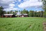 |
Zakrisbo | Sorseleskogen 1:1 | 11 | 65°24′04″N 17°30′29″E / 65.40122°N 17.50819°E | 21300000012637 | ||
| Åkernäs | Kronoöverloppsmarken 1:1 | 7 | 65°42′36″N 16°14′51″E / 65.70987°N 16.24739°E | 21300000012632 | |||
| Örnbo | Kronoöverloppsmarken 1:1 | 6 | 65°56′50″N 16°19′19″E / 65.94735°N 16.32184°E | 21300000012635 |
Storuman Municipality
| Image | Name | Premises | Number of buildings |
Year built | Architect | Coordinates | ID |
|---|---|---|---|---|---|---|---|
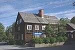 |
previously Järnvägshotellet, Storuman | Kulturen 2 previously Luspen 11:2 |
1 | 65°05′47″N 17°06′53″E / 65.09648°N 17.11477°E | 21300000012639 | ||
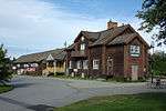 |
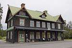
Stationshuset, Storuman | Luspen 1:65 | 1 | 65°05′48″N 17°06′45″E / 65.09654°N 17.11241°E | 21300000012924 |
Umeå Municipality
placeholder
Vilhelmina Municipality
| Image | Name | Premises | Number of buildings |
Year built | Architect | Coordinates | ID |
|---|---|---|---|---|---|---|---|
| Skollägdan 11 | Skollägdan 11 | 1 | 64°37′43″N 16°38′55″E / 64.62865°N 16.64849°E | 21300000012849 | |||
| Dainanäs fjällägenhet | Dainan 1:1 | 7 | 64°55′49″N 16°07′18″E / 64.93038°N 16.12176°E | 21300000012852 | |||
| Oräddska gården (Norgefarargården) | Klimpfjäll 1:73 | 1 | 65°03′45″N 14°47′44″E / 65.06247°N 14.79559°E | 21300000012854 |
Vindeln Municipality
| Image | Name | Premises | Number of buildings |
Year built | Architect | Coordinates | ID |
|---|---|---|---|---|---|---|---|
| Gamla Tingshuset i Vindeln (Degerfors Gamla Tingshus) | Kyrkoherden 1 previously Degerfors 30:1 |
3 | 64°11′36″N 19°42′34″E / 64.19325°N 19.70933°E | 21300000012536 | |||
| Åströmska gården | Degerfors 1:14 (del av | 3 | 64°11′44″N 19°42′51″E / 64.19545°N 19.71418°E | 21300000012535 |
Vännäs Municipality
| Image | Name | Premises | Number of buildings |
Year built | Architect | Coordinates | ID |
|---|---|---|---|---|---|---|---|
 |
Stationshuset, Vännäs | Vännäs 51:1 | 1 | 1891 | Folke Zettervall | 63°54′31″N 19°45′00″E / 63.90856°N 19.75006°E | 21300000012513 |
 |
Vännäs läger Fridhem |
Fridhem 1 | 4 | 1900 | 63°54′35″N 19°44′20″E / 63.90977°N 19.73893°E | 21000001645341 | |
 |
Vännäs läger | Vännäs 50:30 | 5 | 1900 | 63°54′33″N 19°44′00″E / 63.90923°N 19.73337°E | 21300000012855 |
Åsele Municipality
| Image | Name | Premises | Number of buildings |
Year built | Architect | Coordinates | ID |
|---|---|---|---|---|---|---|---|
| Länsmansgården, Åsele Municipality | Gäddan 1 Previously Åsele 2:100 |
2 | 1860s | 64°09′51″N 17°21′41″E / 64.16424°N 17.36131°E | 21300000012911 | ||
| Torvsjö kvarnar | Torvsjö 1:16 Previously Kvarnsamfälligheten litt G1 |
13 | cirka 1850 | 64°22′25″N 17°15′34″E / 64.37351°N 17.25933°E | 21300000012914 | ||
| Åsele bryggeri | Bryggaren 1 Previously Åsele 2:25 |
1 | 1888 | Johan Vikberg | 64°09′41″N 17°21′34″E / 64.16145°N 17.35955°E | 21300000012916 |
External links
| Wikimedia Commons has media related to Protected buildings in Västerbotten County. |
- (Swedish) Bebyggelseregistret
This article is issued from Wikipedia - version of the 9/11/2015. The text is available under the Creative Commons Attribution/Share Alike but additional terms may apply for the media files.
