Madeley, Western Australia
| Madeley Perth, Western Australia | |||||||||||||
|---|---|---|---|---|---|---|---|---|---|---|---|---|---|
 Madeley | |||||||||||||
| Coordinates | 31°48′40″S 115°49′41″E / 31.811°S 115.828°ECoordinates: 31°48′40″S 115°49′41″E / 31.811°S 115.828°E | ||||||||||||
| Population | 2,775 (2006 census)[1] | ||||||||||||
| • Density | 895/km2 (2,320/sq mi) | ||||||||||||
| Established | 1998 | ||||||||||||
| Postcode(s) | 6065 | ||||||||||||
| Area | 3.1 km2 (1.2 sq mi) | ||||||||||||
| Location | 20 km (12 mi) N of Perth City | ||||||||||||
| LGA(s) | City of Wanneroo | ||||||||||||
| State electorate(s) | Wanneroo | ||||||||||||
| Federal Division(s) | Cowan | ||||||||||||
| |||||||||||||
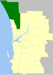
Madeley is a suburb of Perth, the capital city of Western Australia 20 kilometres (12 mi) north of Perth's central business district. Its local government area is the City of Wanneroo. Previously part of Landsdale, much of the suburb was rural in character until the 1990s, with market gardening a common activity. From 2001 onwards, extensive property development resulted in massive population growth, with the Property Investor Magazine of December 2007 estimating a growth rate of 33.3% per year.
History
Name
Madeley was named after early landowner and former Wanneroo Road Board member George Edward Madeley.[2]
Historically, the area was officially unnamed and residents noted their addresses as Wanneroo[3] until the locality of Landsdale was gazetted in 1980, extending from Wanneroo Road to Alexander Drive.[4]
In May–June 1996, with the creation of the East Wanneroo Development Area, Cell 6 was identified as a high priority for development,[5] and was divided into western and eastern sections corresponding to modern Madeley and Darch respectively. On 10 September 1997, the City of Wanneroo resolved to name the locality Kingsway after the main east-west road running through it, and to name the area east of the proposed Skeit Road as Madeley. The Geographic Names Committee (GNC) approved Madeley, but rejected Kingsway as being too similar to Kingsley. The City, by this stage administered by commissioners, met on 17 February 1998, and decided to use Madeley for the western area, and to honour another settler family in naming the eastern section Darch. On 5 March 1998, the name Darch was approved by the GNC, formally releasing the name Madeley. The City applied for the name Madeley on 28 April 1998, and it was granted at the GNC's meeting on 19 June 1998.[6]
Geography
The suburb is bounded by Wanneroo Road to the west, Gnangara Road to the north, Hartman Drive to the east and Hepburn Avenue to the south. It contains the Kingsway City shopping centre.
Demographics
As at the 2006 census, the Australian Bureau of Statistics counted 2,777 residents in 995 dwellings, the great majority of which were detached houses on single lots.[1]
Politics
As a fairly new suburb, Madeley as yet has no clear political direction, with the Liberal party winning more than half the booth vote at both the 2004 and 2007 federal elections, but the Australian Labor Party doing the same at the 2005 state election. An emerging trend is a higher vote than the regional average for the Christian Democratic Party and Family First. The following figures are for booths in neighbouring Darch which serve both suburbs:
|
| ||||||||||||||||||||||||||||||||||||
| |||||||||||||||||||||||||||||||||||||
References
- 1 2 Australian Bureau of Statistics (25 October 2007). "Madeley (State Suburb)". 2006 Census QuickStats. Retrieved 2008-05-21.
- ↑ Western Australian Land Information Authority. "History of metropolitan suburb names – M". Retrieved 2008-05-21.
- ↑ Postmaster General's Department (1971, 1977). White Pages - Perth.
- ↑ "Naming of Localities - Shire of Wanneroo (per 4276/69 V2)". Western Australia Government Gazette. 29 February 1980. p. 1980:641.
- ↑ City of Wanneroo (28 April 1998). Minutes of Meeting of Joint Commissioners (PDF). p. 50.
- ↑ City of Wanneroo (28 April 1998), p.83. Item DP118-04/98, "East Wanneroo Nomenclature". 5 March and 19 June dates sourced from Geographic Names Committee.
