| [3] |
Name on the Register[4] |
Image |
Date listed[5] |
Location |
City or town |
Description |
|---|
| 1 |
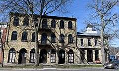
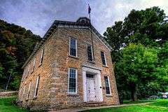
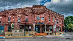
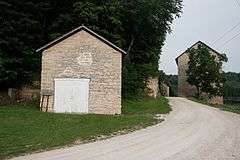
Albertus Building |
|
000000001979-04-26-0000April 26, 1979
(#79000891) |
222 Park River Dr.
42°47′03″N 91°05′47″W / 42.784167°N 91.096389°W / 42.784167; -91.096389 (Albertus Building) |
Guttenberg |
|
| 2 |
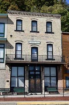
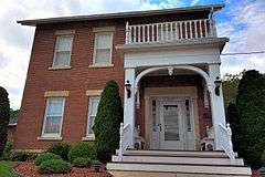
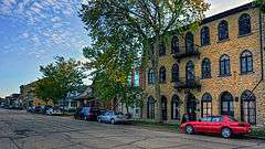
American House |
|
000000002001-08-30-0000August 30, 2001
(#01000913) |
116 Main St.
43°01′33″N 91°10′26″W / 43.025833°N 91.173889°W / 43.025833; -91.173889 (American House) |
McGregor |
|
| 3 |
American School of Wild Life Protection Historic District |
Upload image |
000000001991-12-23-0000December 23, 1991
(#91001840) |
McGregor Heights Rd., north of McGregor
43°01′43″N 91°10′33″W / 43.028611°N 91.175833°W / 43.028611; -91.175833 (American School of Wild Life Protection Historic District) |
McGregor |
|
| 4 |
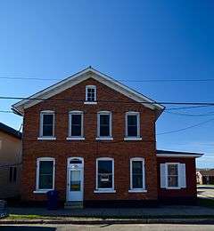
Christian Bloedel Wagon Works |
|
000000002009-09-23-0000September 23, 2009
(#09000765) |
524-526 Main St.
43°01′14″N 91°10′49″W / 43.020483°N 91.180161°W / 43.020483; -91.180161 (Christian Bloedel Wagon Works) |
McGregor |
|
| 5 |
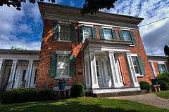
Carter House |
|
000000001976-11-07-0000November 7, 1976
(#76000744) |
101 High St., SE.
42°51′19″N 91°24′09″W / 42.855278°N 91.4025°W / 42.855278; -91.4025 (Carter House) |
Elkader |
|
| 6 |
Clayton County Courthouse |
|
000000001976-10-08-0000October 8, 1976
(#76000745) |
111 High St.
42°51′19″N 91°24′12″W / 42.855278°N 91.403333°W / 42.855278; -91.403333 (Clayton County Courthouse) |
Elkader |
|
| 7 |
Clayton School |
|
000000001974-07-30-0000July 30, 1974
(#74000778) |
1st St.
42°54′09″N 91°08′45″W / 42.9025°N 91.145833°W / 42.9025; -91.145833 (Clayton School) |
Clayton |
|
| 8 |
Timothy Davis House |
|
000000001976-06-22-0000June 22, 1976
(#76000746) |
405 1st St., NW.
42°51′23″N 91°24′30″W / 42.856389°N 91.408333°W / 42.856389; -91.408333 (Timothy Davis House) |
Elkader |
|
| 9 |
Dry Run Bridge |
Upload image |
000000001998-06-25-0000June 25, 1998
(#98000803) |
Local street over Dry Run
42°45′10″N 91°22′08″W / 42.752778°N 91.368889°W / 42.752778; -91.368889 (Dry Run Bridge) |
Littleport |
|
| 10 |
Eckert House |
Upload image |
000000001984-09-24-0000September 24, 1984
(#84001216) |
413 S. 1st St.
42°46′55″N 91°05′45″W / 42.781944°N 91.095833°W / 42.781944; -91.095833 (Eckert House) |
Guttenberg |
|
| 11 |
Effigy Mounds National Monument |
|
000000001966-10-15-0000October 15, 1966
(#66000109) |
3 miles north of Marquette on Iowa Highway 76
43°03′52″N 91°10′50″W / 43.06431°N 91.18052°W / 43.06431; -91.18052 (Effigy Mounds National Monument) |
Marquette |
Extends into Allamakee County
|
| 12 |
Elkader Downtown Historic District |
|
000000002012-03-13-0000March 13, 2012
(#12000095) |
Portions of the 100 & 200 blocks of Main St. & side streets
42°51′16″N 91°24′16″W / 42.854543°N 91.404451°W / 42.854543; -91.404451 (Elkader Downtown Historic District) |
Elkader |
Elkader Downtown Multiple Property Submission
|
| 13 |
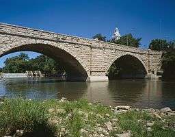
Elkader Keystone Bridge |
|
000000001976-11-07-0000November 7, 1976
(#76000747) |
Bridge St.
42°51′17″N 91°24′13″W / 42.854722°N 91.403611°W / 42.854722; -91.403611 (Elkader Keystone Bridge) |
Elkader |
|
| 14 |
Elkader Opera House |
|
000000001976-10-08-0000October 8, 1976
(#76000748) |
207 N. Main
42°51′19″N 91°24′20″W / 42.855278°N 91.405556°W / 42.855278; -91.405556 (Elkader Opera House) |
Elkader |
|
| 15 |
First Congregational Church |
|
000000001977-03-25-0000March 25, 1977
(#77000504) |
Washington St.
42°52′06″N 91°14′16″W / 42.868333°N 91.237778°W / 42.868333; -91.237778 (First Congregational Church) |
Garnavillo |
|
| 16 |
Franklin Hotel |
|
000000001999-06-25-0000June 25, 1999
(#99000740) |
102 Elkader St.
42°41′01″N 91°32′02″W / 42.683611°N 91.533889°W / 42.683611; -91.533889 (Franklin Hotel) |
Strawberry Point |
|
| 17 |
Front Street (River Park Drive) Historic District |
|
000000001984-09-24-0000September 24, 1984
(#84001222) |
River Park Dr. between Lessing and Pearl Sts.; also S. 1st, Prince, Goethe, Herder, and Schiller Sts.
42°46′56″N 91°05′42″W / 42.782222°N 91.095°W / 42.782222; -91.095 (Front Street (River Park Drive) Historic District) |
Guttenberg |
Second set of addresses represents a boundary increase
|
| 18 |
Fuerste House |
|
000000001984-09-24-0000September 24, 1984
(#84001223) |
503 S. 1st St.
42°46′54″N 91°05′45″W / 42.781667°N 91.095833°W / 42.781667; -91.095833 (Fuerste House) |
Guttenberg |
|
| 19 |
Garnavillo Township Bridge |
Upload image |
000000001998-06-25-0000June 25, 1998
(#98000807) |
County road over an unnamed stream
42°51′47″N 91°16′57″W / 42.863056°N 91.2825°W / 42.863056; -91.2825 (Garnavillo Township Bridge) |
Garnavillo Township |
|
| 20 |
Garnavillo Township Culvert |
Upload image |
000000001998-06-25-0000June 25, 1998
(#98000805) |
County road over an unnamed stream
42°52′04″N 91°16′10″W / 42.867778°N 91.269444°W / 42.867778; -91.269444 (Garnavillo Township Culvert) |
Garnavillo Township |
One of seven stone limestone arch bridges built in 1900.
|
| 21 |
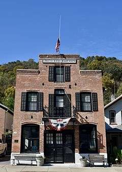
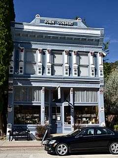
Goedert Meat Market |
|
000000001996-10-18-0000October 18, 1996
(#96001159) |
322 Main St.
43°01′22″N 91°10′40″W / 43.022659°N 91.177837°W / 43.022659; -91.177837 (Goedert Meat Market) |
McGregor |
Italianate influenced commercial building with the only complete cast-iron storefront in McGregor.
|
| 22 |
Guttenberg Corn Canning Co. |
Upload image |
000000001984-09-24-0000September 24, 1984
(#84001226) |
413 N. 3rd St.
42°47′18″N 91°06′05″W / 42.788333°N 91.101389°W / 42.788333; -91.101389 (Guttenberg Corn Canning Co.) |
Guttenberg |
|
| 23 |
Guttenberg National Fish Hatchery and Aquarium Historic District |
|
000000001991-12-23-0000December 23, 1991
(#91001833) |
315 S. River Park Dr.
42°47′01″N 91°05′41″W / 42.783611°N 91.094722°W / 42.783611; -91.094722 (Guttenberg National Fish Hatchery and Aquarium Historic District) |
Guttenberg |
|
| 24 |
Guttenberg State Bank |
|
000000001984-09-24-0000September 24, 1984
(#84001228) |
15 Goethe St.
42°46′59″N 91°05′47″W / 42.783056°N 91.096389°W / 42.783056; -91.096389 (Guttenberg State Bank) |
Guttenberg |
|
| 25 |
I.O.O.F. Hall |
|
000000001979-06-18-0000June 18, 1979
(#79000890) |
Centre St.
42°52′05″N 91°14′10″W / 42.868056°N 91.236111°W / 42.868056; -91.236111 (I.O.O.F. Hall) |
Garnavillo |
|
| 26 |
Kolker House |
|
000000001984-09-24-0000September 24, 1984
(#84001230) |
110 Goethe St.
42°46′58″N 91°06′35″W / 42.782778°N 91.109722°W / 42.782778; -91.109722 (Kolker House) |
Guttenberg |
|
| 27 |
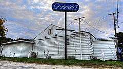
Lakeside Ballroom |
|
000000002002-02-04-0000February 4, 2002
(#01001539) |
1202 N. 4th St.
42°46′22″N 91°06′00″W / 42.772834°N 91.099945°W / 42.772834; -91.099945 (Lakeside Ballroom) |
Guttenberg |
|
| 28 |
Mallory Township Bridge |
Upload image |
000000001998-06-25-0000June 25, 1998
(#98000809) |
County road over an unnamed stream
42°43′08″N 91°10′42″W / 42.718889°N 91.178333°W / 42.718889; -91.178333 (Mallory Township Bridge) |
Mallory Township |
Bridge distinguished as the oldest remaining example of the Pratt half-hip pony truss in Iowa, built in 1890.
|
| 29 |
Matt-Bahls House |
|
000000001984-09-24-0000September 24, 1984
(#84001232) |
615 S. 3rd St.
42°46′24″N 91°05′53″W / 42.773333°N 91.098056°W / 42.773333; -91.098056 (Matt-Bahls House) |
Guttenberg |
|
| 30 |
McClaine House |
Upload image |
000000001984-09-24-0000September 24, 1984
(#84001234) |
300 S. 1st St.
42°47′03″N 91°05′50″W / 42.784167°N 91.097222°W / 42.784167; -91.097222 (McClaine House) |
Guttenberg |
|
| 31 |
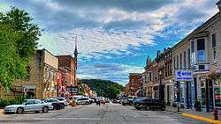
McGregor Commercial Historic District |
|
000000002002-12-10-0000December 10, 2002
(#02001033) |
100-300 blocks of Main St. and the 100 and 200 blocks of A St.
43°01′26″N 91°10′33″W / 43.023889°N 91.175833°W / 43.023889; -91.175833 (McGregor Commercial Historic District) |
McGregor |
|
| 32 |
Mederville Bridge |
|
000000001998-06-25-0000June 25, 1998
(#98000808) |
County road over the Volga River at Mederville
42°45′50″N 91°25′17″W / 42.763889°N 91.421389°W / 42.763889; -91.421389 (Mederville Bridge) |
Cox Creek Township |
|
| 33 |
Monona Township Culvert |
Upload image |
000000001998-06-25-0000June 25, 1998
(#98000806) |
County road over an unnamed stream
43°02′39″N 91°28′35″W / 43.044167°N 91.476389°W / 43.044167; -91.476389 (Monona Township Culvert) |
Monona Township |
|
| 34 |
Moser Stone House |
Upload image |
000000001984-09-24-0000September 24, 1984
(#84001236) |
211 S. 1st St.
42°47′04″N 91°05′49″W / 42.784444°N 91.096944°W / 42.784444; -91.096944 (Moser Stone House) |
Guttenberg |
|
| 35 |
Motor Mill Historic District |
|
000000002014-06-09-0000June 9, 2014
(#14000285) |
Address Restricted
42°48′27″N 91°21′06″W / 42.807500°N 91.351667°W / 42.807500; -91.351667 (Motor Mill Historic District) |
Elkader |
|
| 36 |
Motor Townsite |
|
000000001977-08-02-0000August 2, 1977
(#77000502) |
East of Elkader
42°48′28″N 91°21′05″W / 42.807778°N 91.351389°W / 42.807778; -91.351389 (Motor Townsite) |
Elkader |
|
| 37 |
Nieland House |
Upload image |
000000001984-09-24-0000September 24, 1984
(#84001238) |
715 S. 1st St.
42°46′43″N 91°05′45″W / 42.778611°N 91.095833°W / 42.778611; -91.095833 (Nieland House) |
Guttenberg |
|
| 38 |
Parker House |
|
000000001984-09-24-0000September 24, 1984
(#84001240) |
1015 S. 2nd St.
42°46′34″N 91°05′51″W / 42.776111°N 91.0975°W / 42.776111; -91.0975 (Parker House) |
Guttenberg |
|
| 39 |
Rialto Price House |
|
000000001976-11-21-0000November 21, 1976
(#76000749) |
206 Cedar St., NW.
42°51′16″N 91°24′25″W / 42.854444°N 91.406944°W / 42.854444; -91.406944 (Rialto Price House) |
Elkader |
|
| 40 |
Read Township Culvert |
Upload image |
000000001999-03-12-0000March 12, 1999
(#99000308) |
County road over an unnamed stream
42°50′01″N 91°19′08″W / 42.833611°N 91.318889°W / 42.833611; -91.318889 (Read Township Culvert) |
Read Township |
|
| 41 |
Joseph "Diamond Jo" Reynolds Office Building and House |
|
000000001982-02-19-0000February 19, 1982
(#82002614) |
A and Main Sts.
43°01′32″N 91°10′34″W / 43.025556°N 91.176111°W / 43.025556; -91.176111 (Joseph "Diamond Jo" Reynolds Office Building and House) |
McGregor |
|
| 42 |
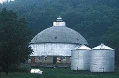
Round Barn, Millville Township |
|
000000001986-06-30-0000June 30, 1986
(#86001423) |
U.S. Route 52
42°42′56″N 91°05′04″W / 42.715556°N 91.084444°W / 42.715556; -91.084444 (Round Barn, Millville Township) |
Millville Township |
|
| 43 |
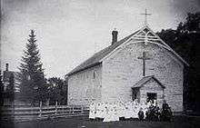
St. Joseph Church and Parish Hall |
|
000000001976-11-21-0000November 21, 1976
(#76000750) |
330 1st St., NW.
42°51′05″N 91°24′13″W / 42.851389°N 91.403611°W / 42.851389; -91.403611 (St. Joseph Church and Parish Hall) |
Elkader |
|
| 44 |
St. Mary's Catholic Church Historic District |
|
000000002004-08-12-0000August 12, 2004
(#04000817) |
502, 518, and 520 S. 2nd St. and 214 Herder St.
42°46′52″N 91°05′38″W / 42.781111°N 91.093889°W / 42.781111; -91.093889 (St. Mary's Catholic Church Historic District) |
Guttenberg |
|
| 45 |
St. Olaf Auditorium |
|
000000001994-12-09-0000December 9, 1994
(#94001446) |
118 S. Main St.
42°55′40″N 91°23′10″W / 42.927778°N 91.386111°W / 42.927778; -91.386111 (St. Olaf Auditorium) |
St. Olaf |
|
| 46 |
St. Peters United Evangelical Lutheran Church |
|
000000001976-12-12-0000December 12, 1976
(#76000743) |
U.S. Route 52
42°49′21″N 91°11′15″W / 42.8225°N 91.1875°W / 42.8225; -91.1875 (St. Peters United Evangelical Lutheran Church) |
Ceres |
|
| 47 |
Schmidt House |
|
000000001977-03-25-0000March 25, 1977
(#77000503) |
101 Oak St., NW.
42°51′11″N 91°24′26″W / 42.853056°N 91.407222°W / 42.853056; -91.407222 (Schmidt House) |
Elkader |
|
| 48 |
Peter Stauer House |
|
000000002003-09-13-0000September 13, 2003
(#03000914) |
629 Main St.
43°01′07″N 91°10′55″W / 43.018611°N 91.181944°W / 43.018611; -91.181944 (Peter Stauer House) |
McGregor |
|
| 49 |
J.C. Stemmer House |
|
000000001976-10-21-0000October 21, 1976
(#76000751) |
113 Oak, NW.
42°51′13″N 91°24′29″W / 42.853611°N 91.408056°W / 42.853611; -91.408056 (J.C. Stemmer House) |
Elkader |
|
| 50 |
Stone Barn |
Upload image |
000000001984-09-24-0000September 24, 1984
(#84001244) |
12 Goethe St.
42°46′58″N 91°06′30″W / 42.782778°N 91.108333°W / 42.782778; -91.108333 (Stone Barn) |
Guttenberg |
|
| 51 |
Turkey River State Preserve Archeological District |
Upload image |
000000001990-05-30-0000May 30, 1990
(#90000774) |
Address Restricted
|
Millville |
|
| 52 |
Valley Mills |
|
000000001976-12-12-0000December 12, 1976
(#76000752) |
East of Garnavillo
42°51′50″N 91°11′34″W / 42.863889°N 91.192778°W / 42.863889; -91.192778 (Valley Mills) |
Garnavillo |
|
| 53 |
Weber House |
|
000000001984-09-24-0000September 24, 1984
(#84001247) |
822 S. River Park Dr.
42°46′37″N 91°05′43″W / 42.776944°N 91.095278°W / 42.776944; -91.095278 (Weber House) |
Guttenberg |
|
| 54 |
Wehmer House |
|
000000001984-09-24-0000September 24, 1984
(#84001249) |
910 S. River Park Dr.
42°46′34″N 91°05′43″W / 42.776111°N 91.095278°W / 42.776111; -91.095278 (Wehmer House) |
Guttenberg |
|

