| [3] |
Name on the Register |
Image |
Date listed[4] |
Location |
City or town |
Description |
|---|
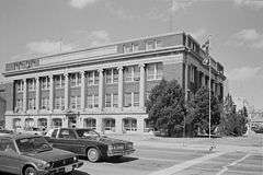
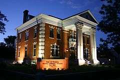
| 1 |
Atlas Theatre |
|
000000001973-04-03-0000April 3, 1973
(#73001933) |
213 W. 16th St.
41°07′57″N 104°48′54″W / 41.1325°N 104.815°W / 41.1325; -104.815 (Atlas Theatre) |
Cheyenne |
|
| 2 |
Baxter Ranch Headquarters Buildings |
|
000000001979-06-14-0000June 14, 1979
(#79002610) |
912-922 E. 18th St. and 1810-1920 Morrie Ave.
41°08′20″N 104°48′19″W / 41.138889°N 104.805278°W / 41.138889; -104.805278 (Baxter Ranch Headquarters Buildings) |
Cheyenne |
|
| 3 |
Charles L. Beatty House |
|
000000001990-06-28-0000June 28, 1990
(#90001001) |
2320 Capitol Ave.
41°08′21″N 104°49′10″W / 41.139167°N 104.819444°W / 41.139167; -104.819444 (Charles L. Beatty House) |
Cheyenne |
|
| 4 |
Boeing/United Airlines Terminal Building, Hangar and Fountain |
|
000000001985-02-07-0000February 7, 1985
(#85000249) |
200 E. 8th Ave.
41°09′13″N 104°49′13″W / 41.153611°N 104.820278°W / 41.153611; -104.820278 (Boeing/United Airlines Terminal Building, Hangar and Fountain) |
Cheyenne |
|
| 5 |
Capitol North Historic District |
Upload image |
000000001980-12-10-0000December 10, 1980
(#80004048) |
Roughly bounded by E. 29th and E. 25th Sts. and Warren and Pioneer Aves.
41°08′32″N 104°48′33″W / 41.142222°N 104.809167°W / 41.142222; -104.809167 (Capitol North Historic District) |
Cheyenne |
|
| 6 |
Castle on 19th Street |
|
000000001979-07-10-0000July 10, 1979
(#79002611) |
1318 E. 19th St.
41°08′29″N 104°48′04″W / 41.141389°N 104.801111°W / 41.141389; -104.801111 (Castle on 19th Street) |
Cheyenne |
|
| 7 |
Cheyenne Flour Milling Company |
|
000000002003-10-13-0000October 13, 2003
(#03001024) |
810-814 W. 23rd St.
41°08′11″N 104°49′35″W / 41.136389°N 104.826389°W / 41.136389; -104.826389 (Cheyenne Flour Milling Company) |
Cheyenne |
|
| 8 |
Cheyenne High School |
|
000000002005-08-22-0000August 22, 2005
(#05000698) |
2810 House Ave.
41°08′41″N 104°49′09″W / 41.144722°N 104.819167°W / 41.144722; -104.819167 (Cheyenne High School) |
Cheyenne |
|
| 9 |
Cheyenne South Side Historic District |
Upload image |
000000002006-10-11-0000October 11, 2006
(#06000939) |
Roughly bounded by Warren Ave., Russell Ave., E. 10th St., and E. 5th St.
41°07′38″N 104°48′13″W / 41.127222°N 104.803611°W / 41.127222; -104.803611 (Cheyenne South Side Historic District) |
Cheyenne |
|
| 10 |
Cheyenne Veterans Administration Hospital Historic District |
Upload image |
000000002013-05-01-0000May 1, 2013
(#13000239) |
2360 Pershing Blvd.
41°08′54″N 104°47′09″W / 41.148276°N 104.78584°W / 41.148276; -104.78584 (Cheyenne Veterans Administration Hospital Historic District) |
Cheyenne |
|
| 11 |
Churchill Public School |
|
000000002005-08-22-0000August 22, 2005
(#05000704) |
510 W. 29th St.
41°08′35″N 104°49′36″W / 41.143056°N 104.826667°W / 41.143056; -104.826667 (Churchill Public School) |
Cheyenne |
|
| 12 |
City and County Building |
|
000000001978-11-30-0000November 30, 1978
(#78002828) |
19th St. and Carey Ave.
41°08′06″N 104°49′06″W / 41.135°N 104.818333°W / 41.135; -104.818333 (City and County Building) |
Cheyenne |
|
| 13 |
Continental Oil Company |
|
000000002003-10-13-0000October 13, 2003
(#03001030) |
801 W. 19th St.
41°07′57″N 104°49′24″W / 41.1325°N 104.823333°W / 41.1325; -104.823333 (Continental Oil Company) |
Cheyenne |
|
| 14 |
Crook House |
|
000000001979-07-10-0000July 10, 1979
(#79002612) |
314 E. 21st St.
41°08′20″N 104°48′50″W / 41.138889°N 104.813889°W / 41.138889; -104.813889 (Crook House) |
Cheyenne |
|
| 15 |
Crow Creek-Cole Ranch Headquarters Historic District |
Upload image |
000000002009-07-14-0000July 14, 2009
(#09000565) |
1065 Happy Jack Rd.
41°10′17″N 105°05′15″W / 41.171253°N 105.087411°W / 41.171253; -105.087411 (Crow Creek-Cole Ranch Headquarters Historic District) |
Cheyenne |
|
| 16 |
Deming School |
|
000000002005-08-22-0000August 22, 2005
(#05000701) |
715 W. 5th Ave.
41°09′01″N 104°49′44″W / 41.150278°N 104.828889°W / 41.150278; -104.828889 (Deming School) |
Cheyenne |
|
| 17 |
Dereemer Ranch Historic District |
Upload image |
000000001983-11-25-0000November 25, 1983
(#83004290) |
East of Horse Creek
41°24′49″N 105°07′54″W / 41.413611°N 105.131667°W / 41.413611; -105.131667 (Dereemer Ranch Historic District) |
Horse Creek |
|
| 18 |
Downtown Cheyenne Historic District |
|
000000001978-12-22-0000December 22, 1978
(#78003434) |
Roughly bounded by 15th and 16th Sts. and Central and Pioneer Aves.; also roughly bounded by 17th and 18th Sts., Pioneer and Carey Aves., also along Central Ave. and 17th St.; also roughly bounded by 19th St., Capital Ave., 17th St., and Carey Ave.; also roughly bounded by 18th, Carey, 16th, and Warren Sts.
41°07′55″N 104°48′56″W / 41.131944°N 104.815556°W / 41.131944; -104.815556 (Downtown Cheyenne Historic District) |
Cheyenne |
Three boundary increases
|
| 19 |
Dubois Block |
|
000000002014-12-02-0000December 2, 2014
(#14000999) |
Blk. 2, Park Addition
Coordinates missing |
Cheyenne |
|
| 20 |
Federal Office Building-Cheyenne |
|
000000002000-10-12-0000October 12, 2000
(#00001191) |
308 W. 21st St.
41°08′13″N 104°49′09″W / 41.136944°N 104.819167°W / 41.136944; -104.819167 (Federal Office Building-Cheyenne) |
Cheyenne |
|
| 21 |
Mabel Fincher School |
|
000000002005-08-22-0000August 22, 2005
(#05000700) |
2201 Morrie Ave.
41°08′34″N 104°48′25″W / 41.142778°N 104.806944°W / 41.142778; -104.806944 (Mabel Fincher School) |
Cheyenne |
|
| 22 |
First United Methodist Church |
|
000000001975-02-25-0000February 25, 1975
(#75001902) |
Northeastern corner of 18th St. and Central Ave.
41°08′07″N 104°48′53″W / 41.135278°N 104.814722°W / 41.135278; -104.814722 (First United Methodist Church) |
Cheyenne |
|
| 23 |
Fort David A. Russell |
|
000000001969-10-01-0000October 1, 1969
(#69000191) |
Western side of Cheyenne
41°09′10″N 104°51′27″W / 41.152778°N 104.8575°W / 41.152778; -104.8575 (Fort David A. Russell) |
Cheyenne |
|
| 24 |
Moreton Frewen House |
|
000000001975-04-14-0000April 14, 1975
(#75001904) |
506 E. 23rd St.
41°08′29″N 104°48′46″W / 41.141389°N 104.812778°W / 41.141389; -104.812778 (Moreton Frewen House) |
Cheyenne |
|
| 25 |
Governor's Mansion |
|
000000001969-09-30-0000September 30, 1969
(#69000192) |
300 E. 21st St.
41°08′13″N 104°48′53″W / 41.136944°N 104.814722°W / 41.136944; -104.814722 (Governor's Mansion) |
Cheyenne |
|
| 26 |
Hebard Public School |
|
000000002005-08-22-0000August 22, 2005
(#05000705) |
413 Seymour Ave.
41°07′32″N 104°47′59″W / 41.125556°N 104.799722°W / 41.125556; -104.799722 (Hebard Public School) |
Cheyenne |
|
| 27 |
Hynds Lodge |
Upload image |
000000001984-03-23-0000March 23, 1984
(#84003685) |
Curt Gowdy State Park
41°11′46″N 105°15′21″W / 41.196111°N 105.255833°W / 41.196111; -105.255833 (Hynds Lodge) |
|
|
| 28 |
Johnson Public School |
|
000000002005-08-22-0000August 22, 2005
(#05000706) |
711 Warren Ave.
41°08′41″N 104°49′09″W / 41.144722°N 104.819167°W / 41.144722; -104.819167 (Johnson Public School) |
Cheyenne |
|
| 29 |
Keefe Row |
|
000000001979-08-03-0000August 3, 1979
(#79002613) |
E. 22nd St. and Evans Ave
41°08′23″N 104°48′47″W / 41.139722°N 104.813056°W / 41.139722; -104.813056 (Keefe Row) |
Cheyenne |
|
| 30 |
Ferdinand Lafrentz House |
|
000000001979-07-17-0000July 17, 1979
(#79003679) |
2015 Warren Ave.
41°08′15″N 104°48′53″W / 41.1375°N 104.814722°W / 41.1375; -104.814722 (Ferdinand Lafrentz House) |
Cheyenne |
|
| 31 |
Lakeview Historic District |
|
000000001996-08-05-0000August 5, 1996
(#88000560) |
Roughly bounded by 27th, Seymour, Maxwell, and Warren
41°08′31″N 104°48′52″W / 41.141944°N 104.814444°W / 41.141944; -104.814444 (Lakeview Historic District) |
Cheyenne |
|
| 32 |
Laramie County Milk Producers Cooperative Association |
|
000000002003-10-13-0000October 13, 2003
(#03001026) |
1122 W. 23rd St.
41°08′13″N 104°49′31″W / 41.136944°N 104.825278°W / 41.136944; -104.825278 (Laramie County Milk Producers Cooperative Association) |
Cheyenne |
|
| 33 |
Masonic Temple |
|
000000001984-10-25-0000October 25, 1984
(#84000162) |
1820 Capitol Ave.
41°08′06″N 104°49′00″W / 41.135°N 104.816667°W / 41.135; -104.816667 (Masonic Temple) |
Cheyenne |
|
| 34 |
McCord-Brady Company |
|
000000002003-10-13-0000October 13, 2003
(#03001028) |
1506 Thomes Ave.
41°07′51″N 104°49′05″W / 41.130833°N 104.818056°W / 41.130833; -104.818056 (McCord-Brady Company) |
Cheyenne |
|
| 35 |
Lulu McCormick Junior High School |
|
000000002005-08-22-0000August 22, 2005
(#05000699) |
2001 Capitol Ave.
41°08′13″N 104°49′01″W / 41.136944°N 104.816944°W / 41.136944; -104.816944 (Lulu McCormick Junior High School) |
Cheyenne |
|
| 36 |
McDonald Ranch |
Upload image |
000000001987-05-14-0000May 14, 1987
(#87000777) |
14 miles southwest of Chugwater on the southern side of the Laramie County line
41°39′17″N 105°02′03″W / 41.654628°N 105.034256°W / 41.654628; -105.034256 (McDonald Ranch) |
Chugwater |
|
| 37 |
Moore Haven Heights Historic District |
Upload image |
000000002009-01-08-0000January 8, 2009
(#08001305) |
Between Bent Ave. on the west, the eastern side of Central Ave. on the east, W. 8th Ave. on the north, and W. Pershing Boulevard on the south
41°08′58″N 104°49′31″W / 41.14958°N 104.82532°W / 41.14958; -104.82532 (Moore Haven Heights Historic District) |
Cheyenne |
|
| 38 |
Nagle Warren Mansion |
|
000000001976-07-12-0000July 12, 1976
(#76001955) |
222 E. 17th St.
41°08′06″N 104°48′44″W / 41.135°N 104.812222°W / 41.135; -104.812222 (Nagle Warren Mansion) |
Cheyenne |
|
| 39 |
Park Addition School |
|
000000002005-08-22-0000August 22, 2005
(#05000703) |
1100 Richardson Court
41°08′34″N 104°49′59″W / 41.142778°N 104.833056°W / 41.142778; -104.833056 (Park Addition School) |
Cheyenne |
|
| 40 |
Pine Bluffs High School |
|
000000001996-03-21-0000March 21, 1996
(#96000228) |
Junction of 7th and Elm Sts.
41°10′42″N 104°03′59″W / 41.17823°N 104.06645°W / 41.17823; -104.06645 (Pine Bluffs High School) |
Pine Bluffs |
|
| 41 |
Rainsford Historic District |
|
000000001984-11-06-0000November 6, 1984
(#84003884) |
Roughly bounded by Morrie, 22nd, Warren, and 17th Sts.
41°08′20″N 104°48′38″W / 41.138889°N 104.810556°W / 41.138889; -104.810556 (Rainsford Historic District) |
Cheyenne |
|
| 42 |
Remount Ranch |
|
000000001990-09-19-0000September 19, 1990
(#90001389) |
Remount Ranch Rd., 1 mile south of U.S. Route 80
41°05′24″N 105°14′30″W / 41.09°N 105.241667°W / 41.09; -105.241667 (Remount Ranch) |
Cheyenne |
|
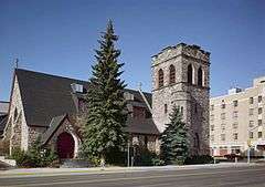
| 43 |
St. Mark's Episcopal Church |
|
000000001970-02-26-0000February 26, 1970
(#70000673) |
1908 Central Ave.
41°08′09″N 104°48′57″W / 41.135833°N 104.815833°W / 41.135833; -104.815833 (St. Mark's Episcopal Church) |
Cheyenne |
|
| 44 |
St. Mary's Catholic Cathedral |
|
000000001974-11-20-0000November 20, 1974
(#74002026) |
2107 Capitol Ave.
41°08′15″N 104°49′03″W / 41.1375°N 104.8175°W / 41.1375; -104.8175 (St. Mary's Catholic Cathedral) |
Cheyenne |
|
| 45 |
Storey Gymnasium |
|
000000002005-08-22-0000August 22, 2005
(#05000707) |
2811 House Ave.
41°08′43″N 104°49′05″W / 41.145278°N 104.818056°W / 41.145278; -104.818056 (Storey Gymnasium) |
Cheyenne |
|
| 46 |
William Sturgis House |
|
000000001982-11-08-0000November 8, 1982
(#82001833) |
821 E. 17th St.
41°08′14″N 104°48′20″W / 41.137222°N 104.805556°W / 41.137222; -104.805556 (William Sturgis House) |
Cheyenne |
|
| 47 |
Texas Oil Company |
|
000000002003-10-13-0000October 13, 2003
(#03001025) |
1122 W. 23rd St.
41°08′06″N 104°49′46″W / 41.135°N 104.829444°W / 41.135; -104.829444 (Texas Oil Company) |
Cheyenne |
|
| 48 |
Union Pacific Railroad Depot |
|
000000001973-01-29-0000January 29, 1973
(#73001934) |
121 W. 15th St.
41°08′01″N 104°48′51″W / 41.133611°N 104.814167°W / 41.133611; -104.814167 (Union Pacific Railroad Depot) |
Cheyenne |
|
| 49 |
Union Pacific Roundhouse, Turntable and Machine Shop |
|
000000001992-07-24-0000July 24, 1992
(#92000930) |
121 W. 15th St.
41°07′47″N 104°48′51″W / 41.129722°N 104.814167°W / 41.129722; -104.814167 (Union Pacific Roundhouse, Turntable and Machine Shop) |
Cheyenne |
|
| 50 |
Van Tassell Carriage Barn |
|
000000001978-09-13-0000September 13, 1978
(#78002829) |
1010 E. 16th St.
41°08′17″N 104°48′11″W / 41.138056°N 104.803056°W / 41.138056; -104.803056 (Van Tassell Carriage Barn) |
Cheyenne |
|
| 51 |
Whipple-Lacey House |
|
000000001980-05-15-0000May 15, 1980
(#80004050) |
300 E. 17th St.
41°08′06″N 104°48′43″W / 41.135°N 104.811944°W / 41.135; -104.811944 (Whipple-Lacey House) |
Cheyenne |
|
| 52 |
Wyoming Fuel Company |
|
000000002003-10-13-0000October 13, 2003
(#03001029) |
720 W. 18th St.
41°07′57″N 104°49′21″W / 41.1325°N 104.8225°W / 41.1325; -104.8225 (Wyoming Fuel Company) |
Cheyenne |
|
| 53 |
Wyoming State Capitol and Grounds |
|
000000001973-01-29-0000January 29, 1973
(#73001935) |
24th St. and Capitol Ave.
41°08′25″N 104°49′11″W / 41.140278°N 104.819722°W / 41.140278; -104.819722 (Wyoming State Capitol and Grounds) |
Cheyenne |
|


.jpg)


.jpg)

