| [3] |
Name on the Register |
Image |
Date listed[4] |
Location |
City or town |
Description |
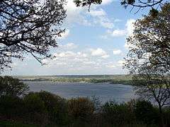
|---|
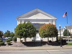
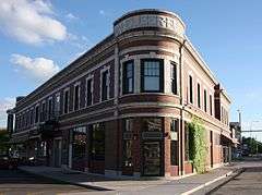
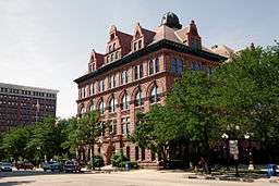
| 1 |
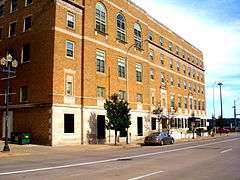
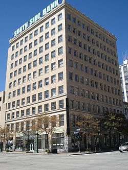
Central National Bank Building |
|
000000001978-12-18-0000December 18, 1978
(#78003450) |
103 SW Adams St.
40°41′27″N 89°35′20″W / 40.690833°N 89.588889°W / 40.690833; -89.588889 (Central National Bank Building) |
Peoria |
|
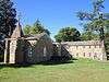
| 2 |
Christ Church of Lower Kickapoo |
|
000000001983-02-10-0000February 10, 1983
(#83000333) |
West of Norwood on Christ Church Rd.
40°42′25″N 89°43′00″W / 40.706944°N 89.716667°W / 40.706944; -89.716667 (Christ Church of Lower Kickapoo) |
Norwood |
|
| 3 |
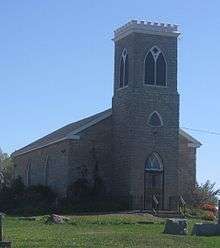
Cumberland Presbyterian Church |
|
000000001980-03-18-0000March 18, 1980
(#80001401) |
405 N. Monson St.
40°41′33″N 89°35′46″W / 40.6925°N 89.596111°W / 40.6925; -89.596111 (Cumberland Presbyterian Church) |
Peoria |
|
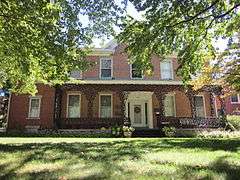
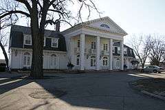
| 4 |
Judge Flanagan Residence |
|
000000001975-09-05-0000September 5, 1975
(#75000670) |
942 NE Glen Oak Ave.
40°42′14″N 89°35′07″W / 40.703889°N 89.585278°W / 40.703889; -89.585278 (Judge Flanagan Residence) |
Peoria |
|
| 5 |
Judge Jacob Gale House |
|
000000001982-03-19-0000March 19, 1982
(#82002591) |
403 NE Jefferson St.
40°41′46″N 89°35′08″W / 40.696111°N 89.585556°W / 40.696111; -89.585556 (Judge Jacob Gale House) |
Peoria |
|
| 6 |
Grand Army of the Republic Memorial Hall |
|
000000001976-07-13-0000July 13, 1976
(#76000723) |
416 Hamilton Boulevard
40°41′40″N 89°35′21″W / 40.694444°N 89.589167°W / 40.694444; -89.589167 (Grand Army of the Republic Memorial Hall) |
Peoria |
|
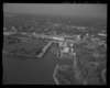
| 7 |
Grand View Drive |
|
000000001996-09-27-0000September 27, 1996
(#96000399) |
Roughly bounded by N. Prospect Rd., the Illinois River bluffs, Adams St., and the Grand View Dr. W. right of way
40°44′30″N 89°33′52″W / 40.741667°N 89.564444°W / 40.741667; -89.564444 (Grand View Drive) |
Peoria and Peoria Heights |
|
| 8 |
Illinois Waterway Project Office |
|
000000002004-03-10-0000March 10, 2004
(#04000168) |
257 Grant St.
40°42′16″N 89°33′58″W / 40.704444°N 89.566111°W / 40.704444; -89.566111 (Illinois Waterway Project Office) |
Peoria |
|
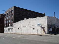
| 9 |
International Harvester Building |
|
000000002005-11-15-0000November 15, 2005
(#05001254) |
1301-1309 SW Washington St.
40°40′53″N 89°36′14″W / 40.681389°N 89.603889°W / 40.681389; -89.603889 (International Harvester Building) |
Peoria |
|
| 10 |
Jubilee College |
|
000000001972-01-04-0000January 4, 1972
(#72000465) |
Northwest of Kickapoo on U.S. Route 150 and Interstate 74
40°49′38″N 89°46′40″W / 40.827222°N 89.777778°W / 40.827222; -89.777778 (Jubilee College) |
Kickapoo |
|
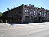
| 11 |
Kickapoo Building |
|
000000002013-12-31-0000December 31, 2013
(#13001005) |
726 W. Main St.
40°41′48″N 89°35′40″W / 40.69673°N 89.594377°W / 40.69673; -89.594377 (Kickapoo Building) |
Peoria |
|
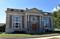
| 12 |
Lincoln Branch Peoria Public Library |
|
000000002014-05-28-0000May 28, 2014
(#14000256) |
1312 W. Lincoln Ave.
40°40′53″N 89°36′52″W / 40.681337°N 89.614528°W / 40.681337; -89.614528 (Lincoln Branch Peoria Public Library) |
Peoria |
Part of the Illinois Carnegie Libraries MPS
|
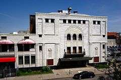
| 13 |
Madison Theatre |
|
000000001980-11-21-0000November 21, 1980
(#80001402) |
502 Main St.
40°41′39″N 89°35′29″W / 40.694167°N 89.591389°W / 40.694167; -89.591389 (Madison Theatre) |
Peoria |
|
| 14 |
North Side Historic District |
|
000000001983-11-21-0000November 21, 1983
(#83003588) |
Roughly bounded by Perry, Caroline, Madison, and Fayette Sts.
40°41′57″N 89°35′02″W / 40.699167°N 89.583889°W / 40.699167; -89.583889 (North Side Historic District) |
Peoria |
|
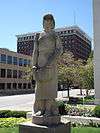
| 15 |
Peace and Harvest |
|
000000001994-02-16-0000February 16, 1994
(#87002527) |
Northwestern corner of the junction of Main and Jefferson Sts.[5]
40°41′35″N 89°35′21″W / 40.693056°N 89.589167°W / 40.693056; -89.589167 (Peace and Harvest) |
Peoria |
|
| 16 |
Peoria Automobile Club |
|
000000001995-08-04-0000August 4, 1995
(#95000984) |
100 Park Boulevard
40°54′12″N 89°29′24″W / 40.903333°N 89.49°W / 40.903333; -89.49 (Peoria Automobile Club) |
Chillicothe |
|
| 17 |
Peoria City Hall |
|
000000001973-02-06-0000February 6, 1973
(#73000715) |
419 Fulton St.
40°41′32″N 89°35′33″W / 40.692222°N 89.5925°W / 40.692222; -89.5925 (Peoria City Hall) |
Peoria |
|
| 18 |
Peoria Cordage Company |
|
000000001982-03-19-0000March 19, 1982
(#82002592) |
1506 SW Washington St.[6]
40°40′47″N 89°36′19″W / 40.67972°N 89.60527°W / 40.67972; -89.60527 (Peoria Cordage Company) |
Peoria |
|
| 19 |
Peoria Mineral Springs |
|
000000001982-03-05-0000March 5, 1982
(#82002593) |
701 W. 7th Ave.
40°41′45″N 89°36′18″W / 40.695833°N 89.605°W / 40.695833; -89.605 (Peoria Mineral Springs) |
Peoria |
|
| 20 |
Peoria State Hospital |
|
000000001982-02-17-0000February 17, 1982
(#82002590) |
Ricketts Ave. near U.S. Route 24
40°38′04″N 89°39′32″W / 40.634444°N 89.658889°W / 40.634444; -89.658889 (Peoria State Hospital) |
Bartonville |
|
| 21 |
Peoria Warehouse Historic District |
|
000000002014-09-17-0000September 17, 2014
(#14000621) |
Roughly along Adams, May, Oak, Persimmon, State, Walnut & Washington Sts.
40°41′08″N 89°35′52″W / 40.685503°N 89.597874°W / 40.685503; -89.597874 (Peoria Warehouse Historic District) |
Peoria |
|
| 22 |
Peoria Waterworks |
|
000000001980-03-18-0000March 18, 1980
(#80001403) |
Lorentz Ave.
40°43′28″N 89°33′08″W / 40.724444°N 89.552222°W / 40.724444; -89.552222 (Peoria Waterworks) |
Peoria |
|
| 23 |
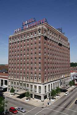
Pere Marquette Hotel |
|
000000001982-08-12-0000August 12, 1982
(#82002594) |
501 Main St.
40°41′37″N 89°35′31″W / 40.693611°N 89.591944°W / 40.693611; -89.591944 (Pere Marquette Hotel) |
Peoria |
|
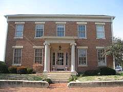
| 24 |
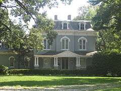
Pettingill-Morron House |
|
000000001976-04-02-0000April 2, 1976
(#76000724) |
1212 W. Moss Ave.
40°41′39″N 89°36′41″W / 40.694167°N 89.611389°W / 40.694167; -89.611389 (Pettingill-Morron House) |
Peoria |
Charles Ulricson, architect
|
| 25 |
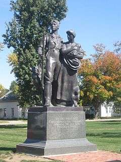
The Pioneers |
|
000000002001-05-04-0000May 4, 2001
(#01000117) |
Central Park, N,. Magnolia St.
40°46′45″N 89°58′22″W / 40.779167°N 89.972778°W / 40.779167; -89.972778 (The Pioneers) |
Elmwood |
|
| 26 |
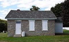
Pleasant Grove School |
|
000000001994-05-19-0000May 19, 1994
(#94000435) |
0.6 miles west of Eden Rd. on Pleasant Grove Rd.
40°40′41″N 89°50′43″W / 40.678056°N 89.845278°W / 40.678056; -89.845278 (Pleasant Grove School) |
Eden |
|
| 27 |
John C. Proctor Recreation Center |
|
000000001979-09-06-0000September 6, 1979
(#79000860) |
300 S. Allen St.
40°41′07″N 89°36′58″W / 40.685278°N 89.616111°W / 40.685278; -89.616111 (John C. Proctor Recreation Center) |
Peoria |
|
| 28 |
Rock Island Depot and Freight House |
|
000000001978-12-22-0000December 22, 1978
(#78001180) |
32 Liberty St.
40°41′17″N 89°35′20″W / 40.688056°N 89.588889°W / 40.688056; -89.588889 (Rock Island Depot and Freight House) |
Peoria |
River Station
|
| 29 |
Springdale Cemetery |
|
000000002004-12-10-0000December 10, 2004
(#04001303) |
3014 N. Prospect Rd.
40°43′24″N 89°34′30″W / 40.723445°N 89.575076°W / 40.723445; -89.575076 (Springdale Cemetery) |
Peoria |
|
| 30 |
U.S. Post Office and Courthouse |
|
000000002012-10-24-0000October 24, 2012
(#12000878) |
100 NE Monroe St.
40°41′42″N 89°35′30″W / 40.69489°N 89.591733°W / 40.69489; -89.591733 (U.S. Post Office and Courthouse) |
Peoria |
|
| 31 |
Washington C. Wear House |
Upload image |
000000001993-08-19-0000August 19, 1993
(#93000838) |
1 mile south and 0.4 miles west of the junction of Illinois Routes 90 and 91
40°54′55″N 89°45′53″W / 40.915278°N 89.764722°W / 40.915278; -89.764722 (Washington C. Wear House) |
Princeville |
|
| 32 |
West Bluff Historic District |
|
000000001976-12-17-0000December 17, 1976
(#76000725) |
Randolph, High, and Moss Sts., east of Western St.
40°41′49″N 89°36′31″W / 40.696944°N 89.608611°W / 40.696944; -89.608611 (West Bluff Historic District) |
Peoria |
|
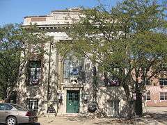
| 33 |
YWCA Building |
|
000000002007-05-17-0000May 17, 2007
(#07000147) |
301 NE Jefferson
40°41′40″N 89°35′16″W / 40.694444°N 89.587778°W / 40.694444; -89.587778 (YWCA Building) |
Peoria |
|
.jpg)