| [3] |
Name on the Register[4] |
Image |
Date listed[5] |
Location |
City or town |
Description |
|---|
| 1 |
Anson Grange No. 88 |
Upload image |
000000002004-04-28-0000April 28, 2004
(#04000371) |
10 Elm St.
44°51′16″N 69°53′55″W / 44.854444°N 69.898611°W / 44.854444; -69.898611 (Anson Grange No. 88) |
North Anson |
|
| 2 |
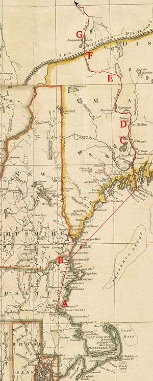
Arnold Trail to Quebec |
|
000000001969-10-01-0000October 1, 1969
(#69000018) |
Along the Kennebec River, through Wayman and Flagstaff lakes along the Dead River and Chain of Ponds to Quebec, Canada
45°10′22″N 70°02′32″W / 45.1727°N 70.0422°W / 45.1727; -70.0422 (Arnold Trail to Quebec) |
Bingham |
Extends through Franklin, Kennebec, Sagadahoc, and Somerset counties
|
| 3 |
Bailey Farm Windmill |
|
000000001988-06-28-0000June 28, 1988
(#88000885) |
State Route 16
44°51′45″N 69°55′49″W / 44.8625°N 69.930278°W / 44.8625; -69.930278 (Bailey Farm Windmill) |
North Anson |
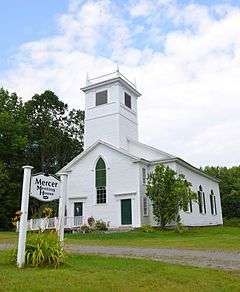
|
| 4 |
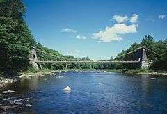
Asa Bates Memorial Chapel |
Upload image |
000000002002-10-31-0000October 31, 2002
(#02001272) |
2 Ten Lots Rd.
44°35′29″N 69°41′51″W / 44.591389°N 69.6975°W / 44.591389; -69.6975 (Asa Bates Memorial Chapel) |
Fairfield Center |
|
| 5 |
Bigelow-Page House |
Upload image |
000000001988-04-20-0000April 20, 1988
(#88000395) |
20 High St.
44°46′10″N 69°43′13″W / 44.769444°N 69.720278°W / 44.769444; -69.720278 (Bigelow-Page House) |
Skowhegan |
|
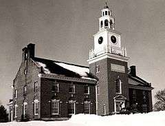
| 6 |
Bingham Free Meetinghouse |
|
000000001976-06-03-0000June 3, 1976
(#76000113) |
S. Main St. (U.S. Route 201)
45°03′08″N 69°52′58″W / 45.052222°N 69.882778°W / 45.052222; -69.882778 (Bingham Free Meetinghouse) |
Bingham |
|
| 7 |
Birch Island House |
Upload image |
000000001996-03-07-0000March 7, 1996
(#96000246) |
Birch Island
45°35′15″N 70°25′36″W / 45.5875°N 70.426667°W / 45.5875; -70.426667 (Birch Island House) |
Holeb |
|
| 8 |
Bloomfield Academy |
|
000000001982-02-19-0000February 19, 1982
(#82000778) |
Main St.
44°45′37″N 69°43′04″W / 44.760278°N 69.717778°W / 44.760278; -69.717778 (Bloomfield Academy) |
Skowhegan |
|
| 9 |
Caratunk Falls Archeological District |
|
000000001986-05-30-0000May 30, 1986
(#86001200) |
Address Restricted
|
Solon |
|
| 10 |
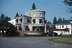
Carrabasset Inn |
Upload image |
000000002000-04-14-0000April 14, 2000
(#00000376) |
Junction of Union St. and State Route 8
44°51′10″N 69°53′44″W / 44.852778°N 69.895556°W / 44.852778; -69.895556 (Carrabasset Inn) |
North Anson |
|
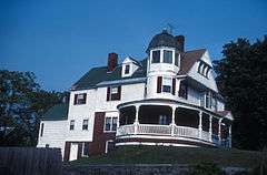
| 11 |
Gov. Abner Coburn House |
|
000000001974-07-30-0000July 30, 1974
(#74000193) |
Main St.
44°45′43″N 69°43′00″W / 44.761944°N 69.716667°W / 44.761944; -69.716667 (Gov. Abner Coburn House) |
Skowhegan |
|
| 12 |
Concord Haven |
Upload image |
000000001992-10-02-0000October 2, 1992
(#92001297) |
Eastern side of State Route 16, 1.7 miles (2.7 km) north of its junction with Berry Rd.
44°58′34″N 69°52′42″W / 44.976111°N 69.878333°W / 44.976111; -69.878333 (Concord Haven) |
Embden |
|
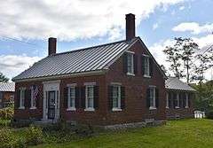
| 13 |
Connor-Bovie House |
|
000000001974-01-18-0000January 18, 1974
(#74000321) |
22 Summit Street
44°35′14″N 69°36′03″W / 44.587222°N 69.600833°W / 44.587222; -69.600833 (Connor-Bovie House) |
Fairfield |
|
| 14 |
Cotton-Smith House |
Upload image |
000000001992-06-18-0000June 18, 1992
(#92000794) |
42 High St.
44°35′11″N 69°36′02″W / 44.586389°N 69.600556°W / 44.586389; -69.600556 (Cotton-Smith House) |
Fairfield |
|
| 15 |
C. F. Douglas House |
Upload image |
000000001978-12-18-0000December 18, 1978
(#78000200) |
State Route 8
44°42′46″N 69°47′44″W / 44.712778°N 69.795556°W / 44.712778; -69.795556 (C. F. Douglas House) |
Norridgewock |
|
| 16 |
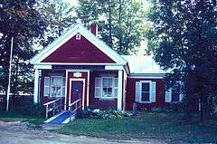
Dudley's Corner School House |
Upload image |
000000002002-07-15-0000July 15, 2002
(#02000787) |
5 Dudley Corner Rd.
44°46′20″N 69°40′34″W / 44.772144°N 69.676041°W / 44.772144; -69.676041 (Dudley's Corner School House) |
Skowhegan |
|
| 17 |
Eaton School |
|
000000001988-06-23-0000June 23, 1988
(#88000884) |
Junction of Main St. and Mercer Rd.
44°42′48″N 69°47′55″W / 44.713333°N 69.798611°W / 44.713333; -69.798611 (Eaton School) |
Norridgewock |
|
| 18 |
Embden Town House |
Upload image |
000000001989-10-16-0000October 16, 1989
(#89001704) |
Cross Town Rd.
44°54′42″N 69°55′57″W / 44.911667°N 69.9325°W / 44.911667; -69.9325 (Embden Town House) |
Embden |
|
| 19 |
The Evergreens |
Upload image |
000000001982-02-08-0000February 8, 1982
(#82000779) |
Ferry Street[6]
44°56′17″N 69°52′03″W / 44.938177°N 69.867364°W / 44.938177; -69.867364 (The Evergreens) |
Solon |
Archaeological site, on the Evergreens Campground property
|
| 20 |
First Baptist Church, Former |
|
000000001991-06-21-0000June 21, 1991
(#91000770) |
Western side of Main St., south of State Route 104
44°45′37″N 69°43′03″W / 44.760278°N 69.7175°W / 44.760278; -69.7175 (First Baptist Church, Former) |
Skowhegan |
|
| 21 |
Founders Hall |
|
000000001979-10-09-0000October 9, 1979
(#79000167) |
S. Main St.
44°46′46″N 69°23′14″W / 44.779444°N 69.387222°W / 44.779444; -69.387222 (Founders Hall) |
Pittsfield |
The central campus building of Maine Central Institute.
|
| 22 |
Gerald Hotel |
|
000000002013-03-25-0000March 25, 2013
(#12000894) |
151-157 Main St.
44°35′13″N 69°35′43″W / 44.586922°N 69.595397°W / 44.586922; -69.595397 (Gerald Hotel) |
Fairfield |
|
| 23 |
Amos Gerald House |
|
000000001980-06-24-0000June 24, 1980
(#80000252) |
107 Main St.
44°35′05″N 69°35′54″W / 44.584722°N 69.598333°W / 44.584722; -69.598333 (Amos Gerald House) |
Fairfield |
|
| 24 |
Gould House |
|
000000001982-02-19-0000February 19, 1982
(#82001886) |
31 Elm St.
44°46′01″N 69°43′23″W / 44.766944°N 69.723056°W / 44.766944; -69.723056 (Gould House) |
Skowhegan |
|
| 25 |
Hinckley Good Will Home Historic District |
|
000000001987-01-09-0000January 9, 1987
(#87000232) |
U.S. Route 201
44°40′05″N 69°37′59″W / 44.668056°N 69.633056°W / 44.668056; -69.633056 (Hinckley Good Will Home Historic District) |
Hinckley |
|
| 26 |
History House |
|
000000001983-12-29-0000December 29, 1983
(#83003677) |
40 Elm St.
44°45′56″N 69°43′32″W / 44.765556°N 69.725556°W / 44.765556; -69.725556 (History House) |
Skowhegan |
|
| 27 |
Hodgdon Site |
Upload image |
000000001980-04-23-0000April 23, 1980
(#80000253) |
Address Restricted
|
Embden |
|
| 28 |
Samuel Holden House |
Upload image |
000000001995-12-14-0000December 14, 1995
(#95001459) |
Eastern side of U.S. Route 201, 0.25 miles (0.40 km) north of its junction with an MDOT road
45°39′04″N 70°15′54″W / 45.651111°N 70.265°W / 45.651111; -70.265 (Samuel Holden House) |
Moose River |
|
| 29 |
Ingalls House |
Upload image |
000000001975-06-05-0000June 5, 1975
(#75000110) |
Main St.
44°40′39″N 69°56′18″W / 44.6775°N 69.938333°W / 44.6775; -69.938333 (Ingalls House) |
Mercer |
|
| 30 |
Kromberg Barn |
Upload image |
000000002009-01-22-0000January 22, 2009
(#08001357) |
Eastern side of E. Pond Rd., across from 462 E. Pond Rd.
44°37′08″N 69°46′10″W / 44.619°N 69.76937°W / 44.619; -69.76937 (Kromberg Barn) |
Smithfield |
|
| 31 |
Lakewood Theater |
|
000000001975-06-18-0000June 18, 1975
(#75000111) |
On the banks of Lake Wesserunsett
44°49′53″N 69°46′38″W / 44.831389°N 69.777222°W / 44.831389; -69.777222 (Lakewood Theater) |
Madison |
|
| 32 |
Lawrence Library |
Upload image |
000000001974-12-31-0000December 31, 1974
(#74000322) |
33 Lawrence Avenue
44°35′16″N 69°36′10″W / 44.587778°N 69.602778°W / 44.587778; -69.602778 (Lawrence Library) |
Fairfield |
|
| 33 |
Madison Public Library |
|
000000001989-01-05-0000January 5, 1989
(#88003022) |
Old Point Ave.
44°47′46″N 69°52′48″W / 44.796111°N 69.88°W / 44.796111; -69.88 (Madison Public Library) |
Madison |
|
| 34 |
Sophie May House |
|
000000001976-10-08-0000October 8, 1976
(#76000114) |
Sophie May Lane
44°43′04″N 69°48′03″W / 44.717778°N 69.800833°W / 44.717778; -69.800833 (Sophie May House) |
Norridgewock |
|
| 35 |
Mercer Union Meetinghouse |
|
000000002007-01-09-0000January 9, 2007
(#06001223) |
Main St., 0.1 miles (0.16 km) west of its junction with U.S. Route 2
44°40′37″N 69°55′54″W / 44.676944°N 69.931667°W / 44.676944; -69.931667 (Mercer Union Meetinghouse) |
Mercer |
|
| 36 |
Moose River Congregational Church |
Upload image |
000000001998-10-08-0000October 8, 1998
(#98001234) |
Junction of U.S. Route 201 and Nichols Rd.
45°38′24″N 70°15′43″W / 45.64°N 70.261944°W / 45.64; -70.261944 (Moose River Congregational Church) |
Jackman |
|
| 37 |
New Portland Wire Bridge |
|
000000001970-01-12-0000January 12, 1970
(#70000065) |
Wire Bridge Rd. over the Carrabassett River
44°53′27″N 70°05′37″W / 44.890833°N 70.093611°W / 44.890833; -70.093611 (New Portland Wire Bridge) |
New Portland |
|
| 38 |
Norridgewock Archeological District |
|
000000001993-04-12-0000April 12, 1993
(#93000606) |
Three sites in Madison, Starks, and Norridgewock[7]
44°46′01″N 69°53′00″W / 44.7670°N 69.8833°W / 44.7670; -69.8833 (Norridgewock Archeological District) |
Norridgewock, Madison and Starks |
|
| 39 |
Norridgewock Female Academy |
Upload image |
000000001996-03-07-0000March 7, 1996
(#96000244) |
Northern side of U.S. Route 2, 0.05 miles (0.080 km) west of its junction with Upper Main Street
44°42′48″N 69°47′54″W / 44.7133°N 69.7983°W / 44.7133; -69.7983 (Norridgewock Female Academy) |
Norridgewock |
Now owned by the Norridgewock Historical Society.
|
| 40 |
Norridgewock Free Public Library |
|
000000001982-02-04-0000February 4, 1982
(#82000780) |
Sophie May Lane
44°43′04″N 69°47′56″W / 44.717778°N 69.798889°W / 44.717778; -69.798889 (Norridgewock Free Public Library) |
Norridgewock |
|
| 41 |
Old Point and Sebastian Rale Monument |
|
000000001973-04-02-0000April 2, 1973
(#73000147) |
South of Madison off Alternate U.S. Route 201
44°46′08″N 69°53′17″W / 44.7689°N 69.8881°W / 44.7689; -69.8881 (Old Point and Sebastian Rale Monument) |
Madison |
|
| 42 |
Pittsfield Public Library |
|
000000001983-01-04-0000January 4, 1983
(#83000471) |
Main St.
44°46′55″N 69°26′50″W / 44.781944°N 69.447222°W / 44.781944; -69.447222 (Pittsfield Public Library) |
Pittsfield |
|
| 43 |
Pittsfield Railroad Station |
Upload image |
000000001980-01-23-0000January 23, 1980
(#80000254) |
Central St.
44°46′57″N 69°23′02″W / 44.7825°N 69.383889°W / 44.7825; -69.383889 (Pittsfield Railroad Station) |
Pittsfield |
|
| 44 |
Pittsfield Universalist Church |
|
000000001983-07-14-0000July 14, 1983
(#83000472) |
N. Main and Easy Sts.
44°47′03″N 69°22′55″W / 44.784167°N 69.381944°W / 44.784167; -69.381944 (Pittsfield Universalist Church) |
Pittsfield |
|
| 45 |
Pittston Farm |
|
000000002000-07-10-0000July 10, 2000
(#00000762) |
Western end of Seboomook Lake at its confluence with the south branch of the Penobscot River
45°53′39″N 69°57′47″W / 45.894167°N 69.963056°W / 45.894167; -69.963056 (Pittston Farm) |
Pittston Academy Grant |
|
| 46 |
Quincy Building |
|
000000001978-10-04-0000October 4, 1978
(#78000330) |
South of Hinckley
44°39′45″N 69°37′40″W / 44.6625°N 69.627778°W / 44.6625; -69.627778 (Quincy Building) |
Hinckley |
|
| 47 |
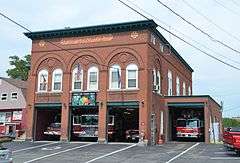
Skowhegan Fire Station |
|
000000001983-10-20-0000October 20, 1983
(#83003679) |
Island Ave.
44°45′50″N 69°43′09″W / 44.763889°N 69.719167°W / 44.763889; -69.719167 (Skowhegan Fire Station) |
Skowhegan |
|
| 48 |
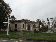
Skowhegan Free Public Library |
|
000000001983-04-14-0000April 14, 1983
(#83000473) |
9 Elm St.
44°45′58″N 69°43′15″W / 44.766111°N 69.720833°W / 44.766111; -69.720833 (Skowhegan Free Public Library) |
Skowhegan |
|
| 49 |
Skowhegan Historic District |
|
000000001982-02-19-0000February 19, 1982
(#82000781) |
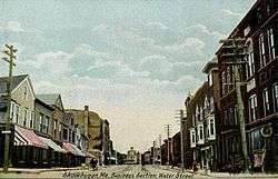
Madison Ave., Water St. and Russell St.
44°45′57″N 69°43′05″W / 44.765833°N 69.718056°W / 44.765833; -69.718056 (Skowhegan Historic District) |
Skowhegan |
|
| 50 |
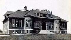
Somerset Academy |
Upload image |
000000001984-07-19-0000July 19, 1984
(#84001499) |
Academy St.
44°55′37″N 69°40′18″W / 44.9269°N 69.6716°W / 44.9269; -69.6716 (Somerset Academy) |
Athens |
|
| 51 |
Somerset County Courthouse |
|
000000001984-11-08-0000November 8, 1984
(#84000332) |
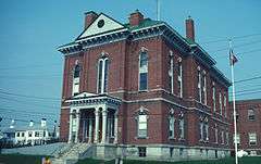
Court St.
44°45′59″N 69°43′10″W / 44.766389°N 69.719444°W / 44.766389; -69.719444 (Somerset County Courthouse) |
Skowhegan |
|
| 52 |
South Solon Meetinghouse |
Upload image |
000000001980-06-16-0000June 16, 1980
(#80000255) |
5 miles (8.0 km) southeast of Solon
44°54′47″N 69°46′44″W / 44.913056°N 69.778889°W / 44.913056; -69.778889 (South Solon Meetinghouse) |
Solon |
|
| 53 |
Spaulding House |
Upload image |
000000001978-12-18-0000December 18, 1978
(#78000201) |
Main St.
44°42′51″N 69°47′45″W / 44.714167°N 69.795833°W / 44.714167; -69.795833 (Spaulding House) |
Norridgewock |
|
| 54 |
Steward-Emery House |
|
000000001992-12-17-0000December 17, 1992
(#92001705) |
Main St., 0.25 miles (0.40 km) north of its junction with State Route 16
44°51′24″N 69°53′52″W / 44.856667°N 69.897778°W / 44.856667; -69.897778 (Steward-Emery House) |
North Anson |
|
| 55 |
Temples Historic District |
Upload image |
000000001983-05-12-0000May 12, 1983
(#83000474) |
Madison Ave.
44°51′22″N 69°53′46″W / 44.856111°N 69.896111°W / 44.856111; -69.896111 (Temples Historic District) |
North Anson |
|
| 56 |
Henry Knox Thatcher House |
Upload image |
000000002002-10-29-0000October 29, 2002
(#02001273) |
Old State Route 3 and Elm St.
44°40′40″N 69°56′03″W / 44.677778°N 69.934167°W / 44.677778; -69.934167 (Henry Knox Thatcher House) |
Mercer |
|
| 57 |
Weston Homestead |
Upload image |
000000001977-11-23-0000November 23, 1977
(#77000086) |
North of Madison on Weston Ave.
44°49′13″N 69°52′13″W / 44.820278°N 69.870278°W / 44.820278; -69.870278 (Weston Homestead) |
Madison |
|
| 58 |
Samuel Weston Homestead |
|
000000001980-11-10-0000November 10, 1980
(#80000256) |
South of Skowhegan on U.S. Route 201
44°44′50″N 69°39′55″W / 44.747222°N 69.665278°W / 44.747222; -69.665278 (Samuel Weston Homestead) |
Skowhegan |
|






.jpg)
.jpg)
