| [3] |
Name on the Register[4] |
Image |
Date listed[5] |
Location |
City or town |
Description |
|---|
| 1 |
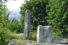
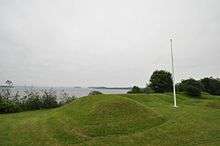
"The Rim" and Site of Fort Foster |
|
000000001973-07-23-0000July 23, 1973
(#73000155) |
South of East Machias off U.S. Route 1
44°43′01″N 67°23′45″W / 44.716944°N 67.395833°W / 44.716944; -67.395833 ("The Rim" and Site of Fort Foster) |
East Machias |
|
| 2 |
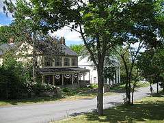
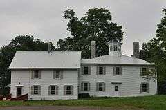
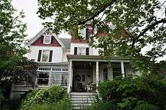
Archibald-Adams House |
|
000000001987-03-13-0000March 13, 1987
(#87000429) |
State Route 193
44°36′21″N 67°55′38″W / 44.605833°N 67.927222°W / 44.605833; -67.927222 (Archibald-Adams House) |
Cherryfield |
|
| 3 |
Atkinson-Koskinen Site 45.13 |
Upload image |
000000001984-11-23-0000November 23, 1984
(#84000282) |
Address Restricted
|
Steuben |
|
| 4 |
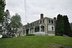
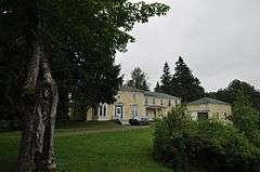
Charles Best House |
|
000000001982-03-02-0000March 2, 1982
(#82000784) |
County Rd.
44°56′51″N 67°10′30″W / 44.9475°N 67.175°W / 44.9475; -67.175 (Charles Best House) |
West Pembroke |
|
| 5 |
Birch Point |
Upload image |
000000001997-12-09-0000December 9, 1997
(#97000913) |
Address Restricted
|
Machiasport |
|
| 6 |
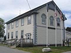
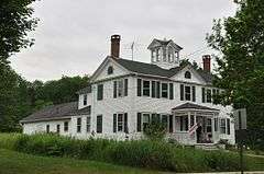
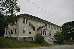
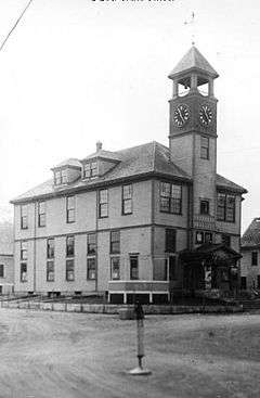
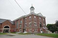
Former Boynton High School |
|
000000002002-04-11-0000April 11, 2002
(#02000351) |
78 High St.
44°54′19″N 66°59′26″W / 44.905278°N 66.990556°W / 44.905278; -66.990556 (Former Boynton High School) |
Eastport |
Now Eastport City Hall.
|
| 7 |
Boynton Street Historic District |
|
000000001984-07-19-0000July 19, 1984
(#84001542) |
13-26 Boynton St.
44°54′18″N 66°59′13″W / 44.905°N 66.986944°W / 44.905; -66.986944 (Boynton Street Historic District) |
Eastport |
|
| 8 |
Henrietta Brewer House |
|
000000001983-10-06-0000October 6, 1983
(#83003688) |
U.S. Route 1
45°05′04″N 67°06′41″W / 45.084444°N 67.111389°W / 45.084444; -67.111389 (Henrietta Brewer House) |
Robbinston |
|
| 9 |
John N.M. Brewer House |
|
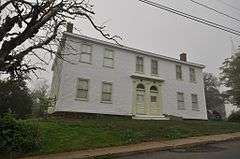
000000001983-10-06-0000October 6, 1983
(#83003690) |
U.S. Route 1
45°04′55″N 67°06′40″W / 45.081944°N 67.111111°W / 45.081944; -67.111111 (John N.M. Brewer House) |
Robbinston |
|
| 10 |
Bucknam House |
Upload image |
000000001975-04-28-0000April 28, 1975
(#75000113) |
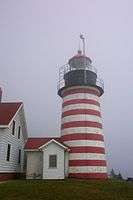
Main St.
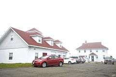
44°39′15″N 67°43′33″W / 44.654167°N 67.725833°W / 44.654167; -67.725833 (Bucknam House) |
Columbia Falls |
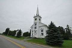
|
| 11 |
Samuel Bucknam House |
Upload image |
000000001978-10-19-0000October 19, 1978
(#78000203) |
Main St.
44°39′09″N 67°43′46″W / 44.6525°N 67.729444°W / 44.6525; -67.729444 (Samuel Bucknam House) |
Columbia Falls |
|
| 12 |
Burnham Tavern |
|
000000001973-04-11-0000April 11, 1973
(#73000152) |
14 Colonial Way
44°42′50″N 67°27′36″W / 44.713889°N 67.46°W / 44.713889; -67.46 (Burnham Tavern) |
Machias |
|
| 13 |
Calais Free Library |
|
000000002001-04-12-0000April 12, 2001
(#01000370) |
Union St., 0.05 miles northwest of its junction with U.S. Route 1
45°11′21″N 67°16′38″W / 45.189167°N 67.277222°W / 45.189167; -67.277222 (Calais Free Library) |
Calais |
|
| 14 |
Calais Historic District |
|
000000001978-12-20-0000December 20, 1978
(#78000204) |
Church, Main, and North Sts.
45°11′19″N 67°16′40″W / 45.188611°N 67.277778°W / 45.188611; -67.277778 (Calais Historic District) |
Calais |
|
| 15 |
Calais Observatory |
|
000000002012-12-19-0000December 19, 2012
(#12001069) |
Meridian Park, North St.
45°11′05″N 67°16′51″W / 45.184763°N 67.280762°W / 45.184763; -67.280762 (Calais Observatory) |
Calais |
Granite installation for performing 1857 longitude survey.
|
| 16 |
Calais Residential Historic District |
|
000000001994-10-28-0000October 28, 1994
(#94001248) |
Roughly the area along Main St. and Calais Ave., and from Calais Ave. to Swan St.
45°11′11″N 67°16′25″W / 45.186389°N 67.273611°W / 45.186389; -67.273611 (Calais Residential Historic District) |
Calais |
|
| 17 |
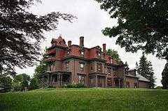
Gen. Alexander Campbell House |
|
000000001977-04-13-0000April 13, 1977
(#77000088) |
Campbell Hill
44°35′53″N 67°55′18″W / 44.598056°N 67.921667°W / 44.598056; -67.921667 (Gen. Alexander Campbell House) |
Cherryfield |
|
| 18 |
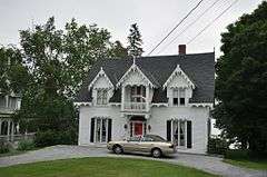
David W. Campbell House |
|
000000001984-07-19-0000July 19, 1984
(#84001545) |
Main St.
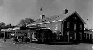
44°36′02″N 67°55′19″W / 44.600556°N 67.921944°W / 44.600556; -67.921944 (David W. Campbell House) |
Cherryfield |
|
| 19 |
Frank Campbell House |
|
000000001982-10-29-0000October 29, 1982
(#82000426) |
U.S. Route 1
44°35′52″N 67°55′23″W / 44.597778°N 67.923056°W / 44.597778; -67.923056 (Frank Campbell House) |
Cherryfield |
|
| 20 |
Col. Samuel Campbell House |
|
000000001982-02-04-0000February 4, 1982
(#82000785) |
U.S. Route 1
44°35′54″N 67°55′18″W / 44.598333°N 67.921667°W / 44.598333; -67.921667 (Col. Samuel Campbell House) |
Cherryfield |
|
| 21 |
Central Congregational Church |
|
000000001976-06-23-0000June 23, 1976
(#76000116) |
Middle St.
44°54′14″N 66°59′16″W / 44.903889°N 66.987778°W / 44.903889; -66.987778 (Central Congregational Church) |
Eastport |
|
| 22 |
Centre Street Congregational Church |
|
000000001975-05-12-0000May 12, 1975
(#75000114) |
Centre St.
44°42′54″N 67°27′37″W / 44.715°N 67.460278°W / 44.715; -67.460278 (Centre Street Congregational Church) |
Machias |
|
| 23 |
Chaloner House |
|
000000002007-02-07-0000February 7, 2007
(#07000009) |
3 Pleasant St.
44°51′42″N 66°59′06″W / 44.861667°N 66.985°W / 44.861667; -66.985 (Chaloner House) |
Lubec |
|
| 24 |
Charlotte Pound |
Upload image |
000000002005-12-21-0000December 21, 2005
(#05001442) |
Charlotte Rd., 0.25 miles east of its junction with 214
45°00′25″N 67°16′16″W / 45.006944°N 67.271111°W / 45.006944; -67.271111 (Charlotte Pound) |
Charlotte |
|
| 25 |
Cherryfield Academy |
|
000000001982-02-19-0000February 19, 1982
(#82000786) |
Main St.
44°36′06″N 67°55′29″W / 44.601667°N 67.924722°W / 44.601667; -67.924722 (Cherryfield Academy) |
Cherryfield |
Now houses town offices
|
| 26 |
Cherryfield Historic District |
|
000000001990-10-01-0000October 1, 1990
(#90001467) |
Roughly bounded by Church, Main, Park, New and High Sts., as well as River Rd. properties from U.S. Route 1 to Driscoll Island
44°35′54″N 67°55′32″W / 44.598333°N 67.925556°W / 44.598333; -67.925556 (Cherryfield Historic District) |
Cherryfield |
|
| 27 |
Columbia House |
Upload image |
000000002000-10-12-0000October 12, 2000
(#00001203) |
Main St. at its junction with Church Hill Circle
44°39′15″N 67°43′43″W / 44.654167°N 67.728611°W / 44.654167; -67.728611 (Columbia House) |
Columbia Falls |
|
| 28 |
Columbia Union Church |
Upload image |
000000001997-06-20-0000June 20, 1997
(#97000607) |
Northern side of State Route 29-608 (Epping Road), 0.05 miles east of its junction with State Route 29-610 (Cemetery Road)
44°40′59″N 67°46′48″W / 44.683056°N 67.78°W / 44.683056; -67.78 (Columbia Union Church) |
Epping (Columbia, Maine) |
|
| 29 |
Dennysville Historic District |
|
000000001982-10-29-0000October 29, 1982
(#82000427) |
The Lane, Main, and King Sts.
44°54′01″N 67°13′45″W / 44.900278°N 67.229167°W / 44.900278; -67.229167 (Dennysville Historic District) |
Dennysville |
|
| 30 |
Devils Head Site |
Upload image |
000000002006-05-17-0000May 17, 2006
(#06000395) |
Address Restricted
|
Calais |
|
| 31 |
East Machias Historic District |
|
000000001973-04-11-0000April 11, 1973
(#73000153) |
High, Water, and Bridge Sts.
44°44′11″N 67°23′21″W / 44.736389°N 67.389167°W / 44.736389; -67.389167 (East Machias Historic District) |
East Machias |
|
| 32 |
Eastport Historic District |
|
000000001982-06-01-0000June 1, 1982
(#82000787) |
Water St.; 15 Sea St.
44°54′18″N 66°59′07″W / 44.905°N 66.985278°W / 44.905; -66.985278 (Eastport Historic District) |
Eastport |
Sea Street address represents a boundary increase July 11, 2016.
|
| 33 |
Fort O'Brien |
|
000000001969-10-01-0000October 1, 1969
(#69000024) |
South of Machiasport on a secondary road
44°41′22″N 67°23′48″W / 44.689444°N 67.396667°W / 44.689444; -67.396667 (Fort O'Brien) |
Machiasport |
|
| 34 |
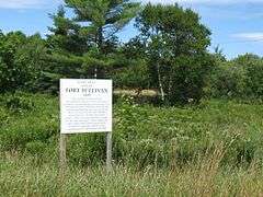
Fort Sullivan |
|
000000001970-01-26-0000January 26, 1970
(#70000081) |
Moose Island; barracks, 74 Washington St.
44°54′27″N 66°59′19″W / 44.9075°N 66.988611°W / 44.9075; -66.988611 (Fort Sullivan) |
Eastport |
|
| 35 |
Jeremiah Fowler House |
|
000000001983-12-29-0000December 29, 1983
(#83003693) |
35 School St.
44°51′37″N 66°59′14″W / 44.860278°N 66.987222°W / 44.860278; -66.987222 (Jeremiah Fowler House) |
Lubec |
|
| 36 |
Gallison Memorial Library |
|
000000002001-01-11-0000January 11, 2001
(#00001632) |
U.S. Route 1, 0.5 miles west of its junction with U.S. Route 1A
44°37′09″N 67°48′45″W / 44.619167°N 67.8125°W / 44.619167; -67.8125 (Gallison Memorial Library) |
Harrington |
|
| 37 |
Gates House |
|
000000001975-04-28-0000April 28, 1975
(#75000115) |
State Route 92
44°41′49″N 67°23′38″W / 44.696944°N 67.393889°W / 44.696944; -67.393889 (Gates House) |
Machiasport |
|
| 38 |
Gilmore House |
|
000000001979-06-14-0000June 14, 1979
(#79000380) |
764 River Road
45°11′01″N 67°15′51″W / 45.183611°N 67.264167°W / 45.183611; -67.264167 (Gilmore House) |
Calais |
Listed at 316 Main Street.
|
| 39 |
Governors Point |
Upload image |
000000002001-08-08-0000August 8, 2001
(#01000812) |
Address Restricted
|
Grand Lake Stream |
|
| 40 |
Grace Episcopal Church |
|
000000002001-08-07-0000August 7, 2001
(#01000816) |
U.S. Route 1 0.5 miles northwest of its junction with 3rd Rd.
45°05′14″N 67°06′53″W / 45.087222°N 67.114722°W / 45.087222; -67.114722 (Grace Episcopal Church) |
Robbinston |
|
| 41 |
Grand Lake Stream Site |
Upload image |
000000001997-12-09-0000December 9, 1997
(#97000916) |
Address restricted
|
Grand Lake Stream |
|
| 42 |
Thomas Hamilton House |
|
000000001982-02-04-0000February 4, 1982
(#82000788) |
78 South St.
45°10′43″N 67°16′20″W / 45.178611°N 67.272222°W / 45.178611; -67.272222 (Thomas Hamilton House) |
Calais |
|
| 43 |
Hinckley Hill Historic District |
|
000000001994-10-28-0000October 28, 1994
(#94001244) |
Roughly 305-326 Main St.
45°10′59″N 67°15′53″W / 45.183056°N 67.264722°W / 45.183056; -67.264722 (Hinckley Hill Historic District) |
Calais |
|
| 44 |
Hog Island-62.23 |
Upload image |
000000001997-12-09-0000December 9, 1997
(#97000911) |
Address restricted
|
Machiasport |
|
| 45 |
Hog Island-62.24 |
Upload image |
000000001997-09-05-0000September 5, 1997
(#97000917) |
Address restricted
|
Machiasport |
|
| 46 |
Hog Island-62.25 |
Upload image |
000000001997-12-09-0000December 9, 1997
(#97000918) |
Address restricted
|
Machiasport |
|
| 47 |
Hog Island-62.29 |
Upload image |
000000001997-09-05-0000September 5, 1997
(#97000912) |
Address restricted
|
Machiasport |
|
| 48 |
Holmes Cottage |
|
000000001988-04-04-0000April 4, 1988
(#87001855) |
521 Main St.
45°11′15″N 67°16′28″W / 45.1875°N 67.274444°W / 45.1875; -67.274444 (Holmes Cottage) |
Calais |
St. Croix Historical Society museum
|
| 49 |
Holmes Point |
Upload image |
000000001997-12-09-0000December 9, 1997
(#97000914) |
Address restricted
|
Machiasport |
|
| 50 |
Dr. Job Holmes House |
|
000000001990-04-05-0000April 5, 1990
(#90000579) |
527 Main St.
45°11′15″N 67°16′26″W / 45.1875°N 67.273889°W / 45.1875; -67.273889 (Dr. Job Holmes House) |
Calais |
St. Croix Historical Society museum
|
| 51 |
Indian River Baptist Church |
Upload image |
000000001988-06-23-0000June 23, 1988
(#88000893) |
State Route 187 at Indian River
44°34′22″N 67°38′36″W / 44.572778°N 67.643333°W / 44.572778; -67.643333 (Indian River Baptist Church) |
Addison |
|
| 52 |
Theodore Jellison House |
|
000000001984-11-23-0000November 23, 1984
(#84000274) |
River Rd.
45°09′53″N 67°12′02″W / 45.164722°N 67.200556°W / 45.164722; -67.200556 (Theodore Jellison House) |
Calais |
|
| 53 |
Jonesboro Grange No. 357 |
|
000000002010-12-15-0000December 15, 2010
(#10001035) |
Harrington Road
44°39′44″N 67°34′21″W / 44.6621°N 67.5725°W / 44.6621; -67.5725 (Jonesboro Grange No. 357) |
Jonesboro |
|
| 54 |
Jonesboro Union Church |
|
000000002002-07-18-0000July 18, 2002
(#02000788) |
Looks Point Rd. at its junction with U.S. Route 1
44°39′35″N 67°34′32″W / 44.659722°N 67.575556°W / 44.659722; -67.575556 (Jonesboro Union Church) |
Jonesboro |
|
| 55 |
Libby Island Light Station |
|
000000001976-06-18-0000June 18, 1976
(#76000117) |
South of Machiasport on Libby Island
44°34′16″N 67°21′54″W / 44.571111°N 67.365°W / 44.571111; -67.365 (Libby Island Light Station) |
Machiasport |
|
| 56 |
Liberty Hall |
|
000000001977-11-23-0000November 23, 1977
(#77000089) |
State Route 92
44°41′51″N 67°23′40″W / 44.6975°N 67.394444°W / 44.6975; -67.394444 (Liberty Hall) |
Machiasport |
|
| 57 |
Lincoln House |
Upload image |
000000001978-03-29-0000March 29, 1978
(#78000206) |
Maine State Route 86
44°54′23″N 67°13′44″W / 44.906389°N 67.228889°W / 44.906389; -67.228889 (Lincoln House) |
Dennysville |
|
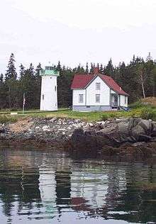
| 58 |
Little River Light Station |
|
000000001988-03-14-0000March 14, 1988
(#88000156) |
Little River Island
44°39′02″N 67°11′39″W / 44.650556°N 67.194167°W / 44.650556; -67.194167 (Little River Light Station) |
Cutler |
|
| 59 |
Lubec Channel Light Station |
|
000000001988-03-14-0000March 14, 1988
(#88000152) |
Lubec Channel
44°50′31″N 66°58′38″W / 44.841944°N 66.977222°W / 44.841944; -66.977222 (Lubec Channel Light Station) |
Lubec |
|
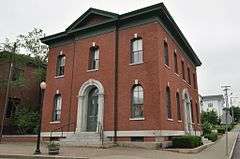
| 60 |
Machias Post Office and Customhouse |
|
000000001977-11-23-0000November 23, 1977
(#77000090) |
Main and Center Sts.
44°42′55″N 67°27′30″W / 44.715278°N 67.458333°W / 44.715278; -67.458333 (Machias Post Office and Customhouse) |
Machias |
|
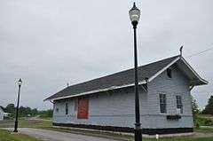
| 61 |
Machias Railroad Station |
|
000000001992-10-02-0000October 2, 1992
(#92001293) |
27 E. Main St.
44°43′10″N 67°27′08″W / 44.719444°N 67.452222°W / 44.719444; -67.452222 (Machias Railroad Station) |
Machias |
|
| 62 |
Machias Valley Grange, No. 360 (Former) |
|
000000002007-05-08-0000May 8, 2007
(#07000410) |
3 Elm St.
44°42′47″N 67°27′27″W / 44.713056°N 67.4575°W / 44.713056; -67.4575 (Machias Valley Grange, No. 360 (Former)) |
Machias |
|
| 63 |
Maine Archeological Survey site 62.46 |
Upload image |
000000002001-08-08-0000August 8, 2001
(#01000814) |
On an island in Machias Bay[6]
|
Machiasport |
A post-contact petroglyph site with carvings of European ships[6]
|
| 64 |
The Mansion House |
|
000000001973-05-22-0000May 22, 1973
(#73000154) |
North of Robbinston on U.S. Route 1
45°05′10″N 67°06′44″W / 45.0861°N 67.1121°W / 45.0861; -67.1121 (The Mansion House) |
Robbinston |
|
| 65 |
Marsh Stream Farm |
Upload image |
000000002016-01-12-0000January 12, 2016
(#15000971) |
38 Marsh Stream Ln.
44°40′03″N 67°25′47″W / 44.667426°N 67.429798°W / 44.667426; -67.429798 (Marsh Stream Farm) |
Machiasport |
|
| 66 |
McCurdy Smokehouse |
|
000000001993-07-15-0000July 15, 1993
(#93000638) |
Eastern side of Water St. at its junction with School St.
44°51′39″N 66°59′01″W / 44.860833°N 66.983611°W / 44.860833; -66.983611 (McCurdy Smokehouse) |
Lubec |
|
| 67 |
McGlashan-Nickerson House |
|
000000001990-06-14-0000June 14, 1990
(#90000920) |
St. Croix Dr. near Pettegrove Pt.
45°07′30″N 67°08′54″W / 45.125°N 67.148333°W / 45.125; -67.148333 (McGlashan-Nickerson House) |
Red Beach |
|
| 68 |
Henry D. Moore Parish House and Library |
|
000000002001-11-29-0000November 29, 2001
(#01001272) |
3 Rogers Point Rd.
44°30′39″N 67°57′43″W / 44.510833°N 67.961944°W / 44.510833; -67.961944 (Henry D. Moore Parish House and Library) |
Steuben |
|
| 69 |
Narraguagus Light Station |
|
000000001987-11-20-0000November 20, 1987
(#87002022) |
Eastern side of Pond Island
44°27′15″N 67°49′44″W / 44.454167°N 67.828889°W / 44.454167; -67.828889 (Narraguagus Light Station) |
Milbridge |
|
| 70 |
William M. Nash House |
|
000000001983-01-04-0000January 4, 1983
(#83000477) |
River Rd.
44°36′02″N 67°55′42″W / 44.600556°N 67.928333°W / 44.600556; -67.928333 (William M. Nash House) |
Cherryfield |
|
| 71 |
Ntolonapemk, Eastern Surplus Superfund Site |
Upload image |
000000002001-08-08-0000August 8, 2001
(#01000819) |
Roughly bounded by State Route 191, Stone Road, Meddybemps Lake, and the Dennys River[7]
45°02′18″N 67°21′31″W / 45.03833°N 67.35855°W / 45.03833; -67.35855 (Ntolonapemk, Eastern Surplus Superfund Site) |
Meddybemps |
|
| 72 |
Patten Building |
|
000000001978-12-22-0000December 22, 1978
(#78000207) |
Main St.
44°35′54″N 67°55′30″W / 44.598333°N 67.925°W / 44.598333; -67.925 (Patten Building) |
Cherryfield |
|
| 73 |
Clark Perry House |
|
000000001979-10-09-0000October 9, 1979
(#79000169) |
Court St.
44°42′55″N 67°27′40″W / 44.715278°N 67.461111°W / 44.715278; -67.461111 (Clark Perry House) |
Machias |
|
| 74 |
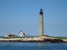
Petit Manan Light Station |
|
000000001987-10-30-0000October 30, 1987
(#87001879) |
Petit Manan Island
44°22′03″N 67°51′53″W / 44.3675°N 67.864722°W / 44.3675; -67.864722 (Petit Manan Light Station) |
Milbridge |
|
| 75 |
Joshua Pettegrove House |
|
000000001994-03-17-0000March 17, 1994
(#94000179) |
Eastern side of U.S. Route 1, 0.25 miles north of its junction with Shattuck Rd.
45°07′32″N 67°08′47″W / 45.125556°N 67.146389°W / 45.125556; -67.146389 (Joshua Pettegrove House) |
Red Beach |
|
| 76 |
Pike's Mile Markers |
|
000000001995-01-20-0000January 20, 1995
(#94001548) |
Twelve locations spaced 1 miles apart along the eastern side of U.S. Route 1 between Robbinston and Calais
45°10′04″N 67°14′01″W / 45.167778°N 67.233611°W / 45.167778; -67.233611 (Pike's Mile Markers) |
Calais |
|
| 77 |
Capt. John Plummer House |
Upload image |
000000002009-01-21-0000January 21, 2009
(#08001358) |
23 Pleasant St.
44°37′08″N 67°44′36″W / 44.61881°N 67.74331°W / 44.61881; -67.74331 (Capt. John Plummer House) |
Addison |
|
| 78 |
Porter Memorial Library |
|
000000001978-01-20-0000January 20, 1978
(#78000208) |
Court St.
44°42′55″N 67°27′36″W / 44.715278°N 67.46°W / 44.715278; -67.46 (Porter Memorial Library) |
Machias |
|
| 79 |
Reversing Falls Site |
Upload image |
000000001990-06-27-0000June 27, 1990
(#90000907) |
Address Restricted
|
Pembroke |
|
| 80 |
Ruggles House |
|
000000001970-01-26-0000January 26, 1970
(#70000080) |
Main Street
44°39′08″N 67°43′49″W / 44.652222°N 67.730278°W / 44.652222; -67.730278 (Ruggles House) |
Columbia Falls |
|
| 81 |
St. Anne's Episcopal Church |
|
000000001982-07-08-0000July 8, 1982
(#82000789) |
Church St.
45°11′16″N 67°16′31″W / 45.187778°N 67.275278°W / 45.187778; -67.275278 (St. Anne's Episcopal Church) |
Calais |
|
| 82 |
St. Croix Island International Historic Site |
|
000000001966-10-15-0000October 15, 1966
(#66000932) |
St. Croix Island, on the US side of the St. Croix River
45°07′42″N 67°08′02″W / 45.128333°N 67.133889°W / 45.128333; -67.133889 (St. Croix Island International Historic Site) |
St. Croix Junction |
|
| 83 |
Sewall Memorial Congregational Church |
|
000000002012-12-19-0000December 19, 2012
(#12001070) |
558 U.S. Route 1
45°05′04″N 67°06′42″W / 45.084324°N 67.111585°W / 45.084324; -67.111585 (Sewall Memorial Congregational Church) |
Robbinston |
Misspelled "Sewell" in the National Register listing.
|
| 84 |
James R. Talbot House |
|
000000001983-01-04-0000January 4, 1983
(#83000478) |
U.S. Route 1
44°44′18″N 67°23′28″W / 44.738333°N 67.391111°W / 44.738333; -67.391111 (James R. Talbot House) |
East Machias |
|
| 85 |
Todd House |
|
000000001980-04-23-0000April 23, 1980
(#80000258) |
11 Capens Ave.
44°54′41″N 66°59′09″W / 44.911389°N 66.985833°W / 44.911389; -66.985833 (Todd House) |
Eastport |
|
| 86 |
Union Church, (former) |
Upload image |
000000002000-07-05-0000July 5, 2000
(#00000759) |
Main St., 0.1 miles northeast of its junction with Addison Rd.
44°39′12″N 67°43′46″W / 44.653333°N 67.729444°W / 44.653333; -67.729444 (Union Church, (former)) |
Columbia Falls |
|
| 87 |
Union Evangelical Church |
Upload image |
000000001996-06-07-0000June 7, 1996
(#96000654) |
Northern side of Addison Ridge Rd., 2 miles south of U.S. Route 1
44°36′59″N 67°45′20″W / 44.616389°N 67.755556°W / 44.616389; -67.755556 (Union Evangelical Church) |
Addison |
|
| 88 |
Union Hall |
|
000000001987-06-25-0000June 25, 1987
(#87000938) |
Near the junction of U.S. Route 1 and State Route 169
45°39′29″N 67°52′02″W / 45.658056°N 67.867222°W / 45.658056; -67.867222 (Union Hall) |
Danforth |
|
| 89 |
Union Meeting House |
|
000000002014-04-11-0000April 11, 2014
(#14000139) |
153 US Route 1
44°47′27″N 67°10′32″W / 44.7909°N 67.1755°W / 44.7909; -67.1755 (Union Meeting House) |
Whiting |
|
| 90 |
U.S. Inspection Station-Calais (Ferry Point), Maine |
|
000000002014-09-10-0000September 10, 2014
(#14000559) |
1 Main St.
45°11′27″N 67°17′01″W / 45.1908°N 67.2835°W / 45.1908; -67.2835 (U.S. Inspection Station-Calais (Ferry Point), Maine) |
Calais |
|
| 91 |
Everett Wallace House |
|
000000001996-03-07-0000March 7, 1996
(#96000243) |
Western side of U.S. Route 1, 0.05 miles north of its junction with Wyman Rd.
44°31′57″N 67°52′59″W / 44.5325°N 67.883056°W / 44.5325; -67.883056 (Everett Wallace House) |
Milbridge |
|
| 92 |
George Washburn House |
|
000000001982-02-11-0000February 11, 1982
(#82000790) |
772 River Road
45°10′59″N 67°15′50″W / 45.183056°N 67.263889°W / 45.183056; -67.263889 (George Washburn House) |
Calais |
Listed at 318 Main Street.
|
| 93 |
Washington County Courthouse |
|
000000001976-11-07-0000November 7, 1976
(#76000119) |
Court St.
44°42′58″N 67°27′36″W / 44.716111°N 67.46°W / 44.716111; -67.46 (Washington County Courthouse) |
Machias |
|
| 94 |
Washington County Jail |
|
000000001988-04-07-0000April 7, 1988
(#88000393) |
Court St.
44°42′58″N 67°27′35″W / 44.716111°N 67.459722°W / 44.716111; -67.459722 (Washington County Jail) |
Machias |
|
| 95 |
West Quoddy Head Light Station |
|
000000001980-07-04-0000July 4, 1980
(#80004601) |
Southeast of Lubec on West Quoddy Head
44°48′54″N 66°57′00″W / 44.815°N 66.95°W / 44.815; -66.95 (West Quoddy Head Light Station) |
Lubec |
|
| 96 |
West Quoddy Lifesaving Station |
|
000000001990-04-20-0000April 20, 1990
(#90000581) |
Northern side of W. Quoddy Head
44°49′04″N 66°57′59″W / 44.817778°N 66.966389°W / 44.817778; -66.966389 (West Quoddy Lifesaving Station) |
Lubec |
|
| 97 |
Whitlocks Mill Light Station |
|
000000001988-01-21-0000January 21, 1988
(#87002276) |
Southern bank of the St. Croix River
45°09′46″N 67°13′41″W / 45.162778°N 67.228056°W / 45.162778; -67.228056 (Whitlocks Mill Light Station) |
Calais |
|
| 98 |
Whitneyville Congregational Church |
|
000000001979-06-26-0000June 26, 1979
(#79000170) |
Main St.
44°43′19″N 67°31′24″W / 44.721872°N 67.52335°W / 44.721872; -67.52335 (Whitneyville Congregational Church) |
Whitneyville |
|
| 99 |
Windswept |
Upload image |
000000002007-05-08-0000May 8, 2007
(#07000411) |
421 Petit Manan Point Rd.
44°25′05″N 67°54′45″W / 44.418056°N 67.9125°W / 44.418056; -67.9125 (Windswept) |
Steuben |
|
| 100 |
Daniel Young House |
|
000000001984-03-22-0000March 22, 1984
(#84001547) |
34 Main St.
44°51′39″N 66°59′15″W / 44.860833°N 66.9875°W / 44.860833; -66.9875 (Daniel Young House) |
Lubec |
|
