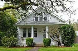
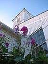
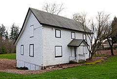
| [5] |
Name on the Register |
Image |
Date listed[6] |
Location |
City or town |
Description |
|---|
| 1 |
Aloha Farmhouse |
|
000000002014-09-30-0000September 30, 2014
(#14000812) |
1080 SW 197th Avenue
45°30′43″N 122°52′45″W / 45.511997°N 122.879067°W / 45.511997; -122.879067 (Aloha Farmhouse) |
Beaverton |
|
| 2 |
Beaverton Downtown Historic District |
|
000000001986-01-07-0000January 7, 1986
(#86000037) |
Roughly bounded by SW Canyon Road and SW East, Washington, 2nd, and Watson Streets
45°29′15″N 122°48′20″W / 45.487377°N 122.805585°W / 45.487377; -122.805585 (Beaverton Downtown Historic District) |
Beaverton |
Beaverton's downtown commercial core remains largely intact as a pedestrian-oriented business district constructed along the street pattern from the city's earliest plats. Significant buildings include a handful from the city's first decades (1868–1920) and a larger number from the period of profound transformation between the world wars (1920–1940).[7]
|
| 3 |
Silas Jacob N. Beeks House |
|
000000001984-06-14-0000June 14, 1984
(#84003100) |
Martin Road
45°32′53″N 123°04′28″W / 45.54813°N 123.0744°W / 45.54813; -123.0744 (Silas Jacob N. Beeks House) |
Forest Grove vicinity |
|
| 4 |
Stephen and Parthena M. Blank House |
|
000000001988-07-14-0000July 14, 1988
(#88001035) |
2117 A Street
45°31′17″N 123°06′50″W / 45.52126°N 123.1138°W / 45.52126; -123.1138 (Stephen and Parthena M. Blank House) |
Forest Grove |
|
| 5 |
M. E. Blanton House |
|
000000001989-03-02-0000March 2, 1989
(#89000123) |
3980 SW 170th Avenue
45°29′27″N 122°51′06″W / 45.4907°N 122.8518°W / 45.4907; -122.8518 (M. E. Blanton House) |
Aloha |
|
| 6 |
Clark Historic District |
|
000000002002-06-01-0000June 1, 2002
(#02000617) |
Roughly bounded by 18th and 16th Avenues, A and Elm Streets
45°30′57″N 123°06′33″W / 45.51595°N 123.1092°W / 45.51595; -123.1092 (Clark Historic District) |
Forest Grove |
|
| 7 |
Benjamin Cornelius, Jr., House |
|
000000001988-07-14-0000July 14, 1988
(#88001034) |
2314 19th Avenue
45°31′06″N 123°06′22″W / 45.51835°N 123.1062°W / 45.51835; -123.1062 (Benjamin Cornelius, Jr., House) |
Forest Grove |
|
| 8 |
Harry A. Crosley House |
|
000000001993-09-09-0000September 9, 1993
(#93000919) |
2125 A Street
45°31′17″N 123°06′50″W / 45.52134°N 123.1138°W / 45.52134; -123.1138 (Harry A. Crosley House) |
Forest Grove |
|
| 9 |
Doriot–Rider Log House |
|
000000002008-06-25-0000June 25, 2008[8]
(#08000554) |
14850 SW 132nd Terrace[8]
45°24′46″N 122°48′44″W / 45.41285278°N 122.8122083°W / 45.41285278; -122.8122083 (Doriot–Rider Log House) |
Tigard[8] |
|
| 10 |
Dundee Lodge |
|
000000001985-06-06-0000June 6, 1985
(#85001186) |
South Road
45°27′34″N 123°11′57″W / 45.4594°N 123.1991°W / 45.4594; -123.1991 (Dundee Lodge) |
Gaston vicinity |
|
| 11 |
Augustus Fanno Farmhouse |
|
000000001984-04-05-0000April 5, 1984
(#84003103) |
8405 SW Creekside Place[9]
45°27′32″N 122°47′35″W / 45.458872°N 122.793167°W / 45.458872; -122.793167 (Augustus Fanno Farmhouse) |
Beaverton |
After emigrating across the Oregon Trail in 1846, Augustus Fanno settled this land claim — the twelfth claim filed at the Oregon City Land Office and the first in what is now Washington County. Fanno built the New England-style farmhouse with neoclassical details in 1859. The farm continued in productive operation until the 1940s, and the family occupied the house until the 1970s.[9]
|
| 12 |
Adam and Johanna Feldman House |
|
000000001993-02-11-0000February 11, 1993
(#93000013) |
8808 SW Rambler Lane
45°28′03″N 122°46′03″W / 45.46748°N 122.7675°W / 45.46748; -122.7675 (Adam and Johanna Feldman House) |
Portland |
|
| 13 |
First Church of Christ Scientist |
|
000000001994-01-21-0000January 21, 1994
(#93001505) |
1904 Pacific Avenue
45°31′11″N 123°06′49″W / 45.51966°N 123.1136°W / 45.51966; -123.1136 (First Church of Christ Scientist) |
Forest Grove |
|
| 14 |
Imbrie Farm |
|
000000001977-02-15-0000February 15, 1977
(#77001117) |
21860 NW Imbrie Drive
45°32′57″N 122°54′02″W / 45.54919°N 122.9005°W / 45.54919; -122.9005 (Imbrie Farm) |
Hillsboro |
|
| 15 |
Belle Ainsworth Jenkins Estate |
|
000000001978-11-28-0000November 28, 1978
(#78002327) |
8005 SW Grabhorn Road[9]
45°27′37″N 122°53′29″W / 45.460264°N 122.891372°W / 45.460264; -122.891372 (Belle Ainsworth Jenkins Estate) |
Beaverton |
Ralph and Belle Jenkins began construction on this 68-acre (28 ha) estate in 1912 as an escape from the city. They included fine equestrian facilities, as well as gardens, a greenhouse, an ornamental pool, a tea house, a carriage house, and a water tower. After the Jenkinses died the property changed hands several times, and was finally acquired as a public park in 1976.[9]
|
| 16 |
Zula Linklater House |
|
000000001984-08-01-0000August 1, 1984
(#84003108) |
230 NE 2nd Avenue
45°31′28″N 122°59′16″W / 45.52436°N 122.9879°W / 45.52436; -122.9879 (Zula Linklater House) |
Hillsboro |
|
| 17 |
Isaac Macrum House |
|
000000001998-08-28-0000August 28, 1998
(#98001120) |
2225 12th Avenue
45°30′39″N 123°06′29″W / 45.51076°N 123.108°W / 45.51076; -123.108 (Isaac Macrum House) |
Forest Grove |
|
| 18 |
Manning–Kamna Farm |
|
000000002007-10-10-0000October 10, 2007
(#07001077) |
29375 Evergreen Road
45°33′02″N 122°58′45″W / 45.550536°N 122.979067°W / 45.550536; -122.979067 (Manning–Kamna Farm) |
Hillsboro |
|
| 19 |
Andrew Jackson and Sarah Jane Masters House |
|
000000002015-09-17-0000September 17, 2015
(#15000615) |
20650 SW Kinnaman Road
45°29′20″N 122°53′23″W / 45.488805°N 122.889701°W / 45.488805; -122.889701 (Andrew Jackson and Sarah Jane Masters House) |
Aloha |
|
| 20 |
Malcolm McDonald House |
|
000000002015-01-14-0000January 14, 2015
(#14001160) |
22180 NW Birch Street
45°31′39″N 122°54′17″W / 45.527398°N 122.904675°W / 45.527398; -122.904675 (Malcolm McDonald House) |
Hillsboro |
|
| 21 |
C. W. Mertz Rental House #2 |
|
000000002005-08-10-0000August 10, 2005
(#05000852) |
1933 16th Avenue
45°30′52″N 123°06′48″W / 45.51456°N 123.1133°W / 45.51456; -123.1133 (C. W. Mertz Rental House #2) |
Forest Grove |
|
| 22 |
Thomas Michos House |
|
000000001991-10-17-0000October 17, 1991
(#91001552) |
4400 SW Scholls Ferry Road
45°29′19″N 122°44′46″W / 45.48872°N 122.746°W / 45.48872; -122.746 (Thomas Michos House) |
Portland |
|
| 23 |
Oak Hills Historic District |
|
000000002013-07-10-0000July 10, 2013
(#13000482) |
Roughly bounded by NW. West Union & Cornell Rds., NW 143rd Ave., Bethany Blvd.
45°32′20″N 122°49′57″W / 45.538931°N 122.832492°W / 45.538931; -122.832492 (Oak Hills Historic District) |
Beaverton |
|
| 24 |
Old Scotch Church |
|
000000001974-11-05-0000November 5, 1974
(#74001723) |
Scotch Church Road
45°34′22″N 122°59′40″W / 45.57281°N 122.9945°W / 45.57281; -122.9945 (Old Scotch Church) |
Hillsboro |
|
| 25 |
Ole and Polly Oleson Farmhouse |
|
000000001991-02-22-0000February 22, 1991
(#91000140) |
5430 SW Ames Way
45°28′51″N 122°44′49″W / 45.48075°N 122.746847°W / 45.48075; -122.746847 (Ole and Polly Oleson Farmhouse) |
Portland vicinity |
|
| 26 |
Painter's Woods Historic District |
|
000000002009-05-28-0000May 28, 2009
(#09000360) |
Centered on 15th Avenue and Birch Street, including portions of 12th, 13th, and 14th Avenues, and Cedar and Douglas Streets
45°30′47″N 123°06′31″W / 45.513192°N 123.108497°W / 45.513192; -123.108497 (Painter's Woods Historic District) |
Forest Grove |
This residential area was the earliest modern subdivision addition to Forest Grove, and represents the town's transition from an agrarian community to a small-urban center. The district includes well-preserved examples of a broad range of architectural styles in currency between 1880 and 1948.[10]
|
| 27 |
John and Elsie Parsons House |
|
000000002005-08-10-0000August 10, 2005
(#05000853) |
1825 Mountain View Lane
45°31′04″N 123°04′33″W / 45.51785°N 123.0758°W / 45.51785; -123.0758 (John and Elsie Parsons House) |
Forest Grove |
|
| 28 |
Harold Wass Ray House |
|
000000001994-01-21-0000January 21, 1994
(#93001504) |
5611 NE Elam Young Parkway
45°31′51″N 122°55′20″W / 45.530789°N 122.922297°W / 45.530789; -122.922297 (Harold Wass Ray House) |
Hillsboro |
|
| 29 |
Richard and Helen Rice House |
|
000000002006-11-29-0000November 29, 2006
(#06001096) |
26385 NW Groveland Drive
45°34′29″N 122°56′54″W / 45.57477°N 122.9482°W / 45.57477; -122.9482 (Richard and Helen Rice House) |
Hillsboro |
|
| 30 |
Rice–Gates House |
|
000000001980-09-08-0000September 8, 1980
(#80003391) |
308 SE Walnut Street
45°31′03″N 122°59′10″W / 45.51755°N 122.986°W / 45.51755; -122.986 (Rice–Gates House) |
Hillsboro |
|
| 31 |
James D. Robb House |
|
000000001988-07-14-0000July 14, 1988
(#88001033) |
2606 17th Avenue
45°30′57″N 123°06′03″W / 45.51576°N 123.1008°W / 45.51576; -123.1008 (James D. Robb House) |
Forest Grove |
|
| 32 |
Schanen–Zolling House |
|
000000001985-12-10-0000December 10, 1985
(#85003340) |
6750 SW Oleson Road
45°28′17″N 122°44′58″W / 45.47131°N 122.7495°W / 45.47131; -122.7495 (Schanen–Zolling House) |
Portland |
|
| 33 |
Edward Schulmerich House |
|
000000001991-02-28-0000February 28, 1991
(#91000050) |
614 E Main Street
45°31′21″N 122°58′49″W / 45.52257°N 122.9804°W / 45.52257; -122.9804 (Edward Schulmerich House) |
Hillsboro |
|
| 34 |
Shaver–Bilyeu House |
|
000000001993-02-11-0000February 11, 1993
(#93000014) |
16445 SW 92nd Avenue
45°24′04″N 122°46′17″W / 45.401°N 122.7714°W / 45.401; -122.7714 (Shaver–Bilyeu House) |
Tigard |
|
| 35 |
Albert S. Sholes House |
|
000000001982-09-02-0000September 2, 1982
(#82003755) |
1599 S Alpine Street
45°31′09″N 123°03′08″W / 45.51919°N 123.0523°W / 45.51919; -123.0523 (Albert S. Sholes House) |
Cornelius |
|
| 36 |
Charles Shorey House |
|
000000001989-06-16-0000June 16, 1989
(#89000518) |
905 E Main Street
45°31′20″N 122°58′31″W / 45.52224°N 122.9754°W / 45.52224; -122.9754 (Charles Shorey House) |
Hillsboro |
|
| 37 |
Alvin T. Smith House |
|
000000001974-11-08-0000November 8, 1974
(#74001721) |
S Elm Street
45°30′16″N 123°06′15″W / 45.50454°N 123.1041°W / 45.50454; -123.1041 (Alvin T. Smith House) |
Forest Grove vicinity |
|
| 38 |
John Sweek House |
|
000000001974-11-08-0000November 8, 1974
(#74001724) |
18815 SW Boones Ferry Road
45°23′03″N 122°45′54″W / 45.384233°N 122.764964°W / 45.384233; -122.764964 (John Sweek House) |
Tualatin |
|
| 39 |
Dr. W. R. and Eunice Taylor House |
|
000000002005-08-10-0000August 10, 2005
(#05000851) |
2212 A Street
45°31′21″N 123°06′50″W / 45.52258°N 123.1139°W / 45.52258; -123.1139 (Dr. W. R. and Eunice Taylor House) |
Forest Grove |
|
| 40 |
John W. Tigard House |
|
000000001979-07-20-0000July 20, 1979
(#79003739) |
10310 SW Canterbury Lane
45°24′53″N 122°47′00″W / 45.4146°N 122.7833°W / 45.4146; -122.7833 (John W. Tigard House) |
Tigard |
|
| 41 |
Tualatin Academy |
|
000000001974-02-12-0000February 12, 1974
(#74001722) |
2043 College Way
45°31′13″N 123°06′39″W / 45.5203°N 123.11074°W / 45.5203; -123.11074 (Tualatin Academy) |
Forest Grove |
Today named Old College Hall, this 1850 building was the earliest home of what grew into Pacific University. Tracing its earliest roots to an orphanage operated by Tabitha Brown and Harvey L. Clark, Tualatin Academy received its official charter in 1849 as the first act of the Oregon Territorial Legislature, and awarded Oregon's first bachelor's degree in 1863. Old College Hall remains the oldest educational building in the West.[11]
|
| 42 |
J. S. and Melinda Waggener Farmstead |
|
000000002003-07-25-0000July 25, 2003
(#03000693) |
34680 SW Firdale Road
45°26′37″N 123°02′29″W / 45.44359°N 123.0415°W / 45.44359; -123.0415 (J. S. and Melinda Waggener Farmstead) |
Cornelius |
|
| 43 |
Walker Naylor Historic District |
|
000000002011-03-03-0000March 3, 2011
(#11000155) |
Gayles Way, Covey Run Dr., A St., and 21st Ave.
45°31′23″N 123°06′56″W / 45.523056°N 123.115556°W / 45.523056; -123.115556 (Walker Naylor Historic District) |
Forest Grove |
|
| 44 |
J. F. Watkins House |
|
000000001993-05-27-0000May 27, 1993
(#93000448) |
5419 SW Scholls Ferry Road
45°28′51″N 122°45′36″W / 45.48091°N 122.7601°W / 45.48091; -122.7601 (J. F. Watkins House) |
Portland |
|
| 45 |
West Union Baptist Church |
|
000000001974-07-10-0000July 10, 1974
(#74001725) |
West Union Road
45°34′25″N 122°54′24″W / 45.57367°N 122.9066°W / 45.57367; -122.9066 (West Union Baptist Church) |
West Union |
Built in 1853, this is the oldest Baptist church building in Oregon, and one of the earliest surviving pioneer churches in the state. The West Union congregation, organized in 1844, was the first Baptist church west of the Rocky Mountains.[12]
|
| 46 |
Woods and Caples General Store |
|
000000001985-12-02-0000December 2, 1985
(#85003028) |
2020 Main Street
45°31′12″N 123°06′44″W / 45.52002°N 123.1121°W / 45.52002; -123.1121 (Woods and Caples General Store) |
Forest Grove |
|
| 47 |
John Quincy Adams and Elizabeth Young House |
|
000000002008-12-31-0000December 31, 2008
(#08001264) |
12050 NW Cornell Road
45°31′36″N 122°48′03″W / 45.526611°N 122.800867°W / 45.526611; -122.800867 (John Quincy Adams and Elizabeth Young House) |
Portland vicinity |
The Young family settled in this saltbox house in the 1860s when they acquired an interest in a nearby lumber mill, which became central to the local Cedar Mill community. In 1874, John Young opened Cedar Mill's first general store and post office in the house, which lasted until 1881. The house is the oldest remaining structure in Cedar Mill.[13] |
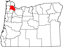
 Media related to National Register of Historic Places in Washington County, Oregon at Wikimedia Commons
