| [3] |
Name on the Register |
Image |
Date listed[4] |
Location |
Municipality |
Description |
|---|
| 1 |
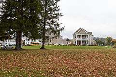
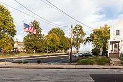
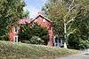
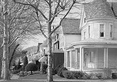
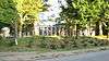
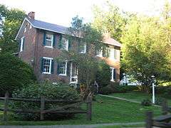
Academy Hill Historic District |
|
000000001999-04-29-0000April 29, 1999
(#99000516) |
Roughly bounded by Baughman Street, North Maple Avenue, Kenneth Street, Culbertson Avenue, Beacon Street, and Pennsylvania Avenue
40°18′39″N 79°32′42″W / 40.310833°N 79.545°W / 40.310833; -79.545 (Academy Hill Historic District) |
Greensburg |
|
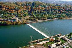
| 2 |
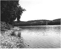
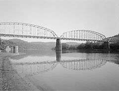
Allegheny River Lock and Dam No. 4 |
|
000000002000-04-21-0000April 21, 2000
(#00000398) |
1 River Avenue
40°36′52″N 79°42′59″W / 40.614444°N 79.716389°W / 40.614444; -79.716389 (Allegheny River Lock and Dam No. 4) |
Lower Burrell |
Extends into Harrison Township in Allegheny County
|
| 3 |
Aluminum Research Laboratories |
|
000000002013-07-23-0000July 23, 2013
(#98000413) |
Freeport Road
40°34′19″N 79°45′21″W / 40.571944°N 79.755833°W / 40.571944; -79.755833 (Aluminum Research Laboratories) |
New Kensington |
|
| 4 |
Bells Mills Covered Bridge |
|
000000001980-06-27-0000June 27, 1980
(#80003648) |
West of Yukon
40°13′09″N 79°42′37″W / 40.219167°N 79.710278°W / 40.219167; -79.710278 (Bells Mills Covered Bridge) |
Sewickley and South Huntingdon Townships |
|
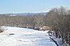
| 5 |
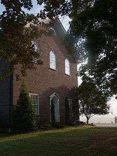
Brush Creek Salems Church |
|
000000001987-05-11-0000May 11, 1987
(#87000675) |
Southeast of Westmoreland City on Brush Creek Road
40°19′09″N 79°39′30″W / 40.319167°N 79.658333°W / 40.319167; -79.658333 (Brush Creek Salems Church) |
Hempfield Township |
|
| 6 |
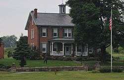
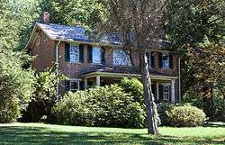
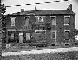
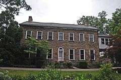
Brush Hill |
|
000000001975-10-14-0000October 14, 1975
(#75001677) |
651 Brush Hill Road
40°19′30″N 79°41′22″W / 40.325°N 79.689444°W / 40.325; -79.689444 (Brush Hill) |
Irwin |
|
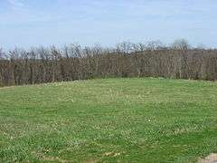
| 7 |
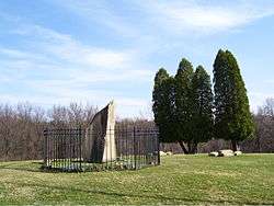
Bushy Run Battlefield |
|
000000001966-10-15-0000October 15, 1966
(#66000696) |
2 miles (3.2 km) east of Harrison City on Pennsylvania Route 993
40°21′21″N 79°37′30″W / 40.355833°N 79.625°W / 40.355833; -79.625 (Bushy Run Battlefield) |
Penn Township |
|
| 8 |
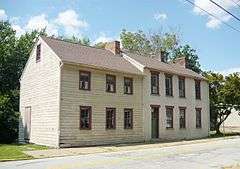
Byerly House |
|
000000001985-07-18-0000July 18, 1985
(#85001567) |
115 Menk Road, east of New Kensington
40°33′14″N 79°41′02″W / 40.553889°N 79.683889°W / 40.553889; -79.683889 (Byerly House) |
Upper Burrell Township |
|
| 9 |
Charleroi-Monessen Bridge |
|
000000001988-06-22-0000June 22, 1988
(#88000812) |
Legislative Route 247 over the Monongahela River
40°09′06″N 79°54′15″W / 40.151667°N 79.904167°W / 40.151667; -79.904167 (Charleroi-Monessen Bridge) |
Monessen |
Extends into North Charleroi in Washington County
|
| 10 |
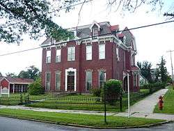
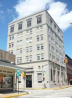
Citizens National Bank of Latrobe |
|
000000002002-11-01-0000November 1, 2002
(#02001281) |
816 Ligonier Street
40°19′00″N 79°23′05″W / 40.316667°N 79.384722°W / 40.316667; -79.384722 (Citizens National Bank of Latrobe) |
Latrobe |
|
| 11 |
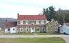
Compass Inn |
|
000000001995-02-24-0000February 24, 1995
(#95000124) |
Junction of U.S. Route 30 (the Lincoln Highway) and California Avenue
40°12′43″N 79°11′57″W / 40.211944°N 79.199167°W / 40.211944; -79.199167 (Compass Inn) |
Ligonier Township |
|
| 12 |
Concord School |
|
000000002014-09-30-0000September 30, 2014
(#14000817) |
Loyalhanna Dam Rd.
40°26′28″N 79°28′04″W / 40.441111°N 79.467916°W / 40.441111; -79.467916 (Concord School) |
Loyalhanna Township |
1848 schoolhouse.
|
| 13 |
Dick Building |
|
000000002007-08-30-0000August 30, 2007
(#07000890) |
201–203 East Main Street
40°12′06″N 79°46′00″W / 40.201667°N 79.766667°W / 40.201667; -79.766667 (Dick Building) |
West Newton |
|
| 14 |
Fairview Park |
|
000000002010-12-27-0000December 27, 2010
(#10001069) |
South side of Old Route 22, approximately 1.5 miles (2.4 km) east of Delmont
40°24′21″N 79°33′21″W / 40.405833°N 79.555972°W / 40.405833; -79.555972 (Fairview Park) |
Salem Township |
|
| 15 |
Adam Fisher Homestead |
|
000000001991-02-28-0000February 28, 1991
(#91000230) |
Brinkerton Road near junction with Mount Pleasant Road, northwest of Calumet
40°13′09″N 79°30′10″W / 40.219167°N 79.502778°W / 40.219167; -79.502778 (Adam Fisher Homestead) |
Mount Pleasant Township |
|
| 16 |
Fort Ligonier Site |
|
000000001975-01-21-0000January 21, 1975
(#75001678) |
South Market Street
40°14′27″N 79°14′16″W / 40.240833°N 79.237778°W / 40.240833; -79.237778 (Fort Ligonier Site) |
Ligonier |
|
| 17 |
Fullerton Inn |
|
000000001983-06-30-0000June 30, 1983
(#83002285) |
11029 Old Trail Road, west of Irwin
40°19′47″N 79°43′35″W / 40.329722°N 79.726389°W / 40.329722; -79.726389 (Fullerton Inn) |
North Huntingdon Township |
|
| 18 |
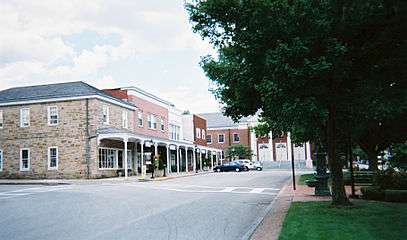
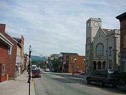
Greensburg Downtown Historic District |
|
000000001995-07-21-0000July 21, 1995
(#95000884) |
Roughly bounded by Tunnel Street, Main Street, Third Street and Harrison Avenue
40°18′11″N 79°32′42″W / 40.303056°N 79.545°W / 40.303056; -79.545 (Greensburg Downtown Historic District) |
Greensburg |
|
| 19 |
Greensburg Railroad Station |
|
000000001977-11-07-0000November 7, 1977
(#77001202) |
Harrison Avenue
40°18′16″N 79°32′49″W / 40.304444°N 79.546944°W / 40.304444; -79.546944 (Greensburg Railroad Station) |
Greensburg |
|
| 20 |
Hannastown Farm |
|
000000001994-03-17-0000March 17, 1994
(#94000209) |
Northwest of the junction of Township 825 and Legislative Route 64054
40°21′11″N 79°30′21″W / 40.353056°N 79.505833°W / 40.353056; -79.505833 (Hannastown Farm) |
Salem Township |
|
| 21 |
Household No. 1 Site (36WM61) |
|
000000001986-03-20-0000March 20, 1986
(#86000465) |
Off Timms Lane[5]
40°10′27″N 79°46′44″W / 40.174167°N 79.778889°W / 40.174167; -79.778889 (Household No. 1 Site (36WM61)) |
Rostraver Township |
|
| 22 |
Kingston House |
|
000000001983-06-30-0000June 30, 1983
(#83002286) |
U.S. Route 30, northeast of Youngstown
40°17′28″N 79°20′29″W / 40.291111°N 79.341389°W / 40.291111; -79.341389 (Kingston House) |
Unity Township |
|
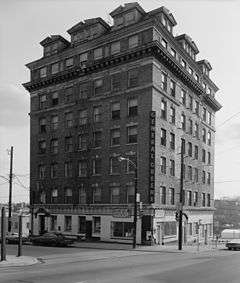
| 23 |
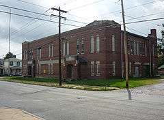
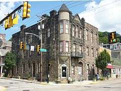
Latrobe Armory |
|
000000001989-12-22-0000December 22, 1989
(#89002076) |
1017 Ridge Avenue
40°19′00″N 79°22′53″W / 40.316667°N 79.381389°W / 40.316667; -79.381389 (Latrobe Armory) |
Latrobe |
|
| 24 |
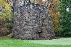
Laurel Hill Furnace |
|
000000001975-04-28-0000April 28, 1975
(#75001679) |
Southeast of New Florence on Baldwin Run
40°22′00″N 79°03′32″W / 40.366667°N 79.058889°W / 40.366667; -79.058889 (Laurel Hill Furnace) |
St. Clair Township |
|
| 25 |
Ligonier Armory |
|
000000001991-05-09-0000May 9, 1991
(#91000514) |
358 West Main Street
40°14′49″N 79°14′33″W / 40.246944°N 79.2425°W / 40.246944; -79.2425 (Ligonier Armory) |
Ligonier |
Demolished.[6]
|
| 26 |
Ligonier Historic District |
|
000000001994-08-30-0000August 30, 1994
(#94001054) |
Junction of Main and Market Streets
40°14′35″N 79°14′16″W / 40.243056°N 79.237778°W / 40.243056; -79.237778 (Ligonier Historic District) |
Ligonier |
|
| 27 |
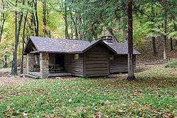
Linn Run State Park Family Cabin District |
|
000000001987-02-12-0000February 12, 1987
(#87000107) |
2 miles (3.2 km) southeast of Rector on Linn Run Road
40°09′14″N 79°13′00″W / 40.153889°N 79.216667°W / 40.153889; -79.216667 (Linn Run State Park Family Cabin District) |
Cook Township |
|
| 28 |
Loyalhanna Lodge No. 275 |
Upload image |
000000002016-02-02-0000February 2, 2016
(#15001036) |
221 Spring St.
40°18′54″N 79°23′00″W / 40.315000°N 79.383333°W / 40.315000; -79.383333 (Loyalhanna Lodge No. 275) |
Latrobe |
|
| 29 |
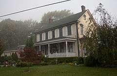
Andrew and Jennie McFarlane House |
|
000000002004-08-04-0000August 4, 2004
(#04000807) |
50 Maus Drive, west of Irwin
40°19′47″N 79°44′21″W / 40.329722°N 79.739167°W / 40.329722; -79.739167 (Andrew and Jennie McFarlane House) |
North Huntingdon Township |
|
| 30 |
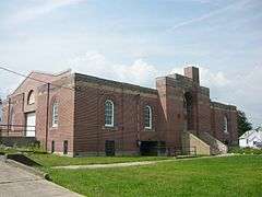
Mount Pleasant Armory |
|
000000001989-12-22-0000December 22, 1989
(#89002079) |
Eagle and Spring Streets
40°08′59″N 79°32′54″W / 40.149722°N 79.548333°W / 40.149722; -79.548333 (Mount Pleasant Armory) |
Mount Pleasant |
Demolished in 1996[7]
|
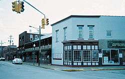
| 31 |
Mount Pleasant Historic District |
|
000000001998-07-23-0000July 23, 1998
(#98000903) |
Roughly along Main, South Church, Eagle, Walnut and College Streets
40°08′54″N 79°32′41″W / 40.148333°N 79.544722°W / 40.148333; -79.544722 (Mount Pleasant Historic District) |
Mount Pleasant |
|
| 32 |
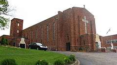
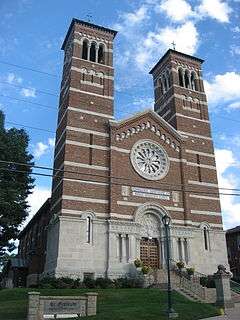
Mount St. Peter Roman Catholic Church |
|
000000001998-05-05-0000May 5, 1998
(#98000398) |
100 Freeport Road
40°33′50″N 79°45′42″W / 40.563889°N 79.761667°W / 40.563889; -79.761667 (Mount St. Peter Roman Catholic Church) |
New Kensington |
|
| 33 |
New Kensington Downtown Historic District |
|
000000001998-07-23-0000July 23, 1998
(#98000904) |
Roughly bounded by 8th Avenue, 3rd Street, 11th Avenue, and Barnes Avenue
40°33′58″N 79°45′58″W / 40.566111°N 79.766111°W / 40.566111; -79.766111 (New Kensington Downtown Historic District) |
New Kensington |
|
| 34 |
New Kensington Production Works Historic District |
|
000000001998-05-07-0000May 7, 1998
(#98000397) |
Roughly along the Allegheny River, from Sixteenth Street to Seventh Street
40°33′56″N 79°46′13″W / 40.565556°N 79.770278°W / 40.565556; -79.770278 (New Kensington Production Works Historic District) |
New Kensington |
|
| 35 |
Samuel Patterson House |
|
000000001985-03-07-0000March 7, 1985
(#85000472) |
Pennsylvania Route 981, north of New Alexandria
40°23′58″N 79°25′20″W / 40.399444°N 79.422222°W / 40.399444; -79.422222 (Samuel Patterson House) |
Derry Township |
|
| 36 |
Pennsylvania Railroad Station-Latrobe |
|
000000001986-07-17-0000July 17, 1986
(#86001689) |
Depot Street
40°19′07″N 79°23′08″W / 40.318611°N 79.385556°W / 40.318611; -79.385556 (Pennsylvania Railroad Station-Latrobe) |
Latrobe |
|
| 37 |
Plumer House |
|
000000001979-12-06-0000December 6, 1979
(#79002368) |
Vine and South Water Street
40°12′33″N 79°46′10″W / 40.209167°N 79.769444°W / 40.209167; -79.769444 (Plumer House) |
West Newton |
|
| 38 |
Ross Furnace |
|
000000001991-09-06-0000September 6, 1991
(#91001142) |
Southwest of Tubmill Reservoir off Pennsylvania Route 711
40°19′33″N 79°05′26″W / 40.325833°N 79.090556°W / 40.325833; -79.090556 (Ross Furnace) |
Fairfield Township |
|
| 39 |
St. Gertrude Roman Catholic Church |
|
000000001983-09-23-0000September 23, 1983
(#83002287) |
311 Franklin Avenue
40°35′59″N 79°33′52″W / 40.599722°N 79.564444°W / 40.599722; -79.564444 (St. Gertrude Roman Catholic Church) |
Vandergrift |
|
| 40 |
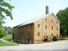
St. Vincent Archabbey Gristmill |
|
000000001978-01-18-0000January 18, 1978
(#78002486) |
Southwest of Latrobe off U.S. Route 30
40°17′43″N 79°24′10″W / 40.295278°N 79.402778°W / 40.295278; -79.402778 (St. Vincent Archabbey Gristmill) |
Unity Township |
|
| 41 |
Salem Crossroads Historic District |
|
000000001978-09-18-0000September 18, 1978
(#78002484) |
Pittsburgh and Greensburg Streets
40°24′44″N 79°34′10″W / 40.412222°N 79.569444°W / 40.412222; -79.569444 (Salem Crossroads Historic District) |
Delmont |
|
| 42 |
Scottdale Armory |
|
000000001991-05-09-0000May 9, 1991
(#91000518) |
501 North Broadway Street
40°06′17″N 79°35′08″W / 40.104722°N 79.585556°W / 40.104722; -79.585556 (Scottdale Armory) |
Scottdale |
|
| 43 |
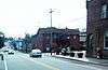
Scottdale Historic District |
|
000000001996-03-29-0000March 29, 1996
(#96000320) |
Roughly bounded by Walnut Street, Constitution Way, Arthur Avenue and Jacob's Creek
40°06′05″N 79°35′22″W / 40.101389°N 79.589444°W / 40.101389; -79.589444 (Scottdale Historic District) |
Scottdale |
|
| 44 |
Sewickley Manor |
|
000000001982-04-19-0000April 19, 1982
(#82003820) |
Legislative Route 64136, north of Calumet
40°14′05″N 79°28′56″W / 40.234722°N 79.482222°W / 40.234722; -79.482222 (Sewickley Manor) |
Mount Pleasant Township |
|
| 45 |
Site of Old Hannastown |
|
000000001972-01-26-0000January 26, 1972
(#72001180) |
4 miles (6.4 km) northeast of Greensburg
40°20′37″N 79°30′19″W / 40.343611°N 79.505278°W / 40.343611; -79.505278 (Site of Old Hannastown) |
Hempfield Township |
|
| 46 |
Slickville Historic District |
|
000000001994-06-03-0000June 3, 1994
(#94000522) |
Roughly bounded by Greenburg and Second Avenue and Delmont, Court, Cottage and Fred Streets, in Slickville
40°27′27″N 79°31′23″W / 40.4575°N 79.523056°W / 40.4575; -79.523056 (Slickville Historic District) |
Salem Township |
|
| 47 |
Squirrel Hill Site |
|
000000001980-03-26-0000March 26, 1980
(#80003647) |
West of New Florence near the banks of the Conemaugh River[8]
40°22′49″N 79°05′20″W / 40.380278°N 79.088889°W / 40.380278; -79.088889 (Squirrel Hill Site) |
St. Clair Township |
|
| 48 |
Vandergrift Historic District |
|
000000001995-04-27-0000April 27, 1995
(#95000525) |
Roughly bounded by Lincoln, Sherman, Franklin and Washington Avenues, along the outer lot lines
40°36′09″N 79°33′44″W / 40.6025°N 79.562222°W / 40.6025; -79.562222 (Vandergrift Historic District) |
Vandergrift |
|
| 49 |
John Walter Farmstead |
|
000000001995-07-21-0000July 21, 1995
(#95000885) |
166 Mamont Drive
40°28′19″N 79°35′21″W / 40.471984°N 79.589261°W / 40.471984; -79.589261 (John Walter Farmstead) |
Washington Township |
|
| 50 |
Samuel Warden House |
|
000000001995-11-07-0000November 7, 1995
(#95001252) |
200 South Church Street
40°08′52″N 79°32′50″W / 40.147778°N 79.547222°W / 40.147778; -79.547222 (Samuel Warden House) |
Mount Pleasant |
|
| 51 |
Webster Donora Bridge |
|
000000001988-06-22-0000June 22, 1988
(#88000813) |
Pennsylvania Route 143 over the Monongahela River at Webster
40°11′03″N 79°51′08″W / 40.184167°N 79.852222°W / 40.184167; -79.852222 (Webster Donora Bridge) |
Rostraver Township |
Extends into Washington County
|
| 52 |
West Overton Historic District |
|
000000001985-07-18-0000July 18, 1985
(#85001572) |
Frick Avenue
40°06′59″N 79°33′59″W / 40.116389°N 79.566389°W / 40.116389; -79.566389 (West Overton Historic District) |
East Huntingdon Township |
|
| 53 |
Western Division-Pennsylvania Canal |
|
000000001974-09-17-0000September 17, 1974
(#74001817) |
Along the Conemaugh River
40°25′30″N 79°13′48″W / 40.425°N 79.23°W / 40.425; -79.23 (Western Division-Pennsylvania Canal) |
Bell Township, Bolivar, Derry Township, Fairfield Township, and Loyalhanna Township |
Boundaries increased on 000000001982-11-14-0000November 14, 1982 under the name "Western Division of the PA Canal"
|
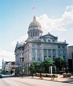
| 54 |
Westmoreland County Courthouse |
|
000000001978-03-30-0000March 30, 1978
(#78002485) |
North Main Street
40°18′09″N 79°32′46″W / 40.3025°N 79.546111°W / 40.3025; -79.546111 (Westmoreland County Courthouse) |
Greensburg |
|

.jpg)

.jpg)
.jpg)