Negro Foot, Virginia
| Negro Foot, Virginia | |
|---|---|
| Unincorporated community | |
 Negro Foot, Virginia  Negro Foot, Virginia | |
| Coordinates: 37°49′36″N 77°35′52″W / 37.82667°N 77.59778°WCoordinates: 37°49′36″N 77°35′52″W / 37.82667°N 77.59778°W | |
| Country | United States |
| State | Virginia |
| County | Hanover |
| Elevation | 295 ft (90 m) |
| Time zone | Eastern (EST) (UTC-5) |
| • Summer (DST) | EDT (UTC-4) |
| GNIS feature ID | 1471367[1] |
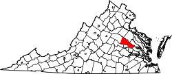
Negro Foot is an unincorporated community in Hanover County, Virginia. It was also called Negro. Negro Foot, located off of Routes 54 and 671 in the Montpelier area (Hanover Co., Virginia) has a long history, most of which is oral tradition. The origin of the name Negro Foot is not known. In nearby Powhatan County (Virginia), there is a place called Negro Arm. It is not known if there is any correlation between the two.
Oral tradition has the location with the name Negro Foot as early as 1770, but the earliest documentation of the place name was found to be approximately 1830. At that time there was an old Negro Foot Road and after the Civil War, a Negro Foot Post Office. The Virginia Business Directory and Gazeteer, published in 1877, lists the place name in Hanover Country also. Apparently a small business community existed at that time. (From Old Homes of Hanover County Virginia, published by the Hanover County Historical Society of Hanover, Va. Published in 1984).
