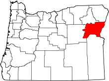
New Bridge, Oregon
| New Bridge, Oregon | |
|---|---|
| Unincorporated community | |
 New Bridge, Oregon  New Bridge, Oregon | |
| Coordinates: 44°48′02″N 117°11′24″W / 44.80056°N 117.19000°WCoordinates: 44°48′02″N 117°11′24″W / 44.80056°N 117.19000°W | |
| Country | United States |
| State | Oregon |
| County | Baker |
| Elevation | 2,369 ft (722 m) |
| Time zone | Pacific (PST) (UTC-8) |
| • Summer (DST) | PDT (UTC-7) |
| Area code(s) | 458 and 541 |
| GNIS feature ID | 1146799[1] |
New Bridge (or Newbridge) is an unincorporated community in Baker County, Oregon, United States,[1] about three miles north of Richland and Oregon Route 86.[2] Its elevation is 2,369 feet (722 m).[1]
New Bridge was founded on the banks of Eagle Creek near an important bridge built across the stream in pioneer times.[3] Joseph Gale was the first postmaster of New Bridge post office, which ran from 1878 until 1967.[3] The town was originally in Union County until 1901, when the boundaries were changed to eliminate the panhandle in which New Bridge was located.[3] New Bridge was platted in 1908, "only after irreversible decline had set in".[4] New Bridge sold agricultural products from the Eagle Valley to miners near Sparta.[4] It had a fruit and vegetable cannery, a box factory, and a packing shed for apples.[4] The decline of New Bridge was due in part to nearby Richland being platted in 1897.[4]
References
- 1 2 3 "New Bridge". Geographic Names Information System. United States Geological Survey. November 28, 1980. Retrieved November 11, 2016.
- ↑ Oregon Atlas & Gazetteer (7th ed.). Yarmouth, Maine: DeLorme. 2008. p. 79. ISBN 0-89933-347-8.
- 1 2 3 McArthur, Lewis A.; McArthur, Lewis L. (2003) [1928]. Oregon Geographic Names (7th ed.). Portland, Oregon: Oregon Historical Society Press. p. 701. ISBN 978-0875952772.
- 1 2 3 4 Bailey, Barbara Ruth (1982). Main Street: Northeastern Oregon. Oregon Historical Society. pp. 53, 55. ISBN 0-87595-073-6.
