Oakdale, Pennsylvania
| Oakdale, Pennsylvania | |
|---|---|
| Borough | |
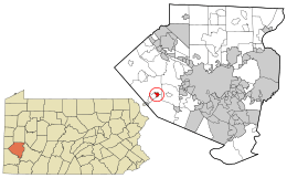
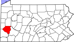
 Location in Allegheny County and the state of Pennsylvania | |
| Coordinates: 40°23′58″N 80°11′8″W / 40.39944°N 80.18556°WCoordinates: 40°23′58″N 80°11′8″W / 40.39944°N 80.18556°W | |
| Country | United States |
| State | Pennsylvania |
| County | Allegheny |
| Area | |
| • Total | 0.5 sq mi (1 km2) |
| Population (2010) | |
| • Total | 1,459 |
| • Density | 2,900/sq mi (1,100/km2) |
| Time zone | Eastern (EST) (UTC-5) |
| • Summer (DST) | EDT (UTC-4) |

Oakdale is a borough in Allegheny County, Pennsylvania, United States and is a Pittsburgh suburb. The population was 1,459 at the 2010 census.[1] Its zip code is 15071.
Oakdale is affectionately known as "America's Home Town". It is home to the Oakdale Inn, Sil's Market, The ROCK, and San Diego Padres pitcher Scott Patterson.
Geography
Oakdale is located at 40°23′58″N 80°11′8″W / 40.39944°N 80.18556°W (40.399422, -80.185676).[2]
According to the United States Census Bureau, the borough has a total area of 0.5 square miles (1.3 km2), all of it land.
Government and management
- Mayor: Paul Hennemuth
- Borough Council President: Huck Gamble
- Borough Council Vice President: Mark Maximovich
- Councilman:
Jonathan DeBor
Bill Hartman, Jr.
Tom Potts - Police Chief: James Lauria
- Fire Chief: Bill Hartman, Jr.
- Community Emergency Response Team (CERT) Director: Bill Hartman, Jr.
- CERT Deputy Director:
Demographics
| Historical population | |||
|---|---|---|---|
| Census | Pop. | %± | |
| 1880 | 507 | — | |
| 1900 | 1,147 | — | |
| 1910 | 1,353 | 18.0% | |
| 1920 | 1,611 | 19.1% | |
| 1930 | 1,703 | 5.7% | |
| 1940 | 1,766 | 3.7% | |
| 1950 | 1,572 | −11.0% | |
| 1960 | 1,695 | 7.8% | |
| 1970 | 2,136 | 26.0% | |
| 1980 | 1,955 | −8.5% | |
| 1990 | 1,752 | −10.4% | |
| 2000 | 1,551 | −11.5% | |
| 2010 | 1,459 | −5.9% | |
| Est. 2015 | 1,470 | [3] | 0.8% |
| Sources:[4][5][6][7][8][9] | |||
As of the census[8] of 2000, there were 1,551 people, 604 households, and 445 families residing in the borough. The population density was 2,956.0 people per square mile (1,151.6/km²). There were 640 housing units at an average density of 1,219.8 per square mile (475.2/km²). The racial makeup of the borough was 98.19% White, 0.90% African American, 0.06% Native American, 0.06% Asian, 0.39% from other races, and 0.39% from two or more races. Hispanic or Latino of any race were 0.71% of the population.
There were 604 households, out of which 28.6% had children under the age of 18 living with them, 62.1% were married couples living together, 8.8% had a female householder with no husband present, and 26.2% were non-families. 22.7% of all households were made up of individuals, and 9.6% had someone living alone who was 65 years of age or older. The average household size was 2.57 and the average family size was 3.04.
In the borough the population was spread out, with 22.8% under the age of 18, 6.8% from 18 to 24, 27.7% from 25 to 44, 30.6% from 45 to 64, and 12.1% who were 65 years of age or older. The median age was 41 years. For every 100 females there were 93.2 males. For every 100 females age 18 and over, there were 94.3 males.
The median income for a household in the borough was $46,574, and the median income for a family was $55,865. Males had a median income of $37,125 versus $26,620 for females. The per capita income for the borough was $21,392. About 2.9% of families and 2.6% of the population were below the poverty line, including 2.9% of those under age 18 and 1.1% of those age 65 or over.
History
Oakdale Borough was incorporated in 1892.[10] On May 18, 1918 a TNT explosion in a local chemical factory killed 200 people.[11] On September 17, 2004, Oakdale was devastated by a flood resulting from the rain brought by the remnants of category 5 Hurricane Ivan. The downpour from Ivan followed a steady rain that had covered the Allegheny County area from category 4 Hurricane Frances which struck the area just 10 days before Ivan hit.[12] The flooding caused a large-scale evacuation of the community, and brought Red Cross volunteers and National Guard members to the area in an effort to control the confusion. The flooding destroyed businesses, many of which never reopened, and displaced many residents whose homes were condemned.
Surrounding areas
Oakdale is bordered by North Fayette Township to the north and South Fayette Township to the south.
References
- ↑ "Race, Hispanic or Latino, Age, and Housing Occupancy: 2010 Census Redistricting Data (Public Law 94-171) Summary File (QT-PL), Oakdale borough, Pennsylvania". U.S. Census Bureau, American FactFinder 2. Archived from the original on September 11, 2013. Retrieved September 21, 2011.
- ↑ "US Gazetteer files: 2010, 2000, and 1990". United States Census Bureau. 2011-02-12. Retrieved 2011-04-23.
- ↑ "Annual Estimates of the Resident Population for Incorporated Places: April 1, 2010 to July 1, 2015". Retrieved July 2, 2016.
- ↑ "Population-Pennsylvania" (PDF). U.S. Census 1910. U.S. Census Bureau. Retrieved 22 November 2013.
- ↑ "Number and Distribution of Inhabitants:Pennsylvania-Tennessee" (PDF). Fifteenth Census. U.S. Census Bureau.
- ↑ "Number of Inhabitants: Pennsylvania" (PDF). 18th Census of the United States. U.S. Census Bureau. Retrieved 22 November 2013.
- ↑ "Pennsylvania: Population and Housing Unit Counts" (PDF). U.S. Census Bureau. Retrieved 22 November 2013.
- 1 2 "American FactFinder". United States Census Bureau. Archived from the original on September 11, 2013. Retrieved 2008-01-31.
- ↑ "Annual Estimates of the Resident Population". U.S. Census Bureau. Retrieved 22 November 2013.
- ↑ "History". Oakdale Hose Company. p. 1. Retrieved 2009-01-05.
- ↑ "TNT explosion in chemical factory in Oakdale, Pennsylvania kills 200". Brainy History. Retrieved 2009-01-05.
- ↑ McDonough, Tim (September 17, 2004). "Widespread flooding causes evacuations, blocks roads". Pittsburgh Post-Gazette. p. 1. Retrieved 2009-01-05.
External links
- Oakdale Borough official website
- Oakdale Hose Company (Volunteer Fire Department)
- CERT(Community Emergency Response Team) home page
- Oakdale Youth League
