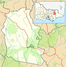
Ovens, Victoria
| Ovens Victoria | |||||||
|---|---|---|---|---|---|---|---|
|
The Happy Valley Hotel | |||||||
 Ovens | |||||||
| Coordinates | 36°35′18″S 146°45′41″E / 36.58833°S 146.76139°ECoordinates: 36°35′18″S 146°45′41″E / 36.58833°S 146.76139°E | ||||||
| Population | 130 (2006 census)[1] | ||||||
| Postcode(s) | 3738 | ||||||
| Elevation | 335 m (1,099 ft) | ||||||
| Location |
| ||||||
| LGA(s) | Alpine Shire | ||||||
| State electorate(s) | Ovens Valley | ||||||
| Federal Division(s) | Indi | ||||||
| |||||||
Ovens is a small town in north east Victoria, Australia located at the junction of the Ovens River and Happy Valley Creek. At the 2006 census, Ovens and the surrounding area had a population of 130.[1] It is 4 kilometres (2 mi) south east of Myrtleford heading towards Bright and is the home of the Happy Valley Hotel and Souter's Vineyard. The area is part of the Alpine Valleys Wine region, and was formerly used for tobacco plantations. Ovens acts as a bypass to many of the local snow fields.
The first Post Office in the area opened on 9 March 1891 as Barwidgee Railway Station, renamed Ovens Vale Railway Station shortly after, Ovens Vale in 1899 and, finally Ovens in 1928.[2]
References
- 1 2 Australian Bureau of Statistics (25 October 2007). "Ovens (State Suburb)". 2006 Census QuickStats. Retrieved 2007-08-05.
- ↑ Premier Postal History. "Post Office List". Retrieved 2008-04-11.
- "Ovens altitude". Google Maps. Retrieved October 2, 2009.
- "Ovens weather". Weatherzone. Retrieved October 2, 2009.
This article is issued from Wikipedia - version of the 4/16/2016. The text is available under the Creative Commons Attribution/Share Alike but additional terms may apply for the media files.