Oyama, Tochigi
| Oyama 小山市 | |||
|---|---|---|---|
| City | |||
|
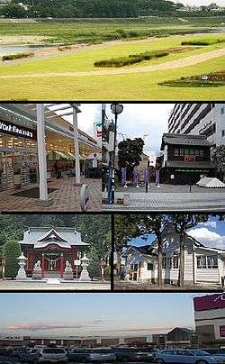
upper:Omoigawa River, upper middle: Oyama Yuen, Oyamamachi Station lower middle: Shirahige Jinja, Oyama City Achives lower:Aeon Oyama shopping center | |||
| |||
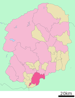 Location of Oyama in Tochigi Prefecture | |||
 Oyama
| |||
| Coordinates: 36°18′52.6″N 139°48′0.6″E / 36.314611°N 139.800167°ECoordinates: 36°18′52.6″N 139°48′0.6″E / 36.314611°N 139.800167°E | |||
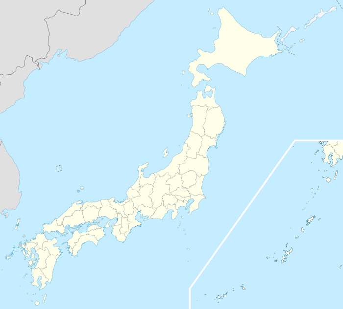
| Country | Japan | ||
| Region | Kantō | ||
| Prefecture | Tochigi Prefecture | ||
| Government | |||
| • Mayor | Toshio Okubo (since July 2000) | ||
| Area | |||
| • Total | 171.76 km2 (66.32 sq mi) | ||
| Population (May 2015) | |||
| • Total | 165,852 | ||
| • Density | 966/km2 (2,500/sq mi) | ||
| Time zone | Japan Standard Time (UTC+9) | ||
| Symbols | |||
| • Tree | Quercus myrsinaefolia | ||
| • Flower | Omoigawazakura (Prunus × subhirtella) | ||
| • Bird | Japanese wagtail | ||
| Phone number | 0285-23-1111 | ||
| Address | 1-1-1 Chūō-chō, Oyama-shi, Tochigi-ken 323-8686 | ||
| Website | Official website | ||


Oyama (小山市 Oyama-shi) is a city located in Tochigi Prefecture, in the northern Kantō region of Japan. As of May 2015, the city had an estimated population of 165,852 and a population density of 966 persons per km2. Its total area was 171.76 km2. In 2006, Oyama became the second most populous city in Tochigi Prefecture, with the capital Utsunomiya retaining the number one spot.
Geography
Oyama is located in the far southeastern corner Tochigi Prefecture, bordered by Ibaraki Prefecture to the south and east. The Omoigawa, a branch of the Watarase River flows through the center of the city.
Surrounding municipalities
History
Oyama-shuku was a post station on the Nikkō Kaidō connecting Edo with the shrines at Nikkō, and was controlled by Utsunomiya Domain during the Edo period. Oyama town was established within Shimotsuga District, Tochigi with the establishment of the municipalities system on April 1, 1889. Oyama merged with the neighboring village of Otani on March 31, 1954 and was elevated to city status. On April 18, 1963, Oyama annexed the town of Mamada and village of Mita, both from Shimotsuga District. This was followed by the town of Kuwakinu on September 30, 1965.
Economy
Oyama is a regional commercial center with a mixed economy. In agriculture, cultivation of rice, kampyo and sericulture are important. One of the major employers in the city is Komatsu making iron castings, diesel engines, fork lift trucks and other hydraulic equipment.
Education
Primary and secondary schools
- Oyama also has 27 primary schools, 11 middle schools and six high schools.
It also has a North Korean school, Tochigi Korean Elementary and Junior High School (栃木朝鮮初中級学校).
Transportation
Railway
- JR East – Tōhoku Shinkansen
- JR East – Tōhoku Main Line (Utsunomiya Line)
- JR East – Ryōmō Line
- JR East – Mito Line
Highway
External relations
-
 - Cairns, Australia, sister-city since March 15, 2006 [1]
 -
 - Lübz, Germany, since January 2, 2003 [2]
 -
 – Shaoxing, Zhejiang, China, friendship-city since October 22, 2010 [3]
 - – Benxi, Liaoning, China, friendship-city since October 26, 2014[2]
Noted people from Oyama
- Yasushi Iihara – professional baseball player [4]
- Masashi Ebinuma – Olympic judoka
- Hiromichi Kataura – scientist
- Hiroaki Takaya – professional baseball player[5]
- Kosuke Hagino - Olympic gold medallist swimmer
References
External links
| Wikivoyage has a travel guide for Oyama. |
![]() Media related to Oyama, Tochigi at Wikimedia Commons
Media related to Oyama, Tochigi at Wikimedia Commons
- Official website (Japanese)