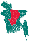
Palash Upazila
| Palash পলাশ | |
|---|---|
| Upazila | |
 Palash Location in Bangladesh | |
| Coordinates: 23°57′N 90°37.5′E / 23.950°N 90.6250°ECoordinates: 23°57′N 90°37.5′E / 23.950°N 90.6250°E | |
| Country |
|
| Division | Dhaka Division |
| District | Narsingdi District |
| Area | |
| • Total | 94.43 km2 (36.46 sq mi) |
| Population (1991) | |
| • Total | 174,040 |
| • Density | 1,800/km2 (4,800/sq mi) |
| Time zone | BST (UTC+6) |
| Website | Official Map of Palash |
Palash (Bengali: পলাশ) is an Upazila of Narsingdi District[1] in the Division of Dhaka, Bangladesh.
Geography
Palash is located at 23°57′00″N 90°37′30″E / 23.9500°N 90.6250°E . It has 31350 households and total area 94.43 km².
Demographics
According to the official 1991 census, Palash had a population of 174,040. Males constitute 53.4% of the population, and females 46.6%. This Upazila's eighteen up population is 89627. Palash has an average literacy rate of 88.6% [2] By 2011 that population had grown to 212,612, consisting of 46,780 households.[3]
Administration
Palash is divided into: 5 Unions/Wards 64 Mauzas/Mahallas 98 villages. This Upazila has a great contribution on the economical and educational aria of Bangladesh. Palash has 22 primary school, 20 high school, 16 colleges, and 2 university. It is one of the richest Upazila in Bangladesh. It has been called the industrial motherland for its strong industrial infrastructure. 28% of industrial product and its raw material of Bangladesh comes from Palash.
See also
- Upazilas of Bangladesh
- Districts of Bangladesh
- Divisions of Bangladesh
- post office of palash
References
- ↑ Md. Iftekhar Uddin Bhuiyan (2012), "Palash Upazila", in Sirajul Islam and Ahmed A. Jamal, Banglapedia: National Encyclopedia of Bangladesh (Second ed.), Asiatic Society of Bangladesh
- ↑ "Population Census Wing, BBS.". Archived from the original on 2005-03-27. Retrieved November 10, 2006.
- ↑ "Census 2011". Bangladesh. p. 27. Archived from the original (PDF) on March 7, 2016. Retrieved March 7, 2016.
