Pico Paraná
| Pico Paraná | |
|---|---|
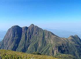
 Pico Paraná from Pico Caratuva | |
| Highest point | |
| Elevation | 1,877 m (6,158 ft) [1] |
| Listing | Brazilian state high point |
| Coordinates | 25°14′S 48°48′W / 25.233°S 48.800°WCoordinates: 25°14′S 48°48′W / 25.233°S 48.800°W [1] |
| Geography | |
 Pico Paraná Brazil | |
| Location | State of Paraná, Brazil |
| Parent range | Serra do Mar |
| Climbing | |
| Easiest route | From "Fazenda Pico Paraná" |
Pico Paraná is the highest mountain in the Brazilian state of Paraná and in all Southern Brazil.[1] It is composed of granite and gneiss. It was discovered by German explorer Reinhard Maack. He also made the first ascent of the mountain, together with Rudolf Stamm and Alfred Mysing. The official height was obtained in 1992 by three teams from the Federal University of Paraná, using the Global Positioning System.
The Pico Paraná and the surrounding peaks of the Paraná section of the Serra do Mar, is protected by the Pico Paraná State Park.[2]
References
- 1 2 3 "Pico Paraná". Peakbagger.com. Retrieved 2009-02-02.
- ↑ Ponto Mais Alto do Sul do País Fica no Parque Estadual Pico Paraná (in Portuguese), Paraná Turismo, 22 September 2015, retrieved 2016-11-19
| Wikimedia Commons has media related to Pico do Paraná. |
This article is issued from Wikipedia - version of the 11/20/2016. The text is available under the Creative Commons Attribution/Share Alike but additional terms may apply for the media files.