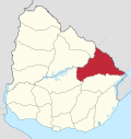
Plácido Rosas
| Plácido Rosas | |
|---|---|
| Village | |
 Plácido Rosas Location in Uruguay | |
| Coordinates: 32°45′0″S 53°43′0″W / 32.75000°S 53.71667°WCoordinates: 32°45′0″S 53°43′0″W / 32.75000°S 53.71667°W | |
| Country |
|
| Department | Cerro Largo Department |
| Population (2011) | |
| • Total | 415 |
| Time zone | UTC -3 |
| Postal code | 37101 |
| Dial plan | +598 4675 (+4 digits) |
Plácido Rosas is a village or populated centre in the Cerro Largo Department of eastern Uruguay.
Location
It is located on the north bank of Río Tacuarí, near the bridge Paso del Dragóneast, over which Route 18 crosses the river. The railroad track Montevideo - Nico Pérez - Río Branco passes through the village.
Population
In 2011 Plácido Rosas had a population of 415.[1]
| Year | Population |
|---|---|
| 1963 | 379 |
| 1975 | 428 |
| 1985 | 387 |
| 1996 | 402 |
| 2004 | 459 |
| 2011 | 415 |
Source: Instituto Nacional de Estadística de Uruguay[2]
References
- ↑ "Censos 2011 Cerro Largo (needs flash plugin)". INE. 2012. Retrieved 25 August 2012.
- ↑ "1963–1996 Statistics / P" (DOC). Instituto Nacional de Estadística de Uruguay. 2004. Retrieved 7 July 2011.
External links
This article is issued from Wikipedia - version of the 5/13/2013. The text is available under the Creative Commons Attribution/Share Alike but additional terms may apply for the media files.
