Pocahontas, Mississippi
| Pocahontas, Mississippi | |
|---|---|
| Unincorporated community | |
 | |
 Pocahontas, Mississippi  Pocahontas, Mississippi | |
| Coordinates: 32°28′28″N 90°17′10″W / 32.47444°N 90.28611°WCoordinates: 32°28′28″N 90°17′10″W / 32.47444°N 90.28611°W | |
| Country | United States |
| State | Mississippi |
| County | Hinds |
| Elevation | 295 ft (90 m) |
| Time zone | Central (CST) (UTC-6) |
| • Summer (DST) | CDT (UTC-5) |
| ZIP code | 39072 |
| Area code(s) | 601 |
| GNIS feature ID | 676161[1] |
Pocahontas is an unincorporated community located in northern Hinds County, Mississippi on U.S. Route 49. It is located 5 miles (8.0 km) south of Flora and 9 miles (14 km) north of Jackson and part of the Jackson Metropolitan Statistical Area.
Pocahontas has a ZIP code of 39072.
References
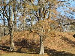
Pocahontas Mound A, located in a roadside park in Pocahontas, is listed on the National Register of Historic Places
Municipalities and communities of Hinds County, Mississippi, United States | ||
|---|---|---|
| Cities | 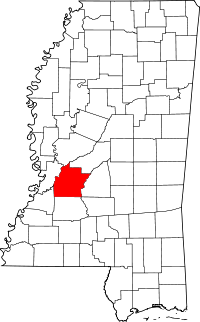 | |
| Towns | ||
| Unincorporated communities | ||
| Footnotes | ‡ This populated place also has portions in an adjacent county or counties | |
This article is issued from Wikipedia - version of the 7/30/2016. The text is available under the Creative Commons Attribution/Share Alike but additional terms may apply for the media files.