Polacca, Arizona
| Polacca, Arizona | |
|---|---|
| Unincorporated community | |
 Polacca, Arizona  Polacca, Arizona | |
| Coordinates: 35°50′12″N 110°22′53″W / 35.83667°N 110.38139°WCoordinates: 35°50′12″N 110°22′53″W / 35.83667°N 110.38139°W | |
| Country | United States |
| State | Arizona |
| County | Navajo |
| Tribal reservation | Hopi-Tewa Reservation |
| Elevation | 5,810 ft (1,770 m) |
| Time zone | Mountain (MST) (UTC-7) |
| ZIP code | 86042 |
| Area code(s) | 928 |
| GNIS feature ID | 9616[1] |
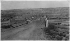
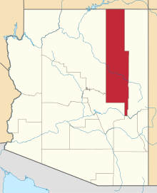
Polacca is an unincorporated community in Navajo County, of northeastern Arizona. It is located on the Hopi-Tewa Reservation.
Geography
Polacca is located along Arizona State Route 264 7.5 miles (12.1 km) northeast of the Hopi Second Mesa. Polacca has a post office with ZIP code 86042.[2]


History and culture
The community is named for Tewa artist—potter Thomas Polacca (1935—2003). He was the grandson of the renowned Hopi potter Nampeyo (d. 1942), from the Tewa pueblo on the Hopi First Mesa.[1] His work developed a deep carved polychrome-ware style. It is in the permanent collection of the Heard Museum.[3][4]
The Polacca Head Start Center is active in the revitalization of the Hopi language. Its Shooting Stars Hopi Lavayi Radio Project broadcasts for students in the First Mesa Dialect are carried on KUYI, 88.1 FM.[5]
See also
| Wikimedia Commons has media related to Polacca Dam. |
- Arizona Tewa
- Walpi, Arizona — includes Tewa Pueblo history.
References
- 1 2 U.S. Geological Survey Geographic Names Information System: Polacca, Arizona
- ↑ ZIP Code Lookup
- ↑ Hopi-Tewa Reservation: Thomas Polacca . accessed 1.9.2012
- ↑ Earthtoarts.com: Thomas (Tom) Polacca Hopi-Tewa Pottery . accessed 1.9.2012
- ↑ "Shooting Stars Hopi Lavayi Radio Project - KUYI". kuyi.net. Retrieved 2012-11-27.
