Ségur (Paris Métro)
| Paris Métro station | |||||||||||
 | |||||||||||
| Location |
15th arrondissement of Paris Île-de-France France | ||||||||||
| Coordinates | 48°50′51″N 2°18′25″E / 48.847434°N 2.306853°ECoordinates: 48°50′51″N 2°18′25″E / 48.847434°N 2.306853°E | ||||||||||
| Owned by | RATP | ||||||||||
| Operated by | RATP | ||||||||||
| Other information | |||||||||||
| Fare zone | 1 | ||||||||||
| History | |||||||||||
| Opened | 29 July 1937 | ||||||||||
| Services | |||||||||||
| |||||||||||
| Location | |||||||||||
 Ségur Location within Paris | |||||||||||
Ségur is a station on line 10 of the Paris Metro on the border of the 7th and 15th arrondissements.
History
The station was opened on 29 July 1937 when line 10 was extended from Duroc to La Motte-Picquet (now called La Motte-Picquet - Grenelle). It is named after the Avenue de Ségur although the station is on the Avenue de Suffren and the Avenue de Ségur is 100 meters away. Marquis de Ségur (1724–1801) was a Marshal of France and Secretary of State for War from 1780 to 1787.
Places of Interest
The station is close to UNESCO, the Avenue de Breteuil (a ceremonial avenue leading to the Invalides) and the École Militaire at the end of the Champ de Mars.
Station layout
| Street Level |
| B1 | Mezzanine |
| Line 10 platforms | ||
| Westbound | ← | |
| Eastbound | | |
Gallery
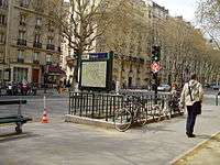
 Street-level entrance at Ségur
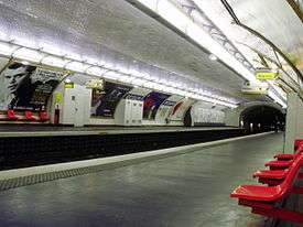
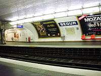
 Line 10 platforms at Ségur
References
| Wikimedia Commons has media related to Ségur (Paris Metro). |
- Roland, Gérard (2003). Stations de métro. D’Abbesses à Wagram. Éditions Bonneton.
| Paris Métro | Line 10 | |||||||||||||||||
|---|---|---|---|---|---|---|---|---|---|---|---|---|---|---|---|---|---|---|
| ||||||||||||||||||
This article is issued from Wikipedia - version of the 11/18/2016. The text is available under the Creative Commons Attribution/Share Alike but additional terms may apply for the media files.