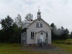
Saint-Cyrille-de-Lessard, Quebec
| Saint-Cyrille-de-Lessard | |
|---|---|
| Parish municipality | |
 | |
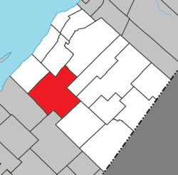 Location within L'Islet RCM | |
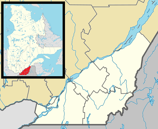 Saint-Cyrille-de-Lessard Location in southern Quebec | |
| Coordinates: 47°02′N 70°17′W / 47.033°N 70.283°WCoordinates: 47°02′N 70°17′W / 47.033°N 70.283°W[1] | |
| Country |
|
| Province |
|
| Region | Chaudière-Appalaches |
| RCM | L'Islet |
| Constituted | July 1, 1855 |
| Government[2] | |
| • Mayor | Luc Caron |
| • Federal riding |
Montmagny—L'Islet— Kamouraska—Rivière- du-Loup |
| • Prov. riding | Côte-du-Sud |
| Area[2][3] | |
| • Total | 231.40 km2 (89.34 sq mi) |
| • Land | 229.72 km2 (88.70 sq mi) |
| Population (2011)[3] | |
| • Total | 753 |
| • Density | 3.3/km2 (9/sq mi) |
| • Pop 2006-2011 |
|
| • Dwellings | 548 |
| Time zone | EST (UTC−5) |
| • Summer (DST) | EDT (UTC−4) |
| Postal code(s) | G0R 2W0 |
| Area code(s) | 418 and 581 |
| Highways |
|
| Website |
www -de-lessard |
Saint-Cyrille-de-Lessard is a parish municipality in Quebec, Canada.
See also
References
External links
-
 Media related to Saint-Cyrille-de-Lessard, Quebec at Wikimedia Commons
 |
L'Islet | Saint-Aubert | Saint-Damase-de-L'Islet | |
| |
Tourville Sainte-Perpétue | |||
| ||||
| | ||||
| Cap-Saint-Ignace | Sainte-Apolline-de-Patton | Saint-Marcel |
| Cities & Towns | |
|---|---|
| Municipalities | |
| Parishes | |
| |
This article is issued from Wikipedia - version of the 12/1/2016. The text is available under the Creative Commons Attribution/Share Alike but additional terms may apply for the media files.