Sardis, Ohio
| Sardis, Ohio | |
|---|---|
| Census-designated place | |
|
Methodist church, Monroe and Fifth | |
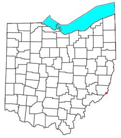
 Location of Sardis, Ohio | |
| Coordinates: 39°37′32″N 80°54′44″W / 39.62556°N 80.91222°WCoordinates: 39°37′32″N 80°54′44″W / 39.62556°N 80.91222°W | |
| Country | United States |
| State | Ohio |
| County | Monroe |
| Area | |
| • Total | 1.2 sq mi (3.2 km2) |
| • Land | 1.2 sq mi (3.2 km2) |
| • Water | 0.0 sq mi (0.0 km2) |
| Elevation[1] | 668 ft (204 m) |
| Population (2010) | |
| • Total | 559 |
| • Density | 450/sq mi (170/km2) |
| Time zone | Eastern (EST) (UTC-5) |
| • Summer (DST) | EDT (UTC-4) |
| ZIP code | 43946 |
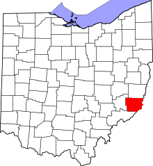
Sardis is a census-designated place (CDP) in southeastern Lee Township, Monroe County, Ohio, United States. It is unincorporated, but has a post office with the ZIP code of 43946.[2] As of the 2010 census, it had a population of 559.[3]
Sardis is at the intersection of Ohio State Routes 7 and 255. An Ohio River town, it lies below Hannibal and above New Matamoras.
Sardis shares a consolidated high school, River High School, with Antioch, Duffy, Fly, Hannibal, Laings, Powhatan Point, and Clarington.
Geography
Sardis is located at 39°37′22″N 80°54′44″W / 39.62278°N 80.91222°W. According to the United States Census Bureau, the CDP has a total area of 1.2 square miles (3.2 km2), all of it land.[4]
References
- ↑ "US Board on Geographic Names". United States Geological Survey. 2007-10-25. Retrieved 2008-01-31.
- ↑ Zip Code Lookup
- ↑ "Profile of General Population and Housing Characteristics: 2010 Demographic Profile Data (DP-1): Sardis CDP, Ohio". U.S. Census Bureau, American Factfinder. Retrieved June 4, 2012.
- ↑ "Geographic Identifiers: 2010 Demographic Profile Data (G001): Sardis CDP, Ohio". U.S. Census Bureau, American Factfinder. Retrieved June 4, 2012.
This article is issued from Wikipedia - version of the 8/25/2015. The text is available under the Creative Commons Attribution/Share Alike but additional terms may apply for the media files.

