Sault-au-Récollet
| Recollet Falls | |
|---|---|
| Neighbourhood | |
| Sault-au-Récollet | |
|
| |
 Recollet Falls Location of Sault-au-Récollet in Montreal | |
| Coordinates: 45°34′40″N 73°38′45″W / 45.57764°N 73.64582°WCoordinates: 45°34′40″N 73°38′45″W / 45.57764°N 73.64582°W | |
| Country | Canada |
| Province | Quebec |
| City | Montreal |
| Borough | Ahuntsic-Cartierville |
Sault-au-Récollet (Recollet Falls, in English) is a neighbourhood in Montreal. It is located in the eastern edge of the borough of Ahuntsic-Cartierville bordering the Rivière des Prairies. Autoroute 19 connects Sault-au-Récollet to the city of Laval. The neighbourhood was designated as a heritage site by the city of Montreal in 1992.[1]
The Church of the Visitation at Sault-au-Récollet is the oldest church on the Island of Montreal, built between 1749 and 1752.
History
Prior to the European colonization of the Americas, this area was covered in forest and was used for portaging by the Amerindians.[2]
Jacques Cartier travelled upriver to the Island of Montreal in 1535, but it was with Samuel Champlain and the Recollet missionaries who travelled with him that the sector's occupation symbolically began with the first mass celebrated in New France. Some say that, in 1610, a Saint Malo navigator named Des Prairies who was travelling with Champlain sailed up the Rivière des Prairies thinking it was the Saint Lawrence. When he discovered his error, he gave his name to the newly discovered river.[2]
Gallery
 In 1726
 1890
1890 1930
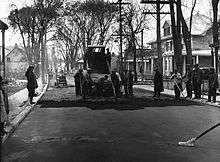
1930
References
- ↑ "Neighbourhood Sault-au-Récollet - Discovery". NEIGHBOURHOODS AND SITES. Heritage Montreal. Retrieved 30 April 2012.
- 1 2 "History — Neighbourhood Sault-au-Récollet". NEIGHBOURHOODS AND SITES. Heritage Montreal. Retrieved 30 April 2012.