Texas State Highway 103
| |||||||
|---|---|---|---|---|---|---|---|
 | |||||||
| Route information | |||||||
| Maintained by TxDOT | |||||||
| Length: | 63.05 mi[1] (101.47 km) | ||||||
| Existed: | by 1933 – present | ||||||
| Major junctions | |||||||
| West end: |
| ||||||
|
| |||||||
| East end: |
| ||||||
| Highway system | |||||||
| |||||||

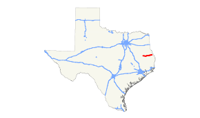
State Highway 103, or SH 103, is a state highway that runs through east Texas from an intersection with SH 7 near the Neches River through Lufkin to an intersection with SH 21 near the Louisiana state border. The route was originally designated in 1926.
Route description
SH 103 begins at an intersection with SH 7 just east of the Neches River. It then travels generally eastward to the western outskirts of Lufkin. The route then briefly travels northeast along State Loop 287 and US Route 69 before entering Lufkin coinciding with the business route of US 69. At Atkinson Drive, it turns east and proceeds out of town. It crosses two arms of Lake Sam Rayburn before reaching its eastern terminus at SH 21 just west of Milam, and 10 miles from the Louisiana border. The entire route covers 63.05 miles.
History
SH 103 was originally designated in 1926 from Centerville east through Crockett to Lufkin, replacing a section of SH 7, which was truncated further to the north. By 1933, the route has only been built between Crockett and Ratcliff, and was only an improved earth road. By 1940, sections around Lufkin were completed, but did not connect to earthen roads to the west. In 1941 the western end from Centerville to Radcliff was reassigned to SH 7, which was shifted to the south. The entire routing was completed by the late 1940s, which the duplication from Radcliff east to the Neches River was removed in 1961.
Major intersections
| County | Location | mi | km | Destinations | Notes |
|---|---|---|---|---|---|
| Angelina | | ||||
| | |||||
| | |||||
| | west end of FM 706 overlap | ||||
| | east end of FM 706 overlap | ||||
| Lufkin | west end of Loop 287 overlap | ||||
| interchange; west end of US 69 Bus. overlap | |||||
| interchange; east end of Loop 287 overlap | |||||
| west end of US 59 Bus. overlap | |||||
| east end of US 59 Bus. / US 69 Bus. overlap | |||||
| interchange | |||||
| | |||||
| | west end of FM 1669 overlap | ||||
| | east end of FM 1669 overlap | ||||
| Nacogdoches | Etoile | west end of FM 226 overlap | |||
| east end of FM 226 overlap | |||||
| | |||||
| San Augustine | | ||||
| | |||||
| | west end of SH 147 overlap | ||||
| | east end of SH 147 overlap | ||||
| | |||||
| | |||||
| Chinquapin | |||||
| | interchange | ||||
| Rebecca | |||||
| Sabine | | west end of FM 1 overlap | |||
| | east end of FM 1 overlap | ||||
| Rosevine | |||||
| | |||||
| | |||||
| 1.000 mi = 1.609 km; 1.000 km = 0.621 mi | |||||