Stjørdalen

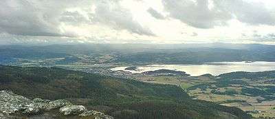
Stjørdalen is a valley and a traditional district in Nord-Trøndelag county, Norway. It makes up the southern part of the Inntrøndelag region.
Stjørdalen is named after the Stjørdalselva river which flows through the valley. The valley stretches 75 kilometres (47 mi) from the Trondheimsfjord eastward towards the Swedish border. The valley consists of the present-day municipalities of Stjørdal and Meråker. The European route E14 highway and the Meråker Line railway follow the river through the length of the valley.[1]
History
Stjørdalen was once a municipality of its own. It was established on 1 January 1838 (see formannskapsdistrikt), but in 1850 it was split to create the two new municipalities of Øvre Stjørdal and Nedre Stjørdal. At that time Stjørdalen had a population of 11,642.
On 1 January 1874, Øvre Stjørdal was split into the two municipalities of almost equal size: Hegra and Meråker. On 1 January 1901, Nedre Stjørdal was split into three municipalities of nearly equal sizes: Skatval, Stjørdal, and Lånke. On 1 January 1962, Hegra, Skatval, Stjørdal, and Lånke were merged to form the new Stjørdal municipality. On 1 June 1997, Stjørdal gained status as a city. Currently, the combined population of the municipalities of Stjørdal and Meråker is 21,738.[2]
References
- ↑ Store norske leksikon. "Stjørdalen" (in Norwegian). Retrieved 2011-05-05.
- ↑ Jukvam, Dag (1999). "Historisk oversikt over endringer i kommune- og fylkesinndelingen" (PDF) (in Norwegian). Statistisk sentralbyrå.
Coordinates: 63°26′14″N 11°20′40″E / 63.4372°N 11.3444°E
